816 place-stories · 735 on the map ·
81 table-only (whole areas/rivers with no single point).
Coordinate provenance + confidence shown per row.
🗺️ open interactive map →
Place
Story
Image
Location clues
Map
Source article
10 Rillington Place, Notting Hill
The sordid murders at 10 Rillington Place, Notting Hill, were investigated by three of London's leading forensic pathologists, who dined together regularly and called themselves 'The Three Musketeers': Keith Simpson (1907-1985), Donald Teare (1911-1979) and Francis Camps (1905-1972). It was Camps who sifted through the potpourri of human and animal bones found at the address. Camps was also called in by the Museum of London to examine the undershirt said to have been worn by Charles I at his execution.
The 12 Bar Club on Denmark Street closed in favour of flats and offices. Its loss was cited as part of a wider crisis in which London music venues were disappearing at a frightening rate, with venues described as the epicentre of a structure impacting local businesses, restaurants, bars, hotels and transport, and the Mayor of London's Music Venues Taskforce estimating their total value to London at £1.6 billion.
The 12 Bar Club on Denmark Street is no more. Photo by Ronald Hackston via the Londonist Flickr pool.
Arthur Conan Doyle lived at 12 Tennison Road in South Norwood, where he penned at least 20 Sherlock Holmes stories. The area clearly rubbed off on him: Croydon features in several of the Victorian mysteries, including The Adventure of the Norwood Builder and The Cardboard Box, which begins with the delivery of an innocent-enough-looking package to a respectable Croydon lady.
Arthur Conan Doyle wrote (and set) many Sherlock Holmes stories in Croydon. Image: public domain
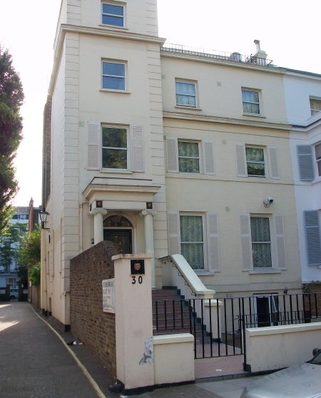
122 Leadenhall Street (The Cheesegrater), City of London
122 Leadenhall, dubbed the Cheesegrater, is a wedge-shaped skyscraper designed by Richard Rogers. It stands directly opposite the Lloyds Building. Its brightly coloured ventilation pipes and external lift shafts are Rogers leitmotifs, and the colour extends onto the building's roof, where a falcon nestbox is also painted a primary red. The building serves as the headquarters of Rogers Stirk Harbour + Partners, Richard Rogers's architectural firm.
122 Leadenhall, dubbed the Cheesegrater. This wedge-shaped skyscraper stands directly opposite the Lloyds Building. Its brightly coloured ventilation pipes and external lift shafts are Rogers leitmotifs. The colour even seeps onto the building's roof, where a falcon nestbox is also painted a primary red. The building is the headquarters for Rogers Stirk Harbour + Partners, Richard Rogers's architectural firm.
Ghost hunter Andrew Green had an early ghostly encounter in the tower of a house on 16 Montpelier Road, Ealing. The house was a sort of suicide house: people kept throwing themselves from the seventy-two foot high tower. Green discovered that 20 suicides had taken place there and caught the image of a spooky girl glaring out an upstairs window when he photographed the house. This is thought to be the ghost of 12-year-old Annie Hinchfield, who started the whole thing by throwing herself from the tower in 1887. The house has since been demolished and flats built in its place, but Green found that the occupants were still troubled by unusual noises.
Wilkie Collins's literary career really started to take off while he was still living with his mother and brother at 17 Hanover Terrace near Regent's Park.
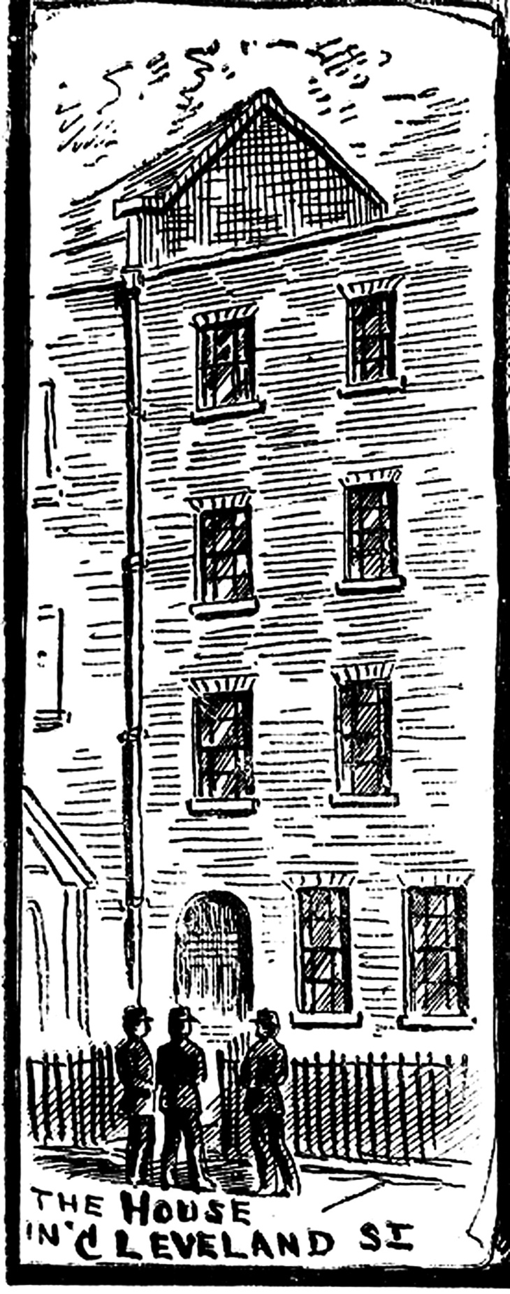
In 1889, a gay brothel was uncovered at No.19 Cleveland Street in London's West End, operating close to Tottenham Court Road. Teenage telegraph messenger boys from the General Post Office were servicing the needs of leading members of the aristocracy. Among the clients was Lord Arthur Somerset, the Prince of Wales's private equerry, and it was rumoured that Prince Albert Victor (Queen Victoria's grandson) was also a visitor. The Establishment closed ranks: the Prince of Wales's fixers put pressure on the government to close down the police investigation and keep it out of the press. But it soon became international news. Six years later, the sparks from the Cleveland Street scandal led directly to the greatest sex scandal of the 19th century: the prosecution and imprisonment of Oscar Wilde for gross indecency. It set the template for how gay men in Britain were mistreated until homosexuality was legalised in England and Wales in 1967. Inspector Frederick Abberline, who had led the unsuccessful Jack the Ripper investigation the year before, was put in charge of the Cleveland Street case. It was to be his last big case, and he finished his police career frustrated at being hampered by higher powers in his probing of it.
The West End Scandal, Sketches At Bow Street'- Some key players in the Cleveland Street scandal, also known as the West End Scandal, as depicted in the media. (Illustrated Police News, 7th December 1889)The scandal rocked the General Post Office, whose messenger boys were being used as male prostitutes.Prince Albert Victor of Wales was created Duke of Clarence and Avondale the year after the scandal.A contemporary newspaper illustration of No. 19 Cleveland Street"It was the sparks from the Cleveland Street scandal that led directly to the greatest sex scandal of the 19th century: the prosecution and imprisonment of Oscar Wilde for gross indecency."The scandal was Inspector Frederick Abberline's final big case, but he was hampered by the Powers That Be.
19 Princelet Street, Spitalfields (Museum of Immigration)
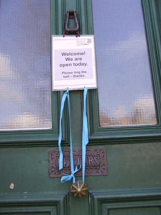
19 Princelet Street in Spitalfields functions as a museum of immigration. It is a fascinating place but has one big drawback: it is hardly ever open, and it is rather small.
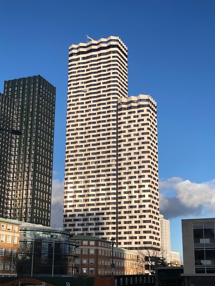
The tallest building in the Square Mile changes with some regularity. Not so long ago, the NatWest Tower (now Tower 42) easily won the crown at 183 metres. That has since been surpassed by several other buildings, the tallest of which is the bulky 22 Bishopsgate. At 278 metres, it is the second tallest structure in London, beaten only by the Shard.
A huge glass tower disappears into the clouds. The silhouette of a plane can be seen nearby
One of London's most notorious hauntings concerns this old town house in Mayfair. The upper rooms are said to be plagued by a ghost so appalling that witnesses either go mad or kill themselves. For a time, 50 Berkeley Square was the most famous haunted house in the country.
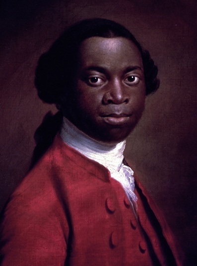
It was in London, at 67-73 Riding House Street, that Olaudah Equiano finally sat down to write his autobiography, The Interesting Narrative of the Life of Olaudah Equiano or Gustavus Vassa, the African, published in 1789. The harrowing tale was a catalyst in ending slavery. It's commemorated in a green plaque.
Wilkie Collins's most permanent London abode, from 1867 to 1888, was at 90 Gloucester Place. Like Dickens, he lived at over 20 addresses in London, most of which were in the Marylebone area.
Abbey Road Studios in St John's Wood is where the Beatles recorded most of their catalogue, including the album that shares its name. The studios are covered in graffiti tributes from fans, and a nearby Beatles Coffee Shop has grown up to serve the steady flow of visitors. The Beatles are one of countless acts who have recorded at Abbey Road; a small tribute to Led Zeppelin is also visible near the site.
Graffiti outside Abbey Road StudiosAt the nearby Beatles Coffee ShopA small tribute to Led Zeppelin. The Beatles, of course, are one of countless acts who've recorded here
Recording studio on Abbey Road, NW8; zebra crossing is a 10-second walk from the studio
The zebra crossing on Abbey Road in suburban north London became perhaps the most iconic album cover ever by accident. The Beatles' album Abbey Road was originally going to be called Everest, with a cover featuring the band in the Nepalese foothills. They couldn't be bothered with the journey. The cheapo stand-in was a zebra crossing, a 10-second walk from their recording studio, photographed in August 1969, just a month before the record was released. Photographer Iain Macmillan used a stepladder and a hired policeman to stop traffic for the shoot. Today, hundreds of visitors come to the crossing every day to recreate the shot. The crossing is also monitored by a 24-hour webcam. Visitors arrive from around the world, including fans who love the music and curious tourists who have simply heard of the place. Many discover that replicating the cover from the pavement is harder than it looks: few are afforded a stepladder or a policeman, and plenty of drivers rev and beep as fans edge into the road, unsure who has right of way.
A screenshot from the Abbey Road Crossing CamNot a bad attempt actually
10-second walk from the recording studio on Abbey Road; suburban north London; postcode NW8
Al Saqi on Westbourne Grove is the UK's largest Middle Eastern specialist bookseller, immediately distinguishable by its white columns on the exterior. The store carries stacks and shelves of books in both English and Arabic across history, art, religion, cooking and fiction, beautifully displayed with enthusiastic staff ready to offer suggestions. Al Saqi is tied to Saqi Books, an award-winning publisher with branches in London, San Francisco and Beirut, renowned for producing high-quality works and promoting awareness of Arab culture and history. The bookshop carries Saqi's newest titles and also holds a section of rare and antiquarian books. Individuals and institutions can place orders, making it an excellent resource for academics and the perpetually curious.
Albert Bridge is a spindly, delicate span that can be unsettled by too many pedestrians walking in unison. That is why it carries a famous vintage sign asking troops to break step when marching over the bridge. Since Chelsea Barracks closed, the bridge is presumably little bothered by military mis-steps. The sign is parodied outside the Albert pub, a little south of the bridge.
Hailed as the birthplace of EastEnders, Albertine is a Shepherd's Bush wine bar with a piece of British TV history behind it. Back in the 1980s, writers from the nearby BBC Television Centre came up with the show's first script here.
Albertine, at 1 Wood Lane near Shepherd's Bush Common, is both a wine bar and a wine shop, tucked away down a side road with a low-key frontage compared to the neighbouring pubs and newsagents. Owner Giles has been running the place for over 30 years. The shop is known for a fun and well-priced selection with no particular ideological ethos, a good range of bottles under a tenner and a particularly strong bracket in the ten to twenty pound take-out range. A simple cheese and charcuterie menu allows customers to eat while considering their purchases.
Albertine, just off Shepherd's Bush Common.The interior of Albertine. Note the Wall of Wine.I'll take some wine thanks, Giles
tucked away down a side road near Shepherd's Bush Common; 1 Wood Lane, W12 7DP
Donna is a school patrol crossing officer on busy Albion Road in Stoke Newington, helping people cross during morning and afternoon shifts. She has an encyclopaedic knowledge of children's names and greets most of them personally as they pass. She combines the crossing role with a job as a lunchtime supervisor. On one occasion a pigeon used the crossing entirely unaided, nonchalantly marching across while Donna and several teachers watched. Donna is described as working on the other side of Hackney from a colleague posted near Shoreditch Park.
Donna in full garb with her usual smile
busy Albion Road in Stoke Newington; on the other side of Hackney from Shoreditch Park
Aldgate is one of the Metropolitan Railway stations designed by Charles Walter Clark, featuring the sea-green tiling characteristic of his work for the line.
Alexandra Palace was the setting for the Sinclair C5's launch in January 1985, in which six of the electrically-assisted pedal capsules shot out of boxes and were driven around by women dressed in grey sci-fi boiler suits. Creator Clive Sinclair claimed the C5 was the future of travel. They were dubbed a 'plastic hip bath on wheels' and ultimately spurned by the public, who did not much fancy looking like a wally or being crushed beneath the wheels of a 10-ton truck. The opening ceremony at Alexandra Palace was probably the most fun anyone ever had in a Sinclair C5.
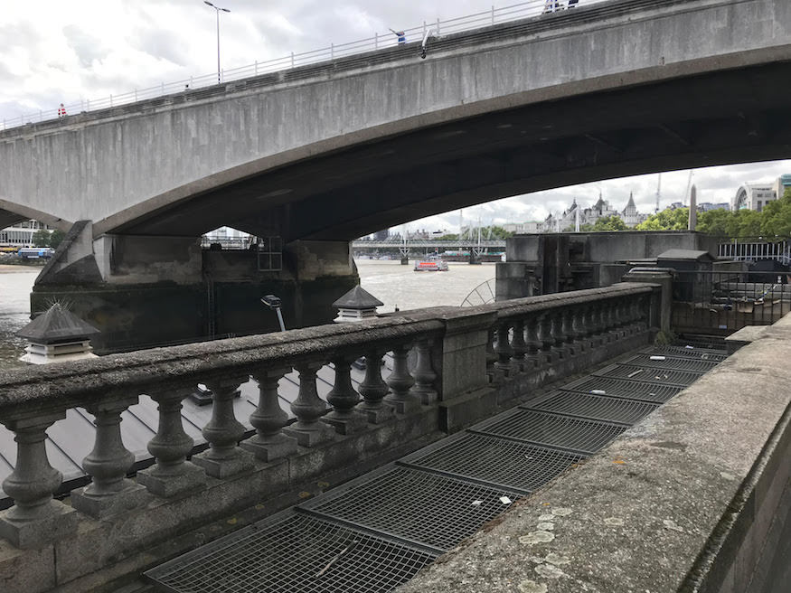
When John Rennie's early-19th-century Waterloo Bridge was demolished in the 1930s, its distinctive stone balusters were dispersed across the country, and pieces of the bridge have turned up in far-flung parts of the Kingdom. Tim Childs discovered one of the balusters lurking in the gardens of Alfriston Clergy House near Seaford, East Sussex. The stone support is now used for a sundial.
Alleyn's Regent's Park school is housed in a beautiful former convent on the doorstep of Regent's Park and London Zoo, which has undergone a multi-million-pound build and refurbishment programme. Notable spaces include The Bear Pit, a beautiful former chapel now used as a space for the performing arts.
on the doorstep of Regent's Park and London Zoo, housed in a beautiful former convent
Alleyn's School in Dulwich dates all the way back to 1619, when it was established as part of Edward Alleyn's College of God's Gift charitable foundation. Today it is a co-ed independent school with a longstanding commitment to a values-led education.
A plaque on Southampton Street remembers Ambrose Godfrey, an 18th century chemist who lived and worked on this site. He's credited with inventing the fire extinguisher in the 1720s: incredibly, the design involved a chamber of gunpowder.
The phantom hound that supposedly haunts the area round the back of the Old Bailey is one of London's most famous ghosts. The phantom has been sighted on many occasions over many centuries, skulking along a brick wall in Amen Court. The ghastly form, accompanied by a vile smell, is said to be the spirit of a 13th century sorcerer, whose body was eaten in desperation by the starving prisoners of Newgate.
no image
Round the back of the Old Bailey, along a brick wall in Amen Court
Andaz Liverpool Street Hotel Masonic Temple, Liverpool Street, London
Inside the Andaz Liverpool Street hotel lies an opulent masonic temple of marble and gilt. The temple remained forgotten and walled off for decades before its rediscovery during a 1990s refurbishment. The hotel, originally the Great Eastern, was built by Charles Barry Jr, son of the architect of the Houses of Parliament. Barry also crafted the temple, at a cost of some £50,000 (around £4 million in today's reckoning). The room reportedly contains 12 types of marble, as well as a golden pipe organ and mahogany furniture. Today the room is used as an events venue, and can sometimes be viewed on Open House weekends every September.
Inside the masonic temple in Liverpool StreetInside the masonic temple in Liverpool StreetThe ceiling of a masonic temple with an eight-point starInside the masonic temple in Liverpool StreetDoors to a masonic temple in Liverpool Street
Andaz London Liverpool Street (formerly Great Eastern Hotel)
The Great Eastern Hotel was designed by railway hotel architect Edward Middleton Barry in conjunction with his brother Charles Barry Jr, and completed in 1884, after Edward had died. Until the 1980s, the Great Eastern Hotel was the only hotel in the City of London. The other two City termini, Holborn Viaduct and Fenchurch Street, never had hotels built onto them.
Andaz Liverpool Street, formerly the Great Eastern Hotel.
Angel station reopened in 1992 after an extensive rebuild. The station had previously featured an island platform serving both running lines. The southbound line was diverted through a new tunnel and the old track filled in, to create a super-wide platform. The station also features the network's longest escalators.
When Old Waterloo Bridge was demolished from 1934, the elm timbers from its foundations were salvaged and reused in various places. The most impressive wooden salvage is at Anglesey Abbey near Cambridge, where the mansion's book cases are crafted from the rescued bridge timbers.
Anna Mae's has been serving mac and cheese from a street food truck since 2010. The decision to specialise in the dish was born out of necessity: a broken-down truck meant the owners had to pick their favourite dish to sell, as it was all they could carry. They loved Southern American food and went on to publish a book of recipes. The truck also cooked at the London Olympics in 2012.
Photo: Anna Mae's
roaming street food truck, found at festivals and food markets around London
Charing Cross Road used to be the heart of London's second-hand book trade, and Any Amount of Books at No. 56 is one of the all too few remnants of those glorious days: there has been a second-hand dealer on the premises since the 1920s, and probably well before. The quaintly dilapidated shop, spread across a ground floor and basement, has its own idiosyncratic atmosphere that sets it apart. Stock is wide-ranging and on fairly high turnover, with very reasonable prices for central London; several times a year the basement goes on sale with all books at £1. Those of a more superficial mind can even buy bound books by the yard for decoration. A visit is all but guaranteed to see you coming out with at least one book under your arm.
The oldest surviving livery company building, Apothecaries' Hall was rebuilt after the Great Fire and looks much as it did in the late 18th century. Photo by Matt Brown.
Arsenal tube station was renamed after the local football club in 1932, having previously been called Gillespie Road. The old name can still be seen on tiles at platform level. The club originally played in Woolwich, taking its name and nickname from the Royal Arsenal munitions complex based there since the 17th century, before moving to Highbury in 1913.
Tiles at Arsenal tube station, giving the former name of Gillespie Road.
old name 'Gillespie Road' visible on platform tiles
A Banksy rat stencil, one of the sardonic rodent artworks the street artist used to build his early fame, has been preserved and is on display at the Art'otel in Hoxton. The piece represents a rare example of a Banksy rat that has survived and been given a permanent home rather than being painted over or removed.
Another Banksy rat, preserved and recently re-displayed at the Art'otel in Hoxton. Image: Matt Brown
Atlantis is the oldest non-externally backed esoteric and occult bookshop in London, focusing on Western religions and magic, as opposed to Cecil Court's Watkins, which specialises in Eastern traditions and mysticism. It was founded in 1922 by magicians including Austin Osman Spare, Dion Fortune and Aleister Crowley, as a place for magicians. These days its clientele range from young people picking up cheap secondhand hardbacks to alchemists. The shop runs a huge number of events including evening classes, art shows and workshops, as well as the Moot With No Name, held at the Devereux Arms, down an alley next to the George pub, every second Wednesday.
no image
49a Museum Street, Bloomsbury; Moot held at Devereux Arms, down an alley next to the George pub
For a brief moment, the Atmospheric Railway looked like it just might be the future of train travel. Pioneered by the Samuda brothers Joseph and Samuel, and running on a line between Forest Hill and West Croydon, the atmospheric trains were powered by a vacuum in a tube, which the train was connected to, and thereby propelled forwards. The trains were quick (70mph+), quiet and fuelless. Well the trains themselves were, anyway; the system also called for whacking great coal-powered pumping stations peppered along the line. Even Isambard Kingdom Brunel took note, trialling his own atmospheric line in Devon. The trains had a tendency to conk out and require a push from the passengers, only to then shoot off without said passengers. The atmospheric experiment was nixed in 1847, but in the meantime, thousands of Londoners had used it (or at least tried to use it) to get into work.
A fragment of atmospheric railway, at Croydon Museum. Image: Matt Brown/Londonist
running on a line between Forest Hill and West Croydon
In the back streets of Southwark, an Edwardian sign issues a stern warning: "Commit No Nuisance." The punishment for committing a nuisance is never stated on the sign itself.
Image by Doreen Joy Barber in the Londonist Flickr pool.
Back streets of Southwark. The article also references paving slabs on Southwark Street bearing an outdated message about the Tate Gallery of Modern Art opening in 2000.
During the 18th century the Bank of England "might justly have been called 'The Bank of the West Indies'", as Peter Fryer's classic 1984 book Staying Power attests. Many slave owners deposited their money here, and several Bank of England governors were human traffickers; one was Sir Humphry Morice MP, who owned at least six slave ships and named four of them after his family members (Anne, Katherine, Sarah and Judith). When Morice died in 1731, it was discovered he was stealing from the Bank and his own daughter.
Many slave owners deposited their money at the Bank of England. Image: iStock/JohnnyGreig
Established in 1694, the Bank of England is the second oldest central bank in operation in the world. The Threadneedle Street frontage seen in a 1903 image shows the lovely original John Soane building which was destroyed in the 1920s. This was considered one of modern architecture's greatest losses. It dated from the 1780s.
Established in 1694, the Bank of England is the second oldest central bank in operation in the world. The Threadneedle Street frontage seen in this evocative 1903 image shows the lovely original John Soane building which was destroyed in the 1920s. This was considered one of modern architecture’s greatest losses. It dated from 1780s.
Bank clerk Philip Whitehead was arrested and hanged for forging cheques in 1811. The news drove his sister Sarah mad. Every day for the rest of her life, Sarah would visit the bank and ask to see her brother. As she always did this in mourning dress, staff nicknamed her the 'Black Nun'. Her visits continued after her death, and she has been glimpsed on Threadneedle Street and even in the passageways of Bank station.
Bank is a giant labyrinth that fills many Londoners and commuters with dread as they navigate its seemingly endless corridors and lengthy interchanges, a station many people avoid if they can. Monument station first opened on 6 October 1884 under the name Eastcheap, and the wider Bank/Monument complex contains sections from many different periods. Walking through it feels a bit like exploring a museum of London Underground design, showcasing well over a century of architectural and engineering history. The station also has 16 marked entrances.
Banksy Piranha Police Box, Ludgate Hill, City of London
In August 2024, street artist Banksy claimed responsibility for turning a 1990s City of London police sentry box on Ludgate Hill into a vicious-looking aquarium, using translucent spray paint. It was part of a spate of critter-themed artworks Banksy delighted London with, others including a gorilla at London Zoo and a pelican outside a Walthamstow chip shop. The fishy police box was soon moved to Guildhall Yard for safekeeping. The City of London Corporation has since announced plans to gift it to the London Museum, which opens at a new home in Smithfield Market in 2026.
Biting satire. Image: City of London Corporation
Ludgate Hill; subsequently moved to Guildhall Yard
Banksy Rat, Cannon Street Station Passage, City of London
One of the few surviving Banksy rat stencils in London can be found in the passage under Cannon Street station. Banksy built his early fame on sardonic, small-scale stencils of rats in anthropomorphic poses. His work was itself heavily inspired by the French stencil-master Blek le Rat. Most of his rat pieces have since been removed or painted over, making the surviving examples particularly notable.
Street artist Banksy built his early fame on sardonic, small-scale stencils, usually of rats in anthropomorphic poses. Most of these have since been removed, including one that was wiped from beneath Waterloo Bridge more than a decade ago. One or two Banksy rats still remain across London, including one on Chiswell Street.
Just one stop down the line on Platform 1 of Hackney Downs station is the eccentric Banner Repeater, a unique artist-led project space and library housed in a former waiting room.
Bar Italia is London's longest running coffee shop, having opened at a time when Soho had a huge Italian community. Those regulars might have left but Bar Italia's popularity endured, as the word spread about its dedication to quality coffee. The building also has a historical gem: the upstairs room hosted the first public demonstration of television, by John Baird. Bar Italia is also well known thanks to Pulp's tune from their seminal album, Different Class.
The concrete goalposts of Barking Creek Barrier peer down on the site of the old Creekmouth village, installed some 50 years too late to be of use to the terraced cottages that stood there. The Creekmouth Preservation Society has placed engraved information boards nearby.
overlooks the former site of Creekmouth village; near the mural depicting Creekmouth's history
During the Second World War, a house on Barnet Avenue in East End Road, Finchley had an upstairs room converted into a women's dormitory for female switchboard operators. A ghostly presence was said to approach one bed in particular.
A fire at the Battersea Arts Centre in 2015 left a lasting impression on the surrounding area of Clapham, which became associated in the popular imagination with the smell of Bonfire Night.
Battersea Power Station, a 1930s building, is being transformed along with its surrounds into an entire new mini-district of Thames-side London, described as the largest regeneration project in Europe. When completed, the area will be a hub of housing, retail, restaurants and parks. The Circus West development being wrapped around the power station was nominated for the 2017 Carbuncle Cup.
Archaeologists have plenty of evidence for river worship in London. Treasures like the Iron Age Battersea Shield might have been votive offerings, given in deference or placation to the river. This beautiful object was dredged from the river in 1857, not far from where the Father Thames sculpture on the Nine Elms river front now resides. You can view it in the British Museum, near to a horned helmet of similar age, found below Waterloo Bridge in 1868.
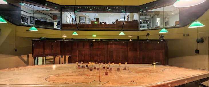
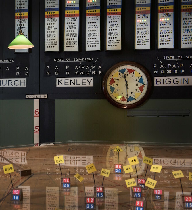
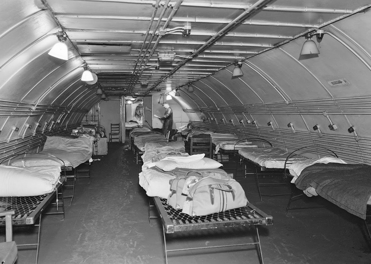
An underground room in west London at the former RAF Uxbridge was used to help the RAF secure victory during the Battle of Britain, the first conflict in history fought solely in the air. As the battle raged between the RAF and Nazi Germany's Luftwaffe in 1940, the Bunker coordinated the air defence of London and the whole of south-east England, helping to prevent a German invasion and shaping history. The original 1940s space sits 60ft below ground, accessible via 76 steps. A visitor centre and exhibition details its role in some of the most important chapters of the conflict, including the evacuation at Dunkirk, the ill-fated Dieppe Raid and the early stages of D-Day. The exhibition features first-hand accounts from people who worked in the Bunker, alongside original artefacts including aircraft wreckage and telecommunications equipment.
West London, former RAF Uxbridge; 60ft below ground, accessible via 76 steps
Bedlam burial ground / Liverpool Street Crossrail site
Crossrail digs at Liverpool Street uncovered a plague pit, which led to the identification of the DNA of the bacteria that caused the 1665 plague. The 'Bedlam burial ground' revealed held 3,000 bodies from between 1569 to at least 1738, a veritable city of bones. A gold sequin from 1501 was also found at Liverpool Street during the Crossrail works.
BedZED is a pioneering eco-village in Beddington, south London, which considers sustainability from all angles. It is built with natural and recycled materials, creates its own energy, makes space for greenery and empowers its inhabitants to live a sustainable lifestyle. The development features roof gardens, pedestrian bridges and renewable energy, with colourful wind turbines.
BedZED is a pioneering eco-village in south London which considers sustainability from all angles. It is built with natural and recycled materials, and also creates its own energy, makes space for greenery and empowers its inhabitants to live a sustainable lifestyle. Image: Taran Wilkhu/Hoxton Mini Press
Bekonscot Model Village and Railway is the world's oldest and original model village, which opened for the first time in 1929. Stepping inside is like entering a 1930s time warp.
no image
Warwick Road, Beaconsfield HP9 2PL; nearest station is Beaconsfield
The Belarusian Memorial Chapel in Finchley is apparently the first wooden church to be built in the city since the Great Fire of London. Crafted from Canadian cedar shingles and Douglas fir, the 69-square-metre chapel seats 40 people. Inside are wooden memorials, an iconostasis (a screen with historic icons) and traditional white-red-white Belarusian textiles, a national colour combination that is currently banned in Belarus.
Inside Finchley's 69-square-metre Belarusian Memorial Chapel, which seats 40 people, there are wooden memorials, an iconostasis (a screen with historic icons) and traditional white-red-white Belarusian textiles – a national colour combination currently banned in Belarus. Image: Taran Wilkhu/Hoxton Mini Press
A ghostly coach known as the Enfield Flyer is said to race along Bell Lane in Enfield, dashing towards pedestrians and disappearing just before impact. The ghost coach carries two female passengers wearing large hats and disappears as it approaches the River Lee. It is thought to be the ghost of a coach that crashed into the river and perished.
no image
Bell Lane, Enfield; disappears as it approaches the River Lee
North of the Marylebone Road in the 1980s there were still surprising pockets of poverty, such as the Bell Street second-hand market, a quiet backwater with the ramp to the beginning of the Westway flyover visible in the background.
North of the Marylebone Road there were still surprising pockets of poverty, such as the Bell Street second-hand market, a quiet backwater but with the ramp to the beginning of the Westway flyover in the background.
north of the Marylebone Road; ramp to the Westway flyover in background
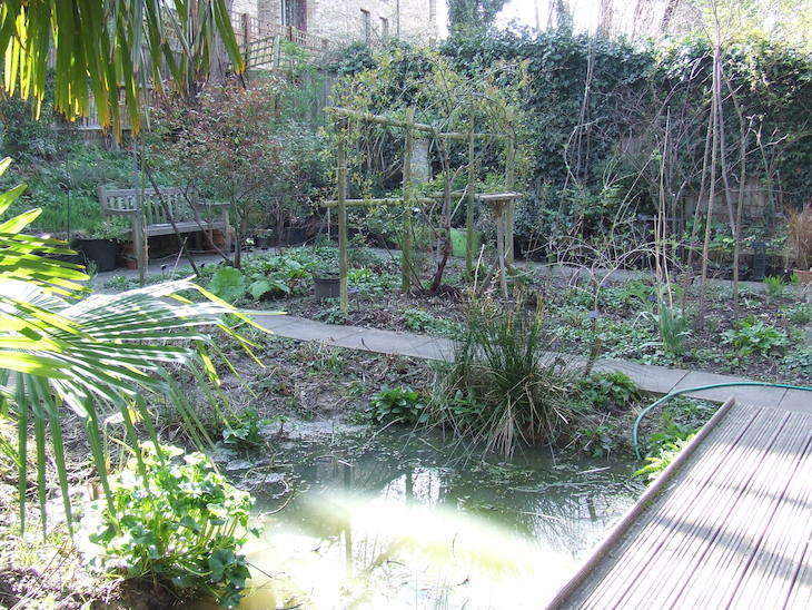
This little patch of neglected and mysterious greenery in south London has been preserved as an urban oasis by the London Centre for Wildlife Gardening, its official caretakers. Once feared destined to become oddly shaped terraced houses or an annexe to the abutting DHSS centre, it has instead been everso-slightly tamed: it now boasts a pond of sorts, a bench, a totem pole, a brown-roof-beetle-haven, and beautiful gates which are, for the most part, left wide open. The wildlife is flourishing, the discarded beercans and other detritus have vanished, and the centre is always on the lookout for volunteers to help the gardener keep it that way.
no image
Bellenden Road, south London; abutting a DHSS centre
Bermondsey (south and south-east of Tower Bridge) had always been a whiffy place. During the 19th century, you could navigate the area by smell alone. The western quarters were home to the tanners, who scraped gore and rotting flesh from skins, then rubbed animal urine and dung into the leather. Nearby stood the Sarson's vinegar factory with its own pungent aromas. To the south, more pleasant odours emanated from the Peek Freans factory in 'Biscuit Town', alongside a jam factory and a custard factory. Right through the middle of it all ran the sooty waft of steam trains along the magnificent viaduct that still dominates the area. In the early 20th century, Bermondsey had established itself as a hub for imported eggs, with a 1921 trade directory listing five egg importers on Tooley Street alone.
The regeneration of Bermondsey Square was held up for years and years after an old abbey was discovered under the ground (Bermondsey Abbey), which was dedicated to Saint Saviour. That was the start of Bermondsey, and everything else was built around it, because Bermondsey was basically just a marsh.
Bermondsey Square hosted an ancient antiques market that predates the square's 21st-century regeneration. The market has deep roots: according to local belief, it was written into some ancient by-law that you were allowed to sell stolen goods there between certain times, which is why the traders start so early in the morning.
“Bermondsey Square was just a pit when I first moved to the area. Once I got involved with the art project I wanted to know what the local community thought about the antiques market being dug up. For the people who run the market it was, obviously, a very serious thing. It’s an ancient market and I think it was written into some ancient by-law that you were allowed to sell stolen goods there between certain times. I guess that’s why they start so early in the morning”, Jones chuckles. Here she is pictured outside the Bermondsey Square Stainless Steel Bicycle Station.
A secret passage once linked the cellars of this shop and St James's Palace to facilitate the philanderous escapades of merry monarch Charles II, or so the legend goes. Whatever tunnels once existed are sadly long sealed up, if they existed at all. Berry Bros. & Rudd's West End premises date back to 1689. The shop holds bottles that are older than Big Ben and a set of scales that once bore the weight of Lord Byron, one of its most illustrious patrons.
During wartime, more than a hundred victims were crushed in a stampede at Bethnal Green Underground station. The tragedy gave pathologist Keith Simpson (1907-1985) an unusual number of cases for his study of asphyxiation.
no image
on the D3 bus route through Bethnal Green, passed after York Hall
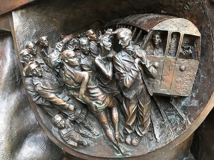
Bethnal Green station was the scene of the worst disaster on the London Underground, when 173 people were killed in a crush in 1943. Anguished cries are still supposedly heard by station staff.
The Big Green Bookshop was born out of a community need: Simon Key and Tim West, formerly Waterstones managers, were told the Wood Green branch was closing and decided to open their own shop so the area would not be left without a bookshop at all. The community pitched in with painting, cakes and logistics from the very start. The stock has evolved according to customers' tastes and now includes dedicated poetry, history and manga sections. Every Wednesday, an author visits to read to a class from one of Haringey's 72 schools (the Big Green Wednesdays programme), which is why the shop does not open until 10.30 on Wednesday mornings. The shop is also packed with author events, reading groups and children's activities. Simon and Tim's enthusiasm for what they do is utterly infectious.
no image
Unit 1 Brampton Park Road, Wood Green; down a side street off Wood Green High Road
The word 'Billingsgate' came to mean foul, loud and vituperative language, so called from the abuse for which the fish-women at Billingsgate Market were once widely renowned. The usage dates to the 17th century.
Sebastian Burdon's Bitten Phone Box formerly stood in Croydon town centre, where it prompted double takes from passers-by with its sculpture of a phone box with a large bite taken out of it. The work is no longer in place at its original location.
Sebastian Burdon's Bitten Phone Box. Tasty. Image: Londonist
The Blackheath Tea Hut has stood on the rolling green expanse of southeast London's Blackheath since 1924, longer than the nearby Cutty Sark has been dry-docked in Greenwich. The pastel blue hut serves tea, cake and sandwiches at the side of the roaring B210 road, and is a favourite meeting point for east London bikers, taxi drivers, NHS workers and errant joggers. In January 2020 the hut was destroyed in a car accident that badly injured three people; it has since reopened, partly thanks to a crowdfunding campaign. The hut's regulars include a veteran who has been pulling up on the heath for 43 years, and the sense of community among visitors is its most striking feature.
In 2024, the tea hut celebrates its centenary.Jo Hayes, who's been working at the hut for over 20 years.Burgers with pineapple are a tea hut stapleThe pastel blue hut is a beacon calling all weary travellers to its counter.Chris, a tea hut veteran.Chris, Dan, Connor and Yoon - a handful of the many bikers who use the tea hut.Cup holders are drilled into the table to stop tea from blowing away.Guy stops in to drop off a birthday card for an employee.A warm welcome and instant camaraderie keeps people coming back.A family visiting from Hungary on their return from the nearby Ranger's House.Leonie Jo and ShaunHut and Hummers.
junction of the A2 and Goffers Road, on Blackheath
The evocatively named Bleeding Heart Yard commemorates a noble lady whose body was found here, ripped limb from limb but with her heart still beating. Her ghost haunts this strange cul-de-sac. The Bleeding Heart Tavern and Bistro are well-known places to dine nearby, and the Scotch Malt Whisky Society dwells in one of the buildings overlooking the yard.
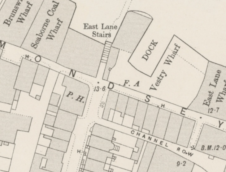
John Bodfield, a coffeehouse keeper, ran his shop at 42 Bermondsey Wall, just 25 metres (80 feet) from the egg-smashing plant. By June of 1915, the stink had so thoroughly deterred his customers that the shop had closed down. He took the matter to the High Court seeking damages for loss of earnings. His successful business had quickly dropped away after the egg smashing began; he now had to work as a docker to make ends meet. His children had suffered illness from the fumes. He was eventually awarded £150 damages.
OS map of 1896. The space labelled Vestry Wharf is the site of the egg-smashing. Bodfield’s coffeehouse is one of the properties shown just to the south. The egg site today is beside the Chambers Wharf development, long occupied by Thames Water as a shaft site for the Thames Tideway sewer. Image via Layers of London.
42 Bermondsey Wall, just 25 metres (80 feet) from the egg-smashing plant on the wharf
West Ham's Boleyn Ground (better known as Upton Park) was the club's home for 101 years before they relocated to the Olympic Stadium in Stratford. The historic stadium is being taken over by Barratt Homes and Galliard Homes, who aim to transform it into a residential village, imagined to be in the same vein as Highbury.
Track off to one side of Portobello Road Market and you'll find Blenheim Crescent, home to a trio of bookshops, the first being Books for Cooks. Founded in 1983, it stocks a book on any type of cookery you can think of, as well as foodie fiction, history, art, chemistry and more. At the back of the shop is a test kitchen and café where staff make lunches with seasonal produce from the nearby market stalls, using recipes from books in stock; lunch is served at 12, but people start queuing much earlier to be sure of grabbing one of the tables. Upstairs is a workshop space where you can learn from the experts how to make all kinds of goodies, and the shop also hosts Literary Lunches with foodie authors. Owner Eric even produces his own red wine from grapes grown on his vineyard in the south of France, available by the glass in the café.
no image
4 Blenheim Crescent, Notting Hill, off Portobello Road Market
A small, one-story, 45m2 chapel on Lee High Road is attributed to Christopher Wren - but the 1683 construction may have been built by someone working for him. The chapel is next to the Worshipful Company of Merchant Taylors almshouses. Image from Google Street View.
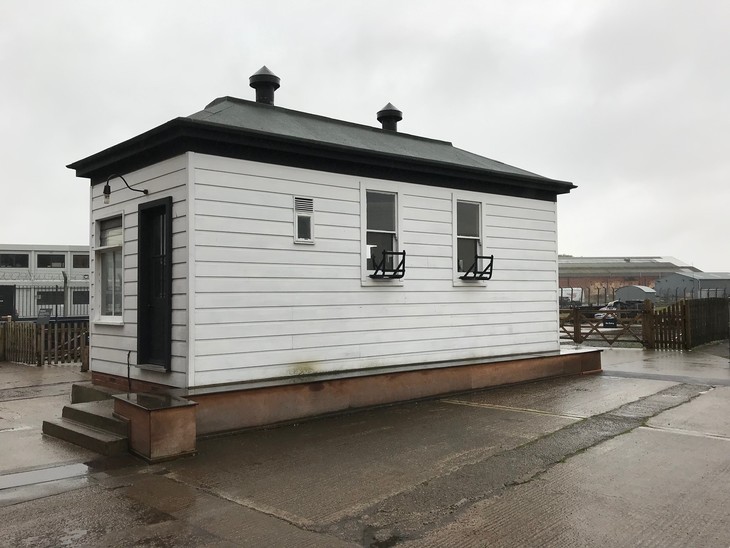
Borough Junction Signal Box, Borough Market, London
The Borough Junction Signal Box stood above Borough Market for almost 100 years, controlling trains in and out of London Bridge Station. It was said to be the busiest signal box in London. It now superintends the National Railway Museum's own steam railway in York.
The Borough Junction Signal Box stood above Borough Market for almost 100 years, controlling trains in and out of London Bridge Station. It was said to be the busiest signal box in London. It now superintends the museum's own steam railway.
Above Borough Market, controlling London Bridge Station
There has been a market on the south side of London Bridge since 1014 AD, as Borough High Street was a vital artery joining London to the ports in the south. By the 16th century, the authorities had a constant battle to keep the chaotic crowds of trader stalls and livestock from making the road impassable. New rules put in place in 1757 included one stating that the clerk of the market ring the market bell every morning at nine o'clock, and that hall porters not set out their stalls or stands until the bell was done ringing. Although it has long since ceased to function as a means of crowd control, a bell still hangs at the Middle Road entrance. The current bell was cast by the Whitechapel Foundry (which also cast Big Ben), and allows the market to continue the tradition on special occasions. Prince Charles rang it when he signalled the re-opening of the market in 2013.
Borough Market features prominently in several scenes of the 2001 film Bridget Jones's Diary, including Bridget's desultory walk home dressed as a playboy bunny after being dumped by Daniel Cleaver, and her shopping trip before the disastrous blue soup dinner with Mark Darcy. The Globe, a real pub below the fictional flat, and Bedales, the venue used for the Greek restaurant in the famous fight scene, are both within or adjacent to the market. Daniel Cleaver's swanky apartment in the film is a stone's throw away on Clink Street.
This Palladian mansion was architect Henry Flitcroft's first commission, in 1729. Its stable block is also Grade I listed. Photo by Derek Voller under Creative Commons.
Brent Museum is one of London's lesser-known museums, housed in Willesden Library. When blogger Diamond Geezer paid a visit to the small collection, he was the only person there, not even a member of staff. The museum was chosen to host an exciting exhibition featuring the iconic Gayer-Anderson Cat, one of the British Museum's great treasures, marking the first time the cat had been displayed at another museum venue. The display focuses on the ancient Egyptian practice of dedicating metal statues of gods in temples, centred around the iconic bronze Gayer-Anderson Cat, revealing how objects can be read in different ways using archaeological, historical and scientific research.
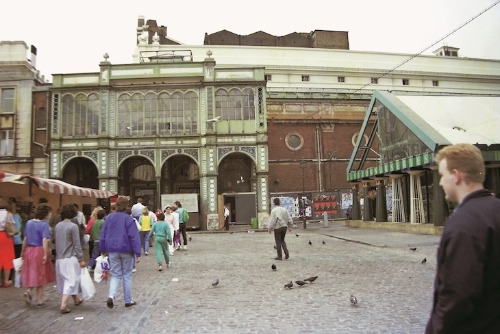
On Sunday mornings in the 1980s, the northern end of Brick Lane, Sclater Street, Cheshire Street and the alleys and courts off them were taken over by a sprawling second-hand market. It was a melting pot for the growing local Bangladeshi community, the longer-established Jewish community, and others who came from far and wide in search of a bargain. The range of goods on sale was extraordinary, and prices were very often not fixed but subject to haggling. Until its abolition in 1994, the buying and selling of goods here was also protected by the ancient law of market overt, which enabled stolen goods to change hands without legal recourse.
On Sunday mornings the northern end of Brick Lane, Sclater Street, Cheshire Street and the alleys and courts off them, were taken over by the sprawling second-hand market. It was a melting pot for the growing local Bangladeshi community, the longer-established Jewish community, and others who came from far and wide in search of a bargain. The range of goods on sale was extraordinary, and very often prices were not fixed but subject to haggling. Until its abolition in 1994 the buying and selling of goods was also protected here by ‘market overt’, which enabled stolen goods to change hands without recourse. window._taboola = window._taboola || []; _taboola.push({ mode: 'thumbnails-mid', container: 'taboola-mid-article-thumbnails-2', placement: 'Mid Article Thumbnails 2', target_type: 'mix' });
northern end of Brick Lane, Sclater Street, Cheshire Street and surrounding alleys
Brick Lane Bookshop, formerly known as Eastside Books, began in 1979 as part of the Tower Hamlets Arts Project, which worked all kinds of wonders with the local community. A couple of years ago the shop became independent of the charity and, in 2005, moved to Brick Lane where it continues to forge incredibly strong links with the area. It is involved in the Tower Hamlets Book Award (where the winner is chosen by local children), holds events with authors who have written about East London, has published its own books, and runs creative writing groups, reading groups and children's storytimes on Fridays. The London section is absolutely heaving with books on the city and the East in particular, without being overburdened with Jack the Ripper material. There are also huge arrays of philosophy and criticism on shelves with seemingly TARDIS-like qualities.
Brick Lane Mosque (Brick Lane Jamme Masjid), Spitalfields
The building at 59 Brick Lane, currently known as Brick Lane Mosque (or Brick Lane Jamme Masjid), used to be a church. Since being built in 1743, it has functioned as a Huguenot chapel, a Methodist church, a Jewish synagogue, and has been a mosque since 1976, by which time much of the area's Jewish community had relocated to north London. Today the building is Grade II* listed. The school next to the mosque used to function as the vestry when the building was the Neuve Eglise church.
A station called Bricklayers Arms was at one point proposed as an additional stop between Elephant and Castle and the Old Kent Road stations on the planned Bakerloo line extension. In 2018, TfL announced it would not be built, citing cost and increased journey times. It was judged too close to other existing and planned tube stations to be worthwhile.
The anonymous frames on the first floor of the British Library, which anyone can pull open and examine, hold some surprising secrets. The Library owns a 2d 'Blue Mauritius', of which just 12 exist. Only the island's first set of stamps, in 1847, read 'Post Office' down the side before it was changed to 'Post Paid', and no one really knows why. When one last changed hands it fetched over one million pounds. The frames also hold the world's first stamp, the Penny Black, invented by Sir Rowland Hill. About 68 million were printed, making them not especially rare, but the pre-paid stamp enabled the Post Office to streamline its complicated charges and meant a letter to anywhere in the country cost a penny.
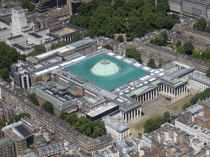
The British Museum covers 18.5 acres (the equivalent of nine football pitches), making it the largest museum in London. It's also the most visited, squeezing in nearly seven million guests per year. The collection contains roughly eight million objects, but only 1% of these can be shown at any one time, with around 80,000 objects on display.
Street artist Cartrain smuggled a dubious artefact into the British Museum, a stunt that drew inevitable comparisons to Banksy, who had previously placed his own unofficial artworks inside the museum. Cartrain's stencil work was spreading across London at the time, with pieces appearing in Shoreditch and opposite the Houses of Parliament.
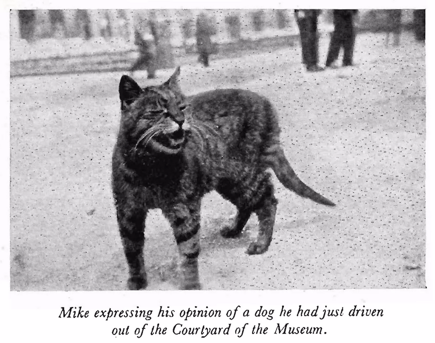
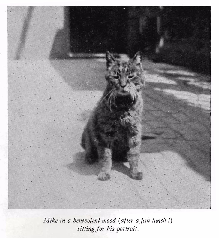
The British Museum was once home to a number of house cats. A newspaper article from 1894 mentions a huge, grey, beautifully-marked cat who sashayed up to the porter's quarters by Great Russell Street and was promptly adopted as a member of staff. From the late 1950s, the museum took on a large cohort of stray cats, numbering over 100 at one point, employed to stave off rats and mice. Among them, one is remembered above all others: Mike. In early spring 1908, a cat known as Black Jack, previously expelled for sharpening his claws on newspaper volumes, returned and deposited a tabby kitten at the feet of E. A. Wallis Budge, Keeper of Egyptian antiquities. That kitten was named Mike. By February 1909, Mike was defending the museum from pigeons in the colonnade out front, and had also become known for fearlessly chasing dogs away from the main gate, swelling himself to twice his normal size and hurling himself on them. He became a fixture referred to as Museum Mike. Time magazine noted his predilection for scratching female visitors who tried to pet him. When Budge retired, he reportedly provided Mike with a weekly maintenance sum for milk and mutton and visited him once a week bearing a tasty parcel of fish. In 1924 Mike took retirement but remained firmly in situ; a 1926 newspaper reported him curled up on an almost inaccessible stone ledge high above the door of the porter's lodge. On 15 January 1929, Mike died at nearly 21 years old. Time magazine published two pieces on the mourned cat, calling him probably the most famed British feline of the 20th Century, and certainly the most misogynous. By the late 1970s, concerns about feral cats causing damage in storerooms led to the house cats being gradually phased out. Rumours suggest there was once a small tombstone dedicated to Mike by the museum gates, but it is no longer there today.
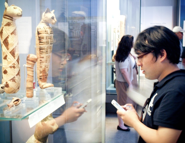
Mike was a legend at the British Museum, guarding its gates for two decades. Image: public domainMike guarded the museum from pigeons and dogs. Image: Luke Massey & the Greater London National Park City InitiativeTaken from an entire pamphlet compiled about Mike.Next time you're viewing the mummified cats in the British Museum, spare a moment to remember Mike. Image: AJP via creative commons
Porter's lodge and main gate; porter's quarters by Great Russell Street; colonnade at the front of the museum
The British Museum sets the scene for an extended chase sequence in Hitchcock's Blackmail (1929), where Tracy (Donald Calthrop) refreshes himself at the water fountain outside (still there) before trying to shrug off pursuers among ancient Egyptian artefacts and in the Reading Room, the glass ceiling of which he later crashes through.
A nail-biting chase scene takes place in the British Museum, in Blackmail. Modern photo by daredevil_81, in the Londonist Flickr pool
The best place to see postboxes in London (with the added bonus that it's indoors) is the British Postal Museum and Archive Store in Debden. It's only open for tours, usually on the first Wednesday of the month. There's an entire 'Pillarbox Alley', Rowland Hill's desk, a 'hen and chickens' penny-farthing (one big wheel, four small ones) and a mail coach.
In September 1854, John Snow had the handle removed from the water pump on Broadwick Street, preventing the further spread of cholera from the pump. Through his research, using ghost maps to track the pump down, Snow proved that cholera was a water-borne disease and not an air-borne one. A replica memorial pump now stands on the site. The ghost of the diseased pump was reportedly seen on Broadwick Street until the replica was installed.
One of London's 'Magnificent Seven' Victorian cemeteries, Brompton Cemetery is 40 acres of green space sandwiched between Brompton Road, Fulham Road and Stamford Bridge football ground, opened in 1840. West Brompton Underground is right next door, with Earls Court a short walk away. Among its famous residents, Emmeline Pankhurst's grave with its striking art nouveau headstone stands on the tree-lined main avenue, while Sir Henry Cole, founder of the V&A, lies in a nearly unmarked corner only recently rediscovered. Beatrix Potter, who lived just down the road, found inspiration here: look for the Nutkins family grave within the ring of catacombs near the small domed chapel. The cemetery's jewel is the grave of shipping magnate Leyland, designed by Pre-Raphaelite Edward Burne-Jones: all white marble embellished with bronze lilies. Topographically flat save for a raised eastern walkway, the site contains over 60 species of trees, many dating from its founding. An energetic ivy-clearing campaign has opened large areas to wild flowers; bluebells and snowdrops grow in the shadows, while magpies and squirrels rule when the dog walkers have gone home.
no image
sandwiched between Brompton Road, Fulham Road and Stamford Bridge; West Brompton Underground right next door; Earls Court a short walk away
The Brompton Road entrance to Knightsbridge station was a Leslie Green design featuring floral metalwork decorations. It is one of the demolished stations from the early 20th century era of tube building that historians most lament the loss of.
Despite regularly featuring in London's 'most hated building' lists, the crumbling Brown and Root tower block that squats above Colliers Wood tube station can afford to be smug: its precarious position atop the Northern line guarantees it a stay of execution from the wrecker's ball. The derelict edifice is accused of all manner of ills, from being the site of amateur porno shoots to 'creating hurricane-like winds' in the vicinity. Planning permission for a conversion into apartments has been granted, but with the economy crumbling as much as the monolith's masonry, the eyes of local residents were set to be sore for some time to come. The block does, for good or ill, put Colliers Wood on the map.
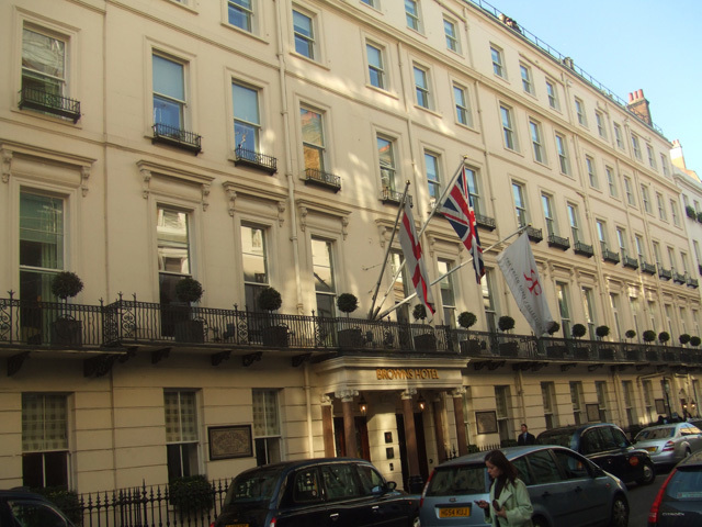
Brown's Hotel opened in 1837, made up of 11 historic Georgian townhouses, with no two of the 117 rooms the same. It was initially run by James and Sarah Brown, the former valet and maid to Lord and Lady Byron, who got hitched and set up a hotel. The Ford family took over in 1859, adding London's first public dining room, and bought the next-door St George's Hotel in 1889, combining the two. Brown's became famous for hosting a veritable who's who of Victorian writers, including Oscar Wilde, Robert Louis Stevenson, Bram Stoker, Arthur Conan Doyle and JM Barrie. It was also the location of London's first phone call, made by Alexander Graham Bell.
Rowland Hill had strong Tottenham connections. His father had set up a progressive school in Birmingham, at which Hill taught from the age of 12. The school moved to Bruce Castle in Tottenham in 1827 and Hill ran it for 12 years. The museum there now has some postboys' coaching horns, quirky items made out of stamps, historic postboxes and collecting tins.
Formerly known as the Post Office Tower, the BT Tower is the iconic peak of Fitzrovia and the tallest structure in the London Borough of Camden. It reaches 177 metres, or 190 metres if the antennae are included, making it much taller than anything nearby.
Long ago, the site of Buckingham Palace was marshy fields belonging to the Manor of Ebury. The River Tyburn meandered through the area and still does, in a pipe beneath the Palace. The land was owned by William the Conqueror and later passed to the monks of Westminster Abbey. In 1536, Henry VIII seized the land during his Dissolution. In 1608, James I used it to plant mulberry trees, hoping to support a silk industry. The experiment failed. The first record of any building on the site dates from 1624, a property later known as Goring House; the current Palace garden also has its origins at this time. Goring House burned down in 1674, replaced by Arlington House, which lasted 30 years before giving way to Buckingham House, built for the 1st Duke of Buckingham and Normandy in 1703 and becoming his main London residence. George III bought it in 1761 for £21,000 as a house for his wife Charlotte. The oldest surviving parts, a wine cellar, date from this period. The future William IV was born here in 1764, the first of three monarchs (with Edward VII and Charles III) born within its walls. The property was called Buckingham Palace in print as early as 1769, though the name only stuck after the 1820s and was cemented by Queen Victoria's residency from 1837. A hairdresser named Spang broke in as early as 1788, the first of many break-ins. John Nash began a major remodelling for George IV in 1826, but cost overruns led to his dismissal; Edward Blore replaced him and completed the work. Marble Arch was built in 1833 as a ceremonial entrance to the Palace, then resited in 1847. William IV offered the Palace as an alternative Houses of Parliament after the Thames building burned in 1834, but the offer was declined; he never moved in. Queen Victoria made the Palace her official abode from 1837. Edward 'The Boy' Jones famously broke in multiple times: in 1838, stealing a sword and other items; in 1840, he was found under the Queen's sofa having reportedly spent two days inside. Blore returned in 1847 to build an entirely new East Front, enclosing the courtyard and giving the Palace its recognisable square form; Marble Arch was relocated to the Oxford Street and Edgware Road junction at the same time. Victoria and the Royal Family appeared on the Palace balcony to mark the opening of the Great Exhibition in 1851, the moment such appearances became a tradition. After Prince Albert's death in 1861, the grief-stricken Queen shunned the Palace and it lay empty for much of the next few years. Edward VII, born in the Palace, was also the first (and so far only) monarch to die there, in 1910; his final words concerned his horse winning a race that day. Architect Aston Webb reworked the public-facing East Front with Portland Stone in 1913, giving it the classical style it still wears, and the monument to Victoria in front was constructed the same year. The Palace was bombed several times in 1940, including a blast that destroyed the chapel; Queen Elizabeth (later the Queen Mother) declared: 'I'm glad we have been bombed. Now I can look the East End in the face.' In 1982, Michael Fagan broke into the Palace and entered the Queen's bedroom. In 1997, following the death of Diana, Princess of Wales, a Union Flag was flown at half-mast above the Palace for the first time ever. The Palace was designated Grade I listed in 1970.
View of Buckingham Palace looking along the facadeJohn Sheffield, 1st Duke of Buckingham. Poet, statesman and little teapot. Image public domain.Buckingham House as it appeared around 1710. Image public domainThis is how the Palace would have looked in 1837, when Queen Vic moved in. Note the Marble Arch to the left. It would be kicked out in 1847 when the East Front was constructed to complete the square. Image public domain.The Palace as we know it today (with bonus snow), was the creation of Aston WebbRay Holmes's Hurricane engine. Image by the authorThis means the King is at home.
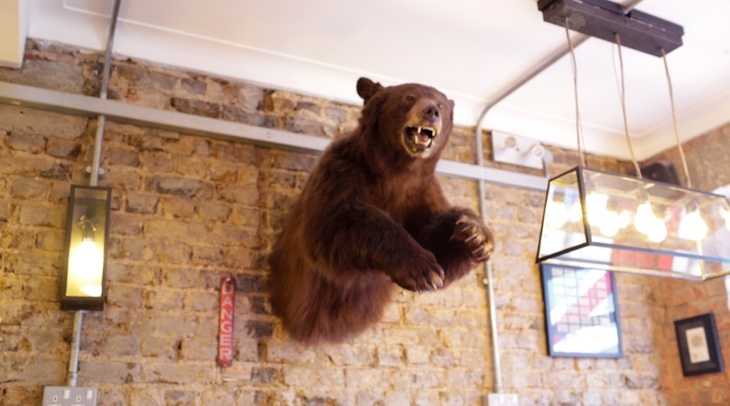
The Queen's Guards who parade at Buckingham Palace during the summer tourist season wear bearskin hats that are 16 inches tall and weigh around a kilogram each. The material is black bear fur, designed to keep an animal warm as it hibernates in deep snow at temperatures of -30°C. There has been talk over the years of ditching the bearskin for something more ethical, but as of January 2016 spending on the traditional bearskin was soaring.
The Buffalo Bar in Highbury closed in favour of flats and offices. Its loss was cited as part of a wider crisis in which London music venues were disappearing at a frightening rate, with venues described as the epicentre of a structure impacting local businesses, restaurants, bars, hotels and transport, and the Mayor of London's Music Venues Taskforce estimating their total value to London at £1.6 billion.
Bunhill 2 Energy Centre harnesses heat waste emissions from the Northern line and uses it to power 1,350 local homes and a leisure centre. Its ox-blood exterior is a nod to the tiles of Leslie Green-era Northern line stations.
Bunhill 2 Energy Centre turns waste heat from the tube into energy that can be used elsewhere. Image: Taran Wilkhu/Hoxton Mini Press
Bunhill Fields, just south of Old Street station, is a well-known graveyard for non-conformists including William Blake and Daniel Defoe. It was also a dumping ground for thousands of carriage-loads of human bones during a clear out of St Paul's charnel house around 1550. Many strange sights have been reported here, from hooded phantoms to mysterious handprints.
In October 1936, police clashed with Jewish, socialist, Irish and communist anti-fascist protesters over a planned march through the streets of the East End by Mosley's Blackshirts, the British Union of Fascists. The decision to march through the then heavily Jewish East End was denounced as Jew-baiting by the Board of Deputies of British Jews. The Battle of Cable Street directly led to the passing of a public order act which forbade the wearing of political uniforms in public, and is widely considered a significant factor in the British Union of Fascists' political decline prior to World War II.
There's so much woodwork inside the Cadogan Arms that you'd almost expect an Ewok to swing down from the ceiling. The pub reopened in 2021 after some time in the doldrums. A major refit sees it looking simultaneously historic (the place dates from 1838) and modern, somehow. This being Chelsea, it's primarily set up for well-heeled diners, though you'll be made to feel very welcome if all you seek is a drink; the front part of the pub retains a 'this is where the drinkers sit' ambience, with some truly cosy corners.
Interior of the Cadogan Arms, chelseaCadogan Arms, King's Road
Now a concert hall and the base of the Royal Philharmonic Orchestra, Cadogan Hall was once a New Christian Science Church with a 1,400-strong congregation. As worshippers declined, the congregation moved to another church and the building fell disused before being bought by the Cadogan Estate in 2000. The Royal Philharmonic Orchestra was looking for a new home at the time, and the concert hall opened in 2004 following changes to the room's acoustic properties. While the venue largely sticks to choral and orchestral performances, it does branch out into the occasional pop concert and Frank Sinatra homage night.
The Lightning Seeds performing at Cadogan Hall in 2010. Photo: roll the dice
The Cafe of Good Hope on Hither Green Lane has a great selection of drinks and hearty soups. The profits go towards the Jimmy Mizen foundation, which was set up in memory of the 16-year-old who was tragically murdered in the area in 2008.
Caledonian Road takes its name from the Caledonian Asylum, originally set up in 1815 to help Scottish children orphaned by the Napoleonic Wars. The institution moved to Islington in 1828 and became so well known that its name was bestowed on the major thoroughfare still called Caledonian Road today.
During World War Two, city planners John Forshaw and Patrick Abercrombie were already plotting the London of the future. Their 1943 County of London Plan included a radical reshaping of London's road networks, with major new ring roads and multi-lane highways right through the centre of town. Famously, Camden Town would have been largely obliterated by a major junction and approach roads. London was largely spared this tarmac overhaul, though some aspects, such as the Westway, did come to fruition.
The famously decorated rail bridge that spans Camden High Street has been an iconic piece of placemaking since the 1980s, when John Bulley was commissioned to spice up the bridge. The two painters depicted on it are based on John's co-workers.
Explosive detection dog Molly, a two-year-old English springer spaniel, patrols Canary Wharf with her handler Gordon. The pair have worked together for 18 months. During a public exercise, Molly spotted what she thought was her tennis ball in a woman's open bag and ran off with the woman's apple instead. Gordon describes her as a complete workaholic whose only dislike is being groomed.
Photo by Matt Grayson
map ↗ Google geocode · area · low conf (table-only, not mapped)
Only the Great Hall, from the 1550s, is Grade I listed in what's now Carew Academy. The arch-braced hammerbeam roof is one of a few examples left in the country (another being at Hampton Court Palace). Exterior photo by Matt Brown.
Carnaby Street was already starting to lose its appeal amongst the mod cognoscenti in the 60s: it was too short for the necessary promenading. 'Once you've been the length in your purple and yellow-striped Mongolian lamb coat, that's it.'
Westminster City Council repaved Carnaby Street with jazzy coloured tiles in the 1980s, to enhance its reputation as a centre of fashion, but it was hard to shed its tawdry image.
Westminster City Council repaved Carnaby Street with jazzy coloured tiles, to enhance its reputation as a ‘centre of fashion’, but it was hard to shed its tawdry image.
Casson Pavilion (former elephant house), London Zoo
The Casson Pavilion (better known as the old elephant house, a building most Londoners seem to have childhood memories of) has an off-limits basement underneath it. The public used to be able to enter the building at ground level, but there's also a basement mainly used by keepers to prepare food for the animals. Inside, the walls are lined with vintage zoo adverts and publicity posters: a subterranean zoological time capsule.
Inside the basement: it's off-limits to the public. Photo: Londonist
The Catford Bridge Tavern (formerly the notorious Copperfield) was taken over, refurbished and reopened by the Antic pub chain, quickly becoming one of the best things to happen to Catford in years. Its future was thrown into doubt when a planning application to Lewisham Council revealed that the building's owners intended to convert the lower level to an A1 retail unit, effectively turning it into a small supermarket for a national retailer, while converting the upper floors into flats. Antic were not even aware of the plan until the application surfaced. Local MP Heidi Alexander described the Catford Bridge Tavern as one of the best things to have happened to Catford and called on residents to object to the planning department. The case was seen as part of a broader London trend of successful community pubs being lost to residential and retail development.
Cecil Court is also known as Booksellers' Row, Flicker Alley and, for the Potterheads among you, Diagon Alley. Home to nigh on 20 independent and antique bookshops, many with beautiful Victorian frontages, it is a bibliophile's paradise.
A medieval skeleton was discovered by Museum of London Archaeology (MOLA) during excavations at Chambers Wharf in Bermondsey, just downstream of the Tower of London, where work is underway to build the Thames Tideway Tunnel. The remains are thought to date back to the late 15th or early 16th century. The skeleton was still wearing a pair of leather thigh-high boots. The good quality boots suggest the man made his living from the river, perhaps a fisherman, sailor or mudlark. Deep grooves found on the teeth seem to have been caused by a repetitive action, 'like passing rope between his teeth as a fisherman might'. The man's position (face-down, with one arm above his head and the other bent back on itself to the side) suggests this was an accident: 'he fell or drowned and was covered quickly by the ground as it moved with the tide,' according to MOLA.
The discovering of this skeleton in Bermondsey caused particular excitement among archaeologists. Image: MOLAArchaeologists carefully excavate the skeleton. Image: MOLAA close up of the boots, preserved for centuries in the Thames mud. Image: MOLAHuman Osteologist Niamh Carty examines the booted man's skeleton. Image: MOLAHeadland archaeologists excavating at Chambers Wharf for Tideway. Image: MOLAWhen boots were made to last. Image: MOLA
The Charing Cross Hotel, built above Charing Cross Station, was designed by architect Edward Middleton Barry, the third son of architect Charles Barry and the man responsible for Covent Garden's Royal Opera House. Edward also designed the nearby Queen Eleanor Memorial Cross. Built to rival the other big railway hotels at King's Cross and Paddington, the Charing Cross Hotel was designed with an ornate frontage in the Franco-Italianate style.
In the film Thor, the title character boards a train at Charing Cross station and is told it is three stops to Greenwich. Artist Thomas Duke, who visited the location, noted that any Londoner will know how painfully wrong that geography is, describing the sequence as a bizarre and nice little homage to London all the same.
"How do I get to Greenwich?" Says Duke, "The biggest mistake from Marvel: misrepresenting the London Underground! Thor boards the train at Charing Cross station and is then told it’s ‘three stops’ to Greenwich. Any Londoner will know how painfully wrong that is. Even so, it’s still a bizarre and nice little homage to the world of London as is the rest of the film."
The Charles Dickens Museum is the late writer's only remaining house, where visitors can see where he ate, slept and put pen to paper. The quaint museum was redeveloped in 2012 with a grant from the Heritage Lottery Fund. Among the developments was a cosy café with a walled garden, where visitors can sit by original gravestones of Dickens' pets.
There are many beauties in Greenwich and Eltham, and Charlton House can get overlooked. Which would be a shame, since it's considered the best preserved Jacobean house in London. Photo by Matt Brown.
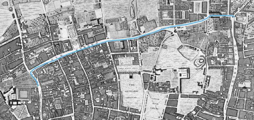
The starting line for James Parrot's legendary four-minute mile attempt on 9 May 1770 was on Goswell Road, beside the wall of the Charterhouse. Parrot, a costermonger, stood to win 15 guineas if he covered the measured mile in under four and a half minutes. According to later accounts, he finished in four minutes, though the only recorded source dates from Sporting Magazine in 1794, a generation after the event.
The John Rocque map of 1746, with Parrot’s route shown in blue. Charterhouse (bottom-left) no longer has a wall on Goswell Road, but it’s clear from the map that its grounds did extend this far in 1746.
Goswell Road (then Goswell Street), beside the wall of the Charterhouse; southern-most extent of Charterhouse Wall
Multiple people have reported seeing the ghost of a man dressed in a blue RAF uniform walking along Chatterton Road in Bromley. One witness said: 'The person didn't seem to look at us at all when he passed by but I felt very uncomfortable. I was so uneasy I turned my head around as soon as we had passed but he had gone.'
Cheapside in the City was 'the Oxford Street of its day', a thoroughfare selling souvenirs, slightly flashier and better-made than the ones we get now. In 1912, 340-odd buried trinkets (including brooches, rings, tankards and salt cellars) were brought to the surface at Cheapside, and gleamed in the London sun once more. 101 years after it was found, the Cheapside Hoard went on display at the Museum of London, where an oversized copy of one of the flashiest brooches slithered along the wall.
Chelsea King's Road (proposed Crossrail 2 station), London
The only brand new station planned for Crossrail 2 would be Chelsea King's Road. There was already some nimbyish resistance to the plan when the article was written.
Beyond the Observatory and Planetarium in Greenwich Park, off Blackheath Avenue, a perpendicular footpath branches towards Ranger's House and the rose garden. Along this straight path, trees lean into each other, creating a Japanese-style cherry blossom tunnel. Benches beneath the branches make it a prime spot for a picnic.
A Japanese-style cherry blossom tunnel in Greenwich. Image: Shutterstock
beyond the Observatory and Planetarium; footpath off Blackheath Avenue, towards Ranger's House and the rose garden
The Chesham Arms is a historic pub that was saved from being developed into flats in 2016, after Hackney Council gave it protected status by declaring it an Asset of Community Value.
There is a bucolic region just to the north of Greater London called the Chess Valley, featuring a 10-mile walk along the meandering River Chess. The valley contains watercress beds, kingfishers, and the site of a Roman villa, making it a charming weekend destination easily accessible via the Metropolitan line.
Don't take everything at face value...Water bailiffs really are a thing, although not sure they ever looked exactly like this...Click to enlarge
Just to the north of Greater London; accessible via the Metropolitan line; the Cock Inn at Sarratt is along the route
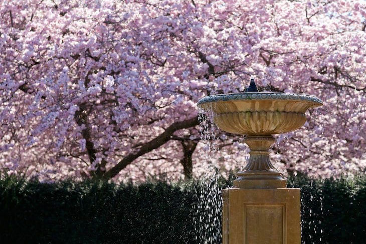
The cherry blossom trees on Chester Road in Regent's Park were removed in 2015 when the diseased Prunus 'Kanzan' variety were replaced with the Prunus 'Sunset Boulevard'. The trees line Chester Road avenue-style; it is one of only two vehicle roads in the whole park. Further cherry blossom can be found in the Avenue Gardens, close to the Broad Walk.
Regent's Park's cherry blossoms are back. Image: The Royal Parks
Chester Road, Regent's Park, one of only two vehicle roads in the park
Atop the Chiltern Firehouse is a brilliant feature of the original Victorian Fire Station: a watchtower from which firefighters would scan London for fires. It's so ornate, it looks more like a castle.
Not a castle, but a fire station. Image: Katie Wignall
Visit 30 towns in a day at Chiltern Open Air Museum, with buildings from all over, including mission rooms, toll gates and furniture factories: It's one of our picks of fantastically quirky and unusual museums to visit near London:
One lamppost along Tower Bridge looks a little different from the rest: it's a chimney hiding in plain sight. Once connected to a guard room beneath the bridge, the Clean Air Act of 1956 banned coal fires, leaving it redundant.
22 miles of manmade caves, where Jimi Hendrix played twice. That's what you'll find under the streets of Chislehurst. Read all about our visit: See also: 7 enchanting caves and grottos to visit in and around London:
There are loads of individual monuments and buildings listed in Hounslow's parks, but we especially like the notion of listing a small waterfall. It's been flowing since around 1738. Photo by Matt Brown.
This is the Chiswick section of the glorious Thames Path that runs all the way from the source of the Thames in the Cotswolds down to the Thames Barrier at Woolwich. To reach it, cross the A4 (the Great West Road in these parts) determinedly past the Fuller's Griffin Brewery, resisting all temptation, then walk down Chiswick Mall and Thames Crescent. The reward is a verdant heaven of tree-lined tracks with the Thames on one side and the bucolic expanse of Dukes Meadows on the other. Barely minutes from the noise and madness of the A4, the trees block out the sounds of city life and transport you to an almost-countryside setting. It is great for walking, running and cycling, but even better for just shutting out the world, watching the river, lazing with a book, or a bit of wildlife spotting. Spring brings wetland grasses and flowers, and several weeping willows line the bank. Ducks, swans, gulls, grebes, and the occasional kingfisher are regulars; squirrels abound; foxes have been spotted a couple of times. The one caveat: airplanes on descent to Heathrow pass directly overhead every few minutes.
no image
Adjoining the Thames at the most easterly and southerly borders of Chiswick. Cross the A4/Great West Road, past Fuller's Griffin Brewery, along Chiswick Mall and Thames Crescent.
Christ Church Lincoln Tower (Oasis Centre), Westminster Bridge Road, Lambeth
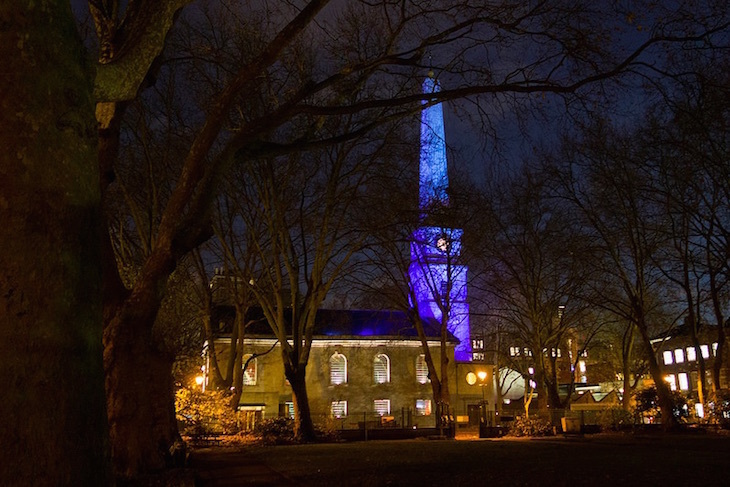
The Kentish ragstone steeple of Christ Church on Westminster Bridge Road sports distinctive red bands separated by rows of stars. Viewed under a clear sky, the red, white and blue conjures images of the US flag. This is deliberate: the church's guiding light, Christopher Newman Hall, had argued passionately for the abolition of slavery in America and decided the tower should serve as a memorial of emancipation, dubbing it the Lincoln Tower in honour of the anti-slavery President. The structure was half-funded by American donations, and its foundation stone was laid by the American Ambassador General Schenk. It was opened on 4 July 1876, exactly 100 years after the Declaration of Independence was approved. The church took significant damage in the Second World War, and only the tower now remains from the original set of buildings. A new concrete block, including a chapel and office space, was added in the 1960s. It is now known as the Oasis Centre.
no image
opposite Lambeth North tube station, Westminster Bridge Road
We're trying to avoid churches in this map, because otherwise we'd be inundated, but we're making an exception for this 12th century one. It's no longer a church, but holds exhibitions and concerts instead. Photo by Friends of St Mary.
City of London (Square Mile), Christopher Wren's unbuilt plan
After the Great Fire destroyed most of the Square Mile, a number of architects rushed out plans for rebuilding the city. Leading the pack was Sir Christopher Wren, whose scheme included grand boulevards meeting at wide piazzas, as was the fashion on the continent. Had the plans gone ahead, the City would look very different today. A 2013 overlay map by James Macdonald shows Wren's scheme atop a modern map of the Square Mile, with a resurrected Fleet Canal to the west and a jaunty angle for Southwark Bridge, though Bank junction still looks like a bit of a nightmare.
The City of London Cemetery is offering second-hand graves, with 'refurbished' monuments including headstones, obelisks and crosses, to be used again. Recycled burial plots, complete with the original memorials, still contain the remains of those who died at least 75 years ago. The names of the dead are simply scoured from the monuments to allow new inscriptions. The cemetery is selling 1,000 such plots advertised as 'traditional-style graves' to be 'adopted' by families willing to pay £3,000 to lease them for 50 years. The City of London corporation says many graves were dug deep enough to allow for more coffins and that re-using the memorials is good conservation.
City Road station opened in November 1901 as part of the Northern line's northward push, but closed after just 21 years' service in 1922. It never reopened, although it might be useful nowadays to serve the preposterous number of tower blocks that have shot up on its doorstep.
Civil Service FC lost in the very first round of the very first FA Cup but were playing a long game. Having celebrated their 150th birthday in 2013, they are the only surviving club considered a founder member of the FA. Their long history means they have helped influence the sport across the world, and even taken on and beaten the likes of Barcelona and Real Madrid. For almost a century they played home games at a ground in Chiswick.
A team of civil servants lines up to face Barcelona in a tour of 1921. Photo courtesy of Civil Service FC.
Locals crowd funded to replace the ads at Clapham Common station with photos of cats who needed rehoming. It wasn't just a cute selfie opportunity but part of a growing trend to reclaim public space from private organisations.
Last year the ads at Clapham Common station were replaced with cats. Photo: James Beard
A hotel called Mivart's was established on this site in 1812, next door to a smaller hotel owned by a Mr and Mrs Claridge. The founding of Claridge's is taken as 1854, when the two were combined. In its first edition of 1878, Baedeker's London listed Claridge's as 'The first hotel in London'. Much of the original building was demolished and rebuilt in 1898 as the hotel known today.
Older than anything else in Westminster, beating the Royal palaces, the medieval parts of the Houses of Parliament and Westminster Abbey, is Cleopatra's Needle. Created around 1500BC, it stood in Heliopolis and Alexandria before being buried for 2,000 years, when it was dug up and transported to London. Photo by Matt Brown.
Cock Lane was the scene of London's most famous Georgian ghost story. Tales of a noisy apparition called Scratching Fanny caused a sensation and drew huge crowds, among them lords, ladies and celebrities, who assembled in the narrow thoroughfare hoping to catch a glimpse of the lewdly named spook. The case was so notorious it became one of the few hauntings to inspire a lengthy Wikipedia entry. Alas, the whole thing was faked.
Colchester was once the capital of England, making Colchester Castle a sort-of former Tower of London, though with fewer crowds and far less bling. It's situated in Colchester town centre. These days it's owned and managed by Colchester & Ipswich Museums, and is run more like a museum than a castle, showcasing Colchester's history from the Celtic kings onwards. Objects of particular interest include the Fenwick Hoard, a stash of Roman jewellery which was buried to keep it safe from Boudica's army. Colchester Castle is the largest Norman keep in Europe, and is built on the foundations of the Roman temple of Claudius. Daily guided tours go down into the Roman vaults and prisons, and up on the castle roof.
College Road Tower A (Enclave Apartments), Croydon
College Road Tower A, also known as Enclave Apartments, topped out in 2022 and at 154.4 metres slightly surpasses the 153 metre Croydon Transmitter to become the tallest structure in the London Borough of Croydon. It is the tallest tower built by modular construction in Europe.
Conan Doyle's very best Sherlock Holmes short stories were written between 1891 and 1893 when he was living in Tennison Road, South Norwood. He was a proper south Londoner, if briefly, and even put his neighbourhood into the title of a short story: The Adventure of the Norwood Builder. A plaque marks the suburban house.
Concrete Ships, Rainham Marshes foreshore, River Thames
On the foreshore at Rainham Marshes, 16 hulking concrete ships lie in the mud, looking at first blush like a pod of beached whales. These are the remains of barges constructed during the Second World War as part of the preparations for D-Day. Their hulls are formed from ferroconcrete, concrete reinforced with iron, a material relatively cheap to produce during wartime metal shortages. Despite appearances, the barges are lighter than the water they displace and can float. They were designed to transport fuel to other craft engaged in the Normandy invasion, but reportedly flunked their tests and probably never saw action. These particular hulks were reportedly given a new lease of life in 1953, when they were towed to this location and sunk to shore up damaged flood barriers. They have sat in the mud ever since, slowly rotting away as the tides wash over them. According to the RSPB, they now support the annual wintering of rock and water pipits, as well as roost sites for other birds.
Satellite view from Google Maps.
Riverfront at Rainham Marshes; Stone Barges car park is nearby; visible on section 24 of the London LOOP between Rainham and Purfleet
West Saxon Kings are said to have been crowned on this stone during the 10th century. It's been in its present position since 1850. Photo by Matt Brown.
The landmark Coronet cinema has its own ghost. Legend has it that a cashier was once caught raiding the till and was so ashamed that she leapt to her death from an upper storey. Her footsteps can still be heard running upstairs to the scene of her fatal plunge.
The Courthouse Hotel near Carnaby Street has one of London's oddest bars: you can relax in an old prison cell, complete with lav, while you sip on a martini.
The Courthouse Hotel near Carnaby Street has one of London's oddest bars -- relax in an old prison cell, complete with lav, while you sip on a martini. Image by M@.
A pedestrian alcove from Old London Bridge survives at the south-western end of the Courtlands Estate in East Sheen, Richmond. It once formed a garden decoration for a posh house called Stawell House (pronounced, for some reason, as 'shawl'). The house is long gone but the alcove remains. A second niche once occupied the site, along with some balustrades from the bridge, but these were spirited away in the 1930s during construction of the estate.
A stone, arch-topped alcove from London Bridge, now nestling on a hillock with a hedge behind.
East Sheen, Richmond; south-western end of the Courtlands Estate
Covent Garden has a history as a red-light district. Its licentious past may explain why the area carries a particular rubbery connotation in the popular imagination.
The old fruit and vegetable wholesale market at Covent Garden dates back to the 17th century; the first record of a market here is from 1654, and Charles II granted a charter for it in 1670. The name is older still: the land was owned by Westminster Abbey during the Middle Ages and referred to as 'the garden of the Abbot and Convent of Westminster' in the 13th century. The name Covent Garden, with 'covent' being a corruption of 'convent', had evolved by the 16th century. The market relocated to Nine Elms in 1974.
Covent Garden was an area of radical change in the 1980s. The fruit market had closed in the 1970s, and the plaza area was reborn as a tourist centre in the early 1980s. But many old structures remained that have since vanished.
The old floral hall at Covent Garden. Part of this structure was saved and is now in Borough Market. May 1987
Dedicated dancers headed to the West End, and a dingy basement club at 223 Wardour Street, named Crackers. The owners of this financially-challenged piano and rock establishment tried out a Friday lunchtime soul session between noon and 2.30. It soon attracted a very young crowd. The music (import-only funk from America) could not be heard anywhere else in London. DJ George Power encouraged dance-offs or 'burn-ups', and it wasn't long before the top dancers were holding court on the floor. Crackers reached its height during the long, hot summer of 1976. The musician Jazzie B said of it: 'Crackers was the start of it all, with people dancing to the right music in the right atmosphere and most importantly with the right people'.
A group of soul boys outside Crackers in 1975. In the foreground is Dez Parkes, one of the top dancers of the era.
Creekmouth village was always in a precarious position, rounded off by water, with the River Roding to the west and the Thames to the south, the land gloopy and the foundations unstable. Gunpowder magazines were installed in the 18th century, the location chosen so that if they'd exploded, the casualties would have been minimal. Generations of Barking Power Stations (one opened by George V in 1925) pulled a toxic blanket over the terraced cottages overlooking the creek. The 55 cottages, school house and mission church standing there by 1889 were for employees of the Lawes Chemical factory. On the night of 31 January 1953, the North Sea flood sloshed freezing, fetid water into the villagers' homes. One resident recalled: "The council gave everyone bags of limes, which were buried in the garden and put under the floorboards to kill off germs." Such efforts proved futile; the cottages were summarily demolished and Creekmouth village was gone. Of the very few remains of the village, the gabled roof of the old school house can be made out over a razor wire fence. It is now the offices of a bulk stainless steel company. The site is now a waste and recycling plant. The Creekmouth Preservation Society has kept close ties with the estate, installing images above the shop fronts including one of the Handley Page Aviation Factory, which manufactured the questionably named 'Yellow Peril' in 1911. The nearby mural spills out Creekmouth's tumultuous history (it was also where the Princess Alice sank) onto the canvas by two 'old souls'.
An engraving depicting Creekmouth Village, on a spot overlooking where it once wasCreekmouth Village. Image: Creekmouth Preservation SocietyWhere Creekmouth village once stoodLee gets up at quarter to three each morning to commute in to CreekmouthA mural by Tamara Froud, depicting landmark events in Creekmouth's history, including the floodIn Creekmouth you will nearly die a lotThe former school house, behind razorwireA rare breathing space, courtesy of Creekmouth Preservation Society
River Roding to the west, Thames to the south; site now occupied by waste and recycling plant; Barking Creek Barrier overlooks the site; accessed via River Road
Harking back to the speculative and moneyed Victorian era, the urban legend suggests that Frank Crocker heard that a new terminus for the Great Central Railway was to be established in St John's Wood. With rail travel being quite the thing, he thought building a splendiferous hotel nearby would be a total no-brainer. In order to attract the well-heeled travellers he spared no expense, using over 50 types of marble, flamboyant crystal chandeliers, soaring marble columns and the innovative concept of a women-only bar, hints of Versailles meeting a classic gin palace aesthetic. Unfortunately for Frank the railway never came to fruition in the locale, so the hotel festered slightly off-grid once complete in 1898. It was later often frequented by England cricketing legends from nearby Lord's. Originally known as The Crown, the pub was renamed Crocker's Folly to remember the misplaced financial stake, and poor old Frank Crocker's ghost is said to haunt the premises to this day. Beautifully renovated and reopened as a restaurant in 2014, it's well worth a visit to enjoy the palatial ambition and grandeur alone.
A less flashy Roman excavation lies in Orpington. Crofton Roman Villa saw the light again in 1926, and is now the fascinating skeleton of a roomy Roman farmhouse.
Kingston's recently refurbished Cromwell Road bus station bears a plaque dedicated to Jill Viner, who became the first woman to drive a London bus licensed to carry passengers. This location was chosen because it is close to the area Viner worked in: she was based at a bus station which no longer exists in nearby Norbiton, and drove route 65. Back then, that route linked Chessington and Ealing, but these days it runs between Kingston and Ealing. Viner first qualified as a bus driver in May 1974, becoming a pioneer for women to drive passenger buses professionally. She retired from driving buses in 1993 and died in 1996. The plaque can be seen at the western entrance to Cromwell Road bus station.
TfL’s Director of Buses and Women in Bus & Coach Director, Lorna Murphy, alongside Paul Sainthouse, Women in Bus & Coach Director, with the new plaque
western entrance to Cromwell Road bus station, Kingston; close to the area Viner worked, near Norbiton
The Crooked Billet was a pub in Creekmouth. On the night of the North Sea flood of 31 January 1953, the licencees, the Stubbs family, made sandwiches and hot food for the flood victims. The building still stands on River Road and a swinging sign still identifies it as the Crooked Billet, though it is now used as a venue for other events.
The former Crooked Billet pub. A swinging sign still calls it this
on River Road in Creekmouth; the busiest stretch of River Road
Cross Bones Graveyard on Union Street was used for Winchester Geese: prostitutes who were licensed by the Bishop of Winchester in return for a cut from their income. A local man leads walks there, going into character as one of the prostitutes and recounting the stories of the time. People come from all over the world to attend.
The final stop on our local tour with Jones veers outside the strict confines of Bermondsey but still within the Saint Saviour catchment area. And for a good reason. We walk down Union Street, which has played a big thematic part in her discography, to reach Cross Bones Graveyard. “There used to be a workhouse on the street and the graveyard itself was used for Winchester Geese. They were prostitutes who were licensed by the Bishop of Winchester, in return for a cut from their income.”“There’s a local man who leads geese walks here, or at least that’s what I believe they call them. He takes in spirits and then goes into character as one of the prostitutes and talks about the stories of the time. People come from all over the world to watch him. I was down here one day and the tragedy of the women buried here really hit me”, Jones says of how she subsequently came to write her song, Reasons.
on Union Street, Bermondsey; near Borough High Street area
Crossbones, which lies in the shadow of The Shard, yielded bodies bearing evidence of syphilis, smallpox, tuberculosis and Paget's disease during a 1990s excavation. These were paupers' bodies, and the excavation is still commemorated with candlelit vigils, amazing how historical digs can strike a chord in the hearts of the living.
Built by Sir Joseph Bazalgette, the Crossness Pumping Station is an ornamental ironworks wonderland and home to the station's heavy duty engines, named Queen Victoria, Albert Edward (King Edward VII), Prince Consort, and Alexandra (wife of Edward VII).
This tiny pub is easily missed down Bride Lane, squeezed between more famous neighbours the Old Bell and the Punch Tavern. It was once part of the Punch Tavern but got walled off after a dispute among the co-owners. Inside, it is almost like a stage set for a typical Sam Smiths pub: dark wooden panels, cut-glass mirrors and a sculpted ceiling. The pub's obscurity means you can usually get a seat or bar stool, despite the limited space.
26 Bride Lane, London EC4Y 8DT; between the Old Bell and the Punch Tavern
The former Croydon Airport is a source of remarkable stories from the golden age of air travel. The mayday distress call was created here. One of the most perplexing episodes involved a desperate Clapham cinema owner who moonlighted as film star Charlie Chaplin's chauffeur, picking him up from his inbound flight from Paris and whisking him straight off to his cinema for an impromptu performance. Agatha Christie featured the airport in her novel Death in the Clouds, which involves the mysterious death of a French moneylender as her plane comes in to land there. Freeman Wills Crofts' novel The 12.30 from Croydon features another peculiar fatality on a flight setting off from the airport.
Kinematograph Weekly, 13 October 1921. From British Newspaper Archive
Crystal Palace sits at the meeting point of multiple London boroughs. From one spot in Crystal Palace it is possible to visit four different London boroughs in a very short space of time, and walking a further two minutes up the road would bring you into a fifth borough, Lewisham.
Mario was one of the two founders of Pizza Express, which started in 1965, but he opened his own pizza restaurant in 1967 with a very different feel in terms of menu and decor. It remains in the hands of his wife and two sons, bringing the authentic tastes of Naples to life, with ingredients sourced directly from there. A whole host of celebrities have dined here, including Dustin Hoffman, Ben Stiller, Penelope Cruz, Madonna and the late Princess Diana, who would bring Princes William and Harry when they were younger.
Danger Mouse Postbox, Melcombe Street, Baker Street
The animated characters Danger Mouse and his sidekick Penfold, who first appeared on screen in 1981 voiced by David Jason and Terry Scott, have their fictional lair inside a postbox on Baker Street. Both the original series and a revived 2015 version used this location. On Melcombe Street, opposite the tube exit on Baker Street, there is just such a postbox. It was at one point decorated with a fake Blue Plaque dedicated to the duo, which was later stripped away. In 2024 an intricate postbox topper appeared there.
Image: Matt Brown
Melcombe Street, opposite the tube exit on Baker Street
Dans Le Noir (French for 'in the dark') is an experimental dining experience in Clerkenwell where adventurous diners eat in a room plunged completely into darkness, not just dim but can't-see-your-hand-in-front-of-your-face pitch black. The idea is to bring focus to the taste and texture of food, heightening other senses as diners are stripped of their sight. Food is chosen from set menus before entering the dining room, and almost all the waiting staff are visually impaired.
When the Dartford Tunnel opened in November 1963, it was deemed too dangerous for cyclists to use. The solution was the Dartford Tunnel Cycle Service, a specially adapted bus on which cyclists could stash their wheels and get a ride under the Thames. Safety concerns about the bus itself arose, and the service folded in 1965 after less than two years of operation.
The Dartford Tunnel Cycle Service only lasted a couple of years, but you can still get a lift across the Dartford Crossing to this day. Image: public domain
This Cheapside branch marks a new episode for bookselling in the City. At the time of opening it was one of the very few, if not the only independent, bookshop in the Square Mile. The two-storey shop carries the excellent selection expected of Daunt, with a large travel section in the basement. Notably, the shop is open at weekends, a rarity for the area. Its only imminent competition was Foyles' planned 'booktique' at nearby One New Change.
David Attenborough mural, tropical fish shop, St Matthew's Row, Bethnal Green
On St Matthew's Row in east London, a mural of naturalist David Attenborough adorns the side of a tropical fish shop. The painting was created by urban artist Jerome, known as @ketones6000, and took around two days to complete. This isn't the first time the artist has used the building as his canvas: the Attenborough effort covers his previous work, which paid tribute to the first world war's fallen heroes. The poppies from the old mural have been woven into its successor. When the shop owner came out for a look, the artist explained: 'It stops me from doing the bad things.'
on the side of a tropical fish shop on St Matthew's Row; around the corner from Bethnal Green Road
De Hems is London's only authentic Dutch pub, originating in the 19th century and full to the brim with Dutch snacks such as cheese parcels and bitterballen (like a crispy deep fried beefy bonbon), beers and interesting spirits. Inside, you feel a bit like you're in Den Haag.
This place occupies that fine space between glorious and awful. Look at those towers and that tiling. It was designed by Halsey Ricardo in 1905 for the store-owning family. Photo by Lindsey Berthoud.
A peculiar building on Buck Street was built in the early 1940s as the portal to a planned high-speed underground railway, but instead ended up as a bomb shelter. It was just one of 13 such buildings dotted along the Northern line. After the war, the money was not there to complete the railway. The deep-level shelters have since found other purposes, including document storage and subterranean farming.
A graffiti spattered brick building with a drum-shaped front - a former deep level shelter
Police brought forensic pathologist David Bowen (1924-2011) samples of mystery meat that had been blocking the drain at a house in Muswell Hill. Bowen quickly identified it as human, and police were in position to arrest the serial killer Dennis Nilsen when he came home from work.
One of slave trader Humphry Morice's purpose-built slave ships, the Whydah Gally, was constructed in Deptford. Built in 1715 to hold 500 hostages, the ship was named after the port of Ouidah in Benin, West Africa. In 1717, it was hijacked by a group of pirates in the Caribbean. Many pirate crews included freed Africans. The Whydah Gally was then used as a pirate flagship by 'Black Sam' Bellamy (who was not Black), before it was shipwrecked (loaded with African gold) off the coast of Massachusetts. In 1984, after decades of searching, deep sea diver Barry Clifford found the wreckage, recovered numerous items (including incredibly fine Akan jewellery) and set up the Whydah Pirate Museum in Cape Cod.
Purpose-built slave ships were put together in Deptford. Image: public domain
Dickins & Jones had stood on Regent Street since 1790. The store was to close due to a downturn in consumer spending and rent rises; its building had been sold to property developers planning to turn it into a series of smaller shops, with flats and offices above, putting 500+ staff at risk of redundancy.
Diesel Gym in the Royal Docks hosts a weekly women-only boxing session run by Athena Bashar and social enterprise SCK Fitness. The free Saturday night sessions began after SCK Fitness identified demand from Somali women in Newham for accessible fitness, and quickly grew to attract women from across London. The sessions are barred to men, and draw participants from North African, South Asian and Eastern European backgrounds who cannot easily access women-only fitness elsewhere. Athena Bashar, who became the head women's boxing coach at Fight For Peace, started boxing at 14 and was among the first hijabi boxers to compete in Kent, finding little diversity at the tournaments she attended.
Female Muslim boxers feel empowered at classes in the Docklands. Image: Momtaz Begum-Hossain/LondonistImage: Momtaz Begum-Hossain/LondonistThe author (right) with Athena, who runs a weekly boxing club for women in east London. Image: Momtaz Begum-Hossain/LondonistAthena competing.Image: Momtaz Begum-Hossain/LondonistImage: Momtaz Begum-Hossain/Londonist
Discover Children's Story Centre in Stratford underwent a major refurbishment to offer three new floors of stories and play, including secret tunnels, a steampunk ship, a sparkly river, crow's nests and walkways to a structure called the Observatron. Children can post stories to Hootah, a resident space alien, in a sorting office of stories. Original artwork on the walls comes from illustrators including Axel Scheffler, Anthony Browne, Chris Riddell and Cressida Cowell. The centre is also home to a monster-themed cafe with a monster-themed menu.
The Docklands Light Railway (DLR) is so-called because it runs predominantly in London's Docklands area and uses rolling stock derived from tram technology. It opened in 1987, though part of the line runs on infrastructure dating back to 1836. Two central stations, Bank and Tower Gateway, run east, south-east, and north-east to terminuses at Stratford International, Woolwich Arsenal, Lewisham, and Beckton. The DLR has been extended a number of times during its near-40-year history and currently encompasses 45 stations.
The Dollis Brook Viaduct is a 13-arched brick viaduct built in 1863 for steam locomotives. It now carries Northern line underground trains to and from Mill Hill East. At 18 metres tall, it is the highest point above ground on the Underground network.
no image
on the Northern line route to Mill Hill East, crossing Dollis Brook
The Dollis Brook Viaduct near Mill Hill originally opened in 1867 but was transferred to the London Underground during the second world war, when old track was incorporated into the Northern line's Mill Hill branch.
The Dollis Brook Viaduct near Mill Hill opened in 1867 but transferred to the tube during the second world war. Image Matt Brown
Dominion Theatre site (former Horseshoe Brewery), St Giles
The great beer flood of 1814 took place at the Horseshoe Brewery of the Meux company, at or very near the site of where the Dominion Theatre now stands. The brewery was owned by the grandfather of Sir Henry Meux, 3rd baronet, whose wife Valerie would later become one of London's most colourful Victorian figures.
no image
at or very near the site of where the Dominion Theatre now stands, St Giles
The Dominion Theatre is built on the site of the Meux brewery. In 1814, a huge barrel burst open and eight people lost their lives, some of whom drowned in beer. Theatre-goers have often reported strange sensations in the theatre, and one couple captured an image of what appeared to be a spectral girl, thought to be one of those killed in the flood.
Don Arden and Small Faces plaque, Carnaby Street, Soho
Music manager Don Arden, known in the industry as 'The Al Capone of pop', has been honoured with a green central London plaque on his old office on Carnaby Street, alongside the Small Faces. It was at this address that Arden signed the Small Faces after only half an hour's meeting. The plaque, paid for by fans of the band, was unveiled by Small Faces drummer Kenny Jones. Arden had used his influence to fix the charts and make the band's debut single a hit in 1965, though the band had to wait until 1977 to receive their royalties. During his 60-year career Arden also managed Gene Vincent, the Animals, Black Sabbath and ELO.
Down Street Underground station closed its doors to passengers in 1932. A descent into its tunnels reveals stairs that have not been used for decades, a World War Two typing pool, and what may be Winston Churchill's old bath.
Dukes Bar's cosy elegance has appealed to generations of London drinkers. James Bond's creator Ian Fleming was a regular, and it is claimed that 007's vodka martini may have its roots in the bar. Dukes' martinis are justly famed and so potent that there is a two-drink maximum.
Dulwich Books opened 27 years ago in leafy West Dulwich and has built very strong sections on fiction, art, biographies and crime, including translations of crime fiction from France, Germany and Scandinavia. The children's area is well stocked, and staff speak warmly of watching local children grow up and seeing their reading tastes evolve. A reading group meets on the last Wednesday of every month, and the shop links up with Lambeth libraries and the local book festival for readings and signings. Authors who have visited include Gillian Slovo, Mark Steel, Arthur Smith, Michael Morpurgo and Andrew Motion. What really stands out is the exceptional effort staff put into recommending books: dedicated racks, handwritten reviews and special cards are dotted throughout the shop.
Dulwich Picture Gallery hosted Rembrandt's Light, an ambitious exhibition exploring whether Rembrandt, a master of capturing the contrast between light and dark, might have been a cinematographer had he been born in recent times. The gallery worked with noted cinematographer Peter Suschitzky (Star Wars: The Empire Strikes Back), adding touches such as displaying paintings that depict night-time in a low-lit room to add atmosphere, and setting drawings in a space akin to Rembrandt's studio, lit to replicate the daylight that would have naturally streamed into his workspace. The most cinematic moment was a painting barely visible until a slowly sweeping spotlight kissed it with light and the work came alive. Art history purists were likely to be unhappy with the dramatic lighting and the typewriter font mimicking film scripts in the captions, but the novel approach gave visitors another way to appreciate the masterpieces.
Founded in 1811 as the world's first purpose-built public art gallery, Dulwich Picture Gallery is home to an impressive collection of paintings by Old Masters and hosts a range of exhibitions. It is a firm favourite with families of south east London.
This Dutch-style house was built in 1705 by doctor Fernando Mendes. It's been a boarding school and is now a school for children and young people with autism. Image from Google Street View.
Earl's Court takes its name from the manorial court of the Vere family, Earls of Oxford, who held the land here for more than 500 years following the Norman Conquest. Their court was located very close to where the underground station stands today.
The East London Liquor Company is the first vodka, gin and whisky distiller in east London for over 100 years. The distillery has a bar serving cocktails, while tours are available for those who want to know more about the process behind the drinks. The company's grain vodka is produced using 100% British wheat spirit and is one of the best of the new wave of London-produced vodkas.
The zoo's public section straddles Regent's Park's Outer Circle, with visitors and staff crossing the road via two underground tunnels. During the Second World War, the East Tunnel (the one now between the gift shop and restaurant) was used as a bomb shelter for zoo staff and local residents. It now displays posters informing visitors about the zoo's history.
The East Tunnel links the two sides of London Zoo. Photo: Katie Chan via creative commons
between the gift shop and restaurant, within London Zoo
Eastbury Manor stands on land formerly belonging to Barking Abbey, and the house dates to shortly after the dissolution of the monasteries. Photo by Matt Brown.
Eel Pie House in Leytonstone is a pie and mash shop serving authentic East End food, including hearty mash and pie covered in bright green parsley liquor. The liquor has a history stretching back hundreds of years to the original eel street sellers of London. This parsley sauce was traditionally cooked with eel water, a practice no longer widely followed, but its continued use is taken as a sign that a place likes to do things properly.
Eel Pie House. Photo: Matt BrownPhoto: Fabio Lugaro
481A High Road Leytonstone, E11 4JU; plastic chairs, vending machines
The Eel Pie Island Hotel was a bohemian music venue on Eel Pie Island, overseen by pipe-smoking club owner Arthur Chisnall. Rod Stewart, Eric Clapton, David Bowie, Jeff Beck, the Rolling Stones, The Who, Pink Floyd, and the Yardbirds all played there. The hotel burnt down in a fire in the early 1970s, seemingly unable to outlast the decade whose popular culture it had helped to shape.
no image
on Eel Pie Island, Twickenham
map ↗ Google geocode · area · low conf (table-only, not mapped)
The Eel Pie Island Museum is not on Eel Pie Island itself. Instead, look for the old cinema building about five minutes' walk away on Richmond Road. You could easily walk past without giving it a second glance, with its peeling paint facade and recessed door labelled "Richmond Borough Chamber of Commerce", it looks at first like you shouldn't be there. Inside is a warren of nooks, crannies and niches plastered with memories from the 50s and 60s. Most of the museum is given over to Eel Pie Island's most important decade, when many of the A-listers of the 60s rock and R&B scenes played the island. Stones fans in particular will find a lot to savour, and Charlie Watts's drumsticks are on display. A whole room is devoted to inventor and islander Trevor Baylis, noted chiefly for his wind-up radios. The museum also touches on the island's long history of boat building and repair. Before leaving, visitors receive an Eel Pie Island passport, a sliver of card that replicates the one which gig-goers would receive in the 1960s, granting unlimited annual access.
A record player and an orange box of vinyls, with division labels for Rod Stewart and Rolling Stones among others.Exterior of the Eel Pie Island Museum. The upper floor is painted white and is quite shabby, the lower floor has windows filled in with promotional images. A black car and white van are parked outsideA neon sign says Welcome to EelpilandA section celebrating the island's fame as a venue for jazz and skiffleGeneral shot of the museumTrevor Baylis's electric shoes and wind-up radioAn orange 'passport' with Eel Piland written on the front. It is clutched in a hand
old cinema building on Richmond Road, about five minutes' walk from the island; 1-3 Richmond Road, Twickenham, TW1 3AB
Between the 1950s and the 1970s, this Twickenham ait was synonymous with British jazz, then later rock and R&B. Now private and mostly residential, the island once rocked to the music of the Rolling Stones, The Who, Pink Floyd, and the Yardbirds. Rod Stewart, Eric Clapton, David Bowie and Jeff Beck all honed their sound at the Eel Pie Island Hotel, a bohemian music venue overseen by pipe-smoking club owner Arthur Chisnall. The island's entertainment history goes back much further: it was mentioned by Dickens in Nicholas Nickleby as a place you could "dance to the music of a locomotive band." That spirit continued down the decades as the venue adapted to ballroom dancing, before turning to jazz in the 1950s. Greats such as George Melly and Acker Bilk were regulars. The Rolling Stones had a famous residency on Eel Pie Island, which kicked in just as they were hitting the big time. Their final gig on 25 September 1963 drew such crowds and commotion that it would have been cancelled today. The island also nods to inventor and islander Trevor Baylis, noted chiefly for his wind-up radios, who had a long and colourful career of adventure and innovation. The island's long history of boat building and repair continues to this day.
The bridge to Eel Pie Island
Twickenham ait on the River Thames; accessible via a footbridge
map ↗ Google geocode · area · low conf (table-only, not mapped)
Egg-smashing depot, Thames wharf near Chambers Street, Bermondsey
A new egg-smashing depot was built on a Thames wharf near Chambers Street to chomp through the vast quantities of rotten eggs. Every day, a steady stream of rotten eggs would reach the wharf by cart. From here, they were introduced to the council's dedicated egg-crushing machine, which resembled a giant mangle. Crates of old eggs were loaded into the top, and a man would then turn a handle to crush the produce. Shells were caught in a wire mesh, and the wretched egg-gloop would decant into a gully, and thence the public drains.
Eleanor Bull has become famous for owning the house in which esteemed wordsmith Christopher Marlowe met his maker. There is much conjecture as to whether it was actually a tavern, or simply a well-kept house down Deptford way. The date was 30 May 1593, and the 29-year-old Marlowe had been enjoying a day of feasting and boozing with a selection of men thought to be from the British intelligence service. Receipt of the 'reckoning', as it was known, was too much to bear for Ingram Frizer, who stabbed Marlowe just over his right eye, killing the self-proclaimed atheist almost instantly. Frizer escaped with a royal pardon, leading to claims of a state cover-up. Marlowe himself ended up buried in an unmarked former plague pit just down the road within 48 hours. Did he really die? Or was his death faked and did he move to Europe and pen the poems and plays later attributed to William Shakespeare? Where could such befuddled, gossipy murkiness occur but in a timeless London tavern?
a well-kept house down Deptford way; Marlowe buried in an unmarked former plague pit just down the road
The Elephant and Castle Shopping Centre was a 1960s mall that housed some excellent Colombian restaurants and bars, but became something of a 'Marmite' landmark in later years. It was demolished in 2021. The iconic pink elephant that once stood above the entrance of the shopping centre was preserved and can now be found in Castle Square.
Elephant and Castle Shopping Centre was demolished in 2021. Image: Matt Brown/LondonistUrban Elephant festival taking place in Castle Square. Image: Castle SquareImage: Matt Brown
Elephant and Castle Tube station has for many years struggled along, with passengers having to use antiquated lifts (or the stairs) to access its Northern and Bakerloo line platforms. TfL estimates that, without intervention, by 2031 some 2,000 passengers would be overflowing out of the station at peak time. A brand new ticket hall entrance is being built for the Northern line, with new escalators, lifts and passenger tunnels, expected to be completed in late 2027. The station has also been safeguarded for a potential Bakerloo line extension, which would bring a new ticket hall for the Bakerloo line as well. The 1906 Bakerloo line building, designed by Leslie Green, remains and will continue to operate with lifts only for the foreseeable future.
Elephant and Castle Underground station will have a new entrance by late 2027. Image: TfLLeslie Green's Bakerloo line Tube station is staying put. Image: Londonist
Northern line Underground entrance is next to UAL's London College of Communication and the Metropolitan Tabernacle Baptist Church
Elephant and Castle is the current southern terminus of the Bakerloo line, and plans exist to extend and redevelop the station as part of a proposed extension towards Lewisham. The redevelopment would integrate the Northern and Bakerloo line ticket halls, which are currently very far apart, making it easier for passengers to switch between the two lines. It would also improve interchange with Thameslink and National Rail services.
The current Bakerloo line terminus at Elephant and Castle.
Elephant and Castle was once known as the 'Piccadilly Circus of south London'. The south London district underwent dramatic development following heavy bombing during the Second World War. In later decades it was fair to say the area had been under-appreciated: not exactly gone to seed, but certainly not looked after as well as it could have been. In 2004 it was identified in the Mayor's London Plan as an Opportunity Area and earmarked for major redevelopment. Over 20 years and £4bn later, big changes have occurred, with more just around the corner. It's in a prime spot: easy walking and busing distance to central London and London Bridge, and incredibly well connected, on two Tube lines and National Rail.
Elephant and Castle is barely recognisable from a few years ago. So what's changed? Image: TfL
Embassy of North Korea, 73 Gunnersbury Avenue, Ealing
The Embassy of North Korea in London sits in a sizeable 1920s family home on the North Circular at 73 Gunnersbury Avenue. The DPRK has had a presence here since 2003, when they bought the seven-bedroom house for £1.3 million. The building looks very much like the other posh houses on the street, with a few minor differences: a lofty flagpole to the left, a couple of black diplomatic cars, and a crest above the front door. The embassy hit the headlines in 2016 when deputy ambassador Thae Yong-ho defected to South Korea. The ambassador at the time, Hyon Hak-bong, was immediately recalled to North Korea, where some speculate he was executed for allowing the defection.
Not as grand as some embassies. Image: Matt BrownWho could live in a house like this? Image: Matt BrownThe flag is flying in this Google Street View from 2020.
73 Gunnersbury Avenue; on the North Circular; near Ealing Studios just along the road
Enfield Island Village (Royal Small Arms Factory site), Enfield, London
Enfield Island Village is a housing estate on an island between the River Lee Navigation and the River Lea, to the northeast of Enfield Town. The name has only existed since around 1997, when the estate was built, and gives no clue to the site's former occupation: an arms factory. The Royal Small Arms Factory opened on the island in 1816 and functioned until 1988, manufacturing rifles, muskets and swords. Several notable incidents occurred, including an explosion that injured three workers in 1895 and the death of a worker caused by a grindstone falling through a floor in 1894. A smaller arms factory had previously been operating in Lewisham, but within two years of the Enfield site opening, production in Lewisham ceased. The demand caused by the Crimean War in the 1850s gave the factory a boost, and both world wars enabled it to expand further. The Lee Enfield rifle, issued to British and Commonwealth armed forces in the early twentieth century, was originally made here. The site was chosen partly because of the river: in the factory's early days a water mill provided power (replaced by steam in the 1860s), and completed weapons were transported by barge to the Thames, 15 miles away, to be loaded onto ships bound for conflicts around the world. Former nearby pubs, including the Gun and Magpie and The Rifles (originally named the Royal Small Arms Tavern, and converted to housing after a fire in 2004), recall the area's history.
The River Lea flows right through the village. Photo: NorthmetpitThis building, still standing today, was part of the original factory. Photo: Christine Matthews
Island between the River Lee Navigation and the River Lea, northeast of Enfield Town
Epping Forest is London's largest open space, stretching from Manor Park to the north of Epping. Its 2,400 hectares provide a habitat for 500 rare and endangered insect species and a herd of wild fallow deer. The forest is characterised by a canopy of ancient oak, beech and hornbeam trees, and holds workshops in identifying herbs, pond dipping, and bushcraft activities such as wood whittling and shelter building. In autumn, forest keepers host venison butchery and cookery courses. The best place to spot deer is from Long Street, Upshire.
no image
stretches from Manor Park to north of Epping; deer best spotted from Long Street, Upshire
The giant arch at Euston station was demolished in the 1960s, to much anger. Many of the stones have been recovered from an east London waterway, and there are tentative plans to rebuild the structure. The station was entirely rebuilt in a more efficient but less inspiring style.
The Great Hall at Euston was a sad loss to London's architecture and character. It was unrivalled in scale and almost palatial in its execution. The structure stood in the way of modernisation and would have hindered the necessary capacity increases of the 1960s. It was torn down along with the arch.
Plaque from Euston stationImage Public Domain.The Britannia sculpture, which stood over the door to a meeting room in Euston's Great Hall. Note the pendant 'Platform 9 3/4' sign. JK Rowling has said that she was thinking of Euston when she first dreamt up the Hogwarts Express, so it's amusing to see her plans realised.
Two hotels could be found adjacent to Euston Station, which later amalgamated into the single Euston Hotel, which flanked Euston Grove. The elegant Victorian building offered travellers a place to stay close to the station, but was demolished as Euston was rebuilt and expanded in the 1960s. A busy bus station now occupies the site.
The importance of Euston Station grew significantly in the mid- and late-1800s as passenger demand increased. Two hotels could be found adjacent to the station, which later amalgamated into the single Euston Hotel, which flanked Euston Grove, as seen here. The elegant Victorian building offered travellers a place to stay close to the station, but was demolished as Euston was rebuilt and expanded in the 1960s. A busy bus station now occupies the site.
Euston St Pancras (proposed Crossrail 2 station), London
Crossrail 2 plans would create a combined 'Euston St Pancras' station by linking the existing stations at Euston and King's Cross St Pancras. The linking up would be achieved with two new platforms, 250 metres long and 20 metres below the ground, situated between the two stations and running beneath Somers Town, a neighbourhood directly behind the British Library. Cross-passage walkways would link one platform to the other. Crossrail 2 entrances and ticket halls would be installed in St Pancras station and at King's Cross, while an entirely new station entrance and ticket hall would be built in Grafton Place near Euston station. 30 Crossrail 2 trains would run through Euston St Pancras each way per hour during peak hours, meaning 14,000 more passengers would fit in, a 25% reduction in crowding. The area was already set to become even more of a transport hub, especially with HS2 having been given the go-ahead, linking Crossrail 2 with the Victoria and Northern lines as well as high speed services to the Midlands and the north.
Not an iffy bootleg, but something that will hopefully become reality. Image: TfLImage: TfLWorks would take place just behind the British LibraryThe official Crossrail 2 logo
situated between Euston and King's Cross St Pancras, running beneath Somers Town, a neighbourhood directly behind the British Library; new station entrance and ticket hall in Grafton Place near Euston station
Eva Rothschild Sculpture 'My World and Your World', Lewis Cubitt Park
A spindly sculpture by Eva Rothschild is a permanent fixture at the northern end of Lewis Cubitt Park. Known as My World and Your World, the branching, colourful artwork is not meant to represent any one thing; viewers are invited to make their own interpretations. At 16 metres, it is one of the tallest sculptures in London.
Wapping recorded 48 executions, including many pirates at 'Execution Dock'. Six unnamed men were executed for piracy here in 1556 (the first recorded piracy executions). William Watts and George Davis became the last to be publicly executed for piracy in 1830, at Execution Dock in Wapping.
A noose swings over the river at the Prospect of Whitby pub, Wapping. It recalls the nearby Execution Dock where pirates where traditionally executed. Image: Matt Brown
Execution Dock, Wapping; recalled by a noose at the Prospect of Whitby pub
Ezra Pound was an incredibly influential poet, who spent a number of his formative years living on a quiet cul-de-sac in Kensington. It was actually a rather large moment when the plaque was unveiled in 2004, after many felt Pound's controversial history meant he should be excluded.
Family Club in London Fields was fitted out using smooth-plywood joinery, non-toxic child-friendly materials such as recycled vinyl flooring, and Cradle-to-Cradle certified products.
Smooth-plywood joinery, non-toxic, child-friendly materials such as recycled vinyl flooring, and Cradle-to-Cradle certified products, have been used to create Family Club in London Fields. Image: Taran Wilkhu/Hoxton Mini Press
Farringdon Road Book Market and Booth's Gin Warehouse
The Farringdon Road book market in the 1980s was run by the indefatigable George Jefferies. The elegant building behind the stalls had been used by Booth's gin distillery as a warehouse, and was converted into studios in 1984, with the famous Turnmills bar and nightclub opening in its cavernous basements.
The Farringdon Road book market was run by the indefatigable George Jefferies (seen here carrying a bundle of books). The elegant building behind had been used by Booth’s gin distillery as a warehouse, and was converted into studios in 1984, with the famous Turnmills bar and nightclub in its cavernous basements.
Thirteen-year-old Anne Naylor was a maltreated orphan who starved to death after being tied to an attic door. To conceal her death, her guardian dismembered the body, burnt the remains, then threw what was left into the Fleet Ditch. Not long after, locals claimed to have seen the ghost of a girl and heard screams in the area. The house was subsequently demolished to make way for Farringdon station.
Farringdon station was designed by Charles Walter Clark, the chief architect for the Metropolitan Railway. The Metropolitan Railway stations Clark designed are characterised by distinctive sea-green tiling.
A naked demigod stands guard over the Nine Elms riverbank. The tangerine deity tussles with a frutti di mare of dolphins, fishes, giant anemones, a playful water baby and a skulking octopus. The polychrome relief, designed by Stephen Duncan in 1988, is a monument to Father Thames, London's very own river god.
A pocket park at the far end of Featherstone Street, running parallel behind car-choked Old Street. The space offers a bench, some planting, an attempt at a pergola, a Japanese-influenced rocky corner and perky bright flowers, a mini-oasis in an area not generous with green spaces. Being in the heart of the grubby-chic Old Street area makes it more than welcome for the fume-weary foot passenger. There's an orderly, cared-for feel about the place, and the dazzling shade of pink on the flowers is enough to lighten the step of any passer-by. A nice spot to rest a short while, sip a coffee and escape from the clamour of the roads nearby.
no image
far end of Featherstone Street, running parallel behind Old Street
Finchley Road junction with West End Lane and Frognal, NW3
The junction of Finchley Road with West End Lane and Frognal in NW3 is the setting for a crucial scene near the beginning of Wilkie Collins's The Woman in White. It is here where the main character, Walter Hartright, is walking home from Hampstead late one night when he comes across a mysterious woman, Anne Catherick, dressed all in white, who demands to know which way London is. He directs her down Finchley Road towards Regent's Park and off she goes.
Laurie Cunningham, a pioneering black footballer who first represented England in 1977, grew up in Finsbury Park, an area with a large Caribbean population. Locals dressed up for evening gatherings outside shebeens. The men in particular, sporting vibrant coloured shirts and tonik suits gleaming in the lamplight, left a lasting impression on the young Cunningham.
no image
map ↗ Google geocode · area · low conf (table-only, not mapped)
First gas-powered street lighting plaque, Pall Mall
Pall Mall bore witness to the world's first demonstration of gas-powered street lighting. The light itself is no longer in situ, but a green plaque records the occasion. The street's name comes from 'Paille Maile', an obscure lawn game (like croquet) popular with the Stuart court.
First Postmark Plaque, Princes Street, City of London
Henry Bishop, Postmaster General to Charles II, invented the handstruck date stamp in 1661 after complaints that letter-carriers were delaying the post. It was first used in the General Letter Office just off Post Office Yard. A plaque on the Princes Street side of NatWest now commemorates this. The stone even bears a small AP/19 'Bishop Mark', because the first day of use was 19 April.
Fishmongers Hall, beside the modern London Bridge, contains an ornate chair made from the wood of the medieval Old London Bridge. The chair's back features three representations of the bridge, including the modern version. The nearby Watermen's Hall has to make do with a simple fragment of the same ancient timber.
Chair at Fishmongers Hall. Note the three representations of the bridge in the back, including the modern bridge.
The tower on the Crescent Lawn at Great Comp Garden puts on a thoroughly convincing show of being an ancient ruin. Surrounded by trees and bushes on three sides and open lawn on the fourth, crumbling stone walls of various heights leave two staircases open to the elements, with moss covering many surfaces and plants wrapping their tendrils around anything they can get a grip on. But these are not real ruins. They were installed in the 1970s and 80s by Roderick Cameron, created from materials excavated when the gardens were being laid out. Multiple such structures appear throughout the garden, blending seamlessly into the landscape, roofs long gone but footprints intact. From the top of the tower, only 10 to 12 feet off the ground, visitors get a vantage point over the surrounding gardens.
The 'Tower' on the Crescent LawnThe 'Tower' hidden among the greeneryNature thrives in the 'ruins'The view from the 'Tower'
on the Crescent Lawn, surrounded by trees and bushes on three sides and open lawn on the fourth
The Football Association was born in London in 1863, in a pub in Holborn. The FA gradually managed to codify the sport by persuading clubs to sign up to a set of standardised rules, rules which would evolve and ultimately govern the game worldwide. The first ever FA Cup, of 1871-72, was competed by only 15 teams, eight of which were London sides.
Within the Ford Dagenham complex, a drafty depot secreted in a corner of the site houses over 100 very special Fords, tended by two Ford retirees, Ivan Bartholomeusz and Paul Wilson. The collection includes the cherry red Fiesta that was the last car to roll off the Dagenham production line in February 2002 (still kept under plastic sheeting), early Transit vans, 1970s Mexico Escorts, the first ever RS (driven straight off the production line in Germany all the way to Dagenham), and a brace of Model Ts. The cars are regularly lent out for advertising shoots and events.
A Ford Zephyr police van, which previously looked in much worse shapeA Ford Model T, under wraps in the heritage centreIvan Bartholomeusz and Paul Wilson chat in their 'office'
a drafty depot in a corner of the Ford Dagenham complex
Ford Dagenham is an engine plant built on a 49-acre complex perched on the marshlands of east London. The corrugated ceiling of the main Panther plant was erected by Ford in 1929. Dagenham's debut vehicle, the Model AA truck, was driven off the production line at 1.16pm on 1 October 1931 by Ford's general manager; it did not prove overly popular with the British public, though the Model Y that followed went down a storm, helped by its thrifty £100 price tag. When war came to the East End, Dagenham and its cousin plant in Cologne continued to operate, respectively rolling out armoured tanks whose cannons would point at each other's soldiers. Then came the sewing machinist's strikes of 1968, a chapter made famous in the film and then the musical Made in Dagenham; the Equal Pay Act was passed just two years later. Ford Dagenham reeled off its final car, a cherry red Fiesta, in February 2002. Rather than close, the site pivoted to engine design and production; since 2003, EcoBlue diesel engines have been both designed and built there. The factory now employs over 2,000 people and makes 750,000 engines per year. Finished engines are shuttled to the docks by Ford's own railway and shipped to markets across the world.
Ford's most up to date plant functions under an original 1920s roofFactory machinists inspired a film, musical... and new pay legislationManual work will always be vital to Ford, say those who head the production linesThe Panther plant is over a mile long if you follow it from start to finishCraig Black leads us through the Panther production plantNick Pollard with one of the emissions-cutting engines he helped design"A cross between a cutting edge design suite and a teenager's bedroom"A 3D printout of a Ford engineHenry Ford stands outside the Panther production line. His son, Edsel, cut the first sod of reclaimed marshland here on 17 May 1929"There's been a massive turnaround in 20 years, huge." Lee Mears (left) and Mark ChappellThe Lion assembly line
49-acre complex on the marshlands of east London; engineering offices look out over the A13 and a pond; Ford's own railway connects to the docks
Former Booth's gin distillery reliefs, Britton Street, Clerkenwell
In the 19th century, Britton Street in Clerkenwell was dominated by Booth's gin distillery, one of the largest in London. Although demolished in 1978, you can still look up to see carvings celebrating gin production, created by Frederick W Pomeroy in 1903.
Former Port of London Authority Building, Trinity Square
London's most impressive representation of the river god can be found in Trinity Square, near The Tower. The divinity perches high on the former Port of London Authority building. He is shown naked, save for a rather impractical cloak that must inhibit his swimming. He clutches a Poseidon-like trident in his right hand, while his left hand points east towards the sea.
Former site of Lloyd's Coffee House, Lombard Street
Lloyds is one of the biggest insurance companies in the world. It officially insured slave ships between 1688 and 1807, at which point the British slave trade was 'abolished'. Lloyds apologised for its role in slavery in 2020, but following this, Black professor Rebecca Hall documented being unceremoniously kicked out of the Lloyds building archive while researching her graphic book Wake: The Hidden History of Women-Led Slave Revolts. Her 'offence', she said, was to tell the archivists she wanted to research Lloyds' slave history. The original site of Lloyds Coffee House, where the company started out, is now a Sainsbury's at 10-15 Lombard Street. There is a Corporation of London blue plaque outside the premises recognising this, but it does not mention slavery.
Lloyds officially insured slave ships between 1688 and 1807. Image: Londonist
10-15 Lombard Street; now a Sainsbury's; Corporation of London blue plaque outside
Around the King's Road, cow heads look down as a surprising reminder of Chelsea's rural past. They once promoted Wrights Dairy which, from the late 1700s, had around 50 grazing cows providing milk for Londoners. The heads can be found on the old dairy HQ and former shop on Old Church Street.
This three story manor house was built for Sir Nicholas Raynton between 1629-36. These days it's run by the London Borough of Enfield as a museum, events space and park. Photo by Matt Brown.
This Enfield-based organic vineyard covers 10 acres. It launched in 2015 and has sold London's first homegrown sparkling wine for centuries, making it the first commercial-scale vineyard in the capital since the Middle Ages. It operates as a social enterprise, using modern equipment but traditional methods.
The Fountain and Ink, near Waterloo, is based in a building which once housed the company that made the indelible ink so trusted it was used to sign the Treaty of Versailles.
In Fountain Court chuckles a single jet of crystal water close to the Thames, described by one writer as a 'pert squirt'. It stands in a courtyard shaded by 17th century black mulberry and plane trees. Charles Dickens certainly came to Middle Temple, and the fountain appears in one of his novels as a meeting place for John Westlock and Ruth Pinch, described in The Life And Adventures Of Martin Chuzzlewit as a welcoming contrast to the smoke and grime of the capital.
Entry to the Square Mile was once controlled through seven gates, one of which was Ludgate. All were demolished in the 18th century, leaving little trace. A small fragment of Ludgate may still survive just yards from its original location. Turn south off Ludgate Hill down the short side-road called Pilgrim Street, and immediately on the right stands a rounded lump of stone by the kerb. A 1953 guide to the capital, the London Explorer by Peter Jackson, provides a drawing of the stone and Ludgate with the note: 'This is said to have been one of its cornerstones.'
no image
Turn south off Ludgate Hill, down the short side-road called Pilgrim Street. Immediately on your right, by the kerb.
Franco-British Exhibition Court of Honour, White City
The Court of Honour at the Franco-British Exhibition of 1908 in White City was a very impressive architectural statement and a great area in which to gather and enjoy the sights and amble around the lake. The oriental style of the exhibition buildings and their whiteness combined to make a very impressive and exotic ensemble.
The Court of Honour at the Franco-British Exhibition of 1908 in White City was a very impressive architectural statement and a great area in which to gather and enjoy the sights and amble around the lake. The oriental style of the exhibition buildings and their whiteness combined to make a very impressive and exotic ensemble.
The Frontline Club is a media club for independent journalism and freedom of expression that prides itself on being completely devoid of air-kissing and bullshitting. Originally a collective of freelance journalists working in warzones, it is now a membership organisation for international photographers, journalists and cameramen. The club hosts weekly talks and double-bill screenings of ground-breaking documentaries.
The former summer retreat of the Bishops of London, Fulham Palace was once enclosed by the largest moated site in England. Its Great Hall dates from 1495.
In 2009 the London Underground got its first permanent work of art for a quarter of a century: Full Circle by Knut Henrik Henriksen (born 1970), installed in the remodelled passages of King's Cross tube station. Found at the end of a corridor on the Northern line, it consists of nothing more than a lip-shaped piece of metal, upended like a lopsided crescent moon. The title is the key: that lip of metal represents the missing piece of any tunnel on the London Underground, the part that completes the full circle. Most of the subterranean tubes were bored out with circular cutting heads, yet the lower part of that cross-section is never seen, always filled with track beds and rails while pedestrian passages are levelled off to provide flat floors. The piece hides in plain sight, easily mistaken for a random bit of wall panelling, and millions ignore it every year, all of which, once you are in on the concept, makes the work even more special.
Image: TfLImage by the author.
at the end of a corridor on the Northern line, King's Cross tube station
Hitchcock made his mark with silent movies, many of which were shot at Gainsborough Studios, overlooking Shoreditch Park. The Gainsborough building remains today in the guise of luxury apartments. Allusions to its filmic past include the studio name in big metal letters on the roof and a fat-headed bust. A Hitchcock's Reel sculpture, formerly on Paul Street, is now in Shoreditch Park. In 1922, Hitch had his first shot as a director there with Number 13, a film about low-income Londoners and their struggle to survive. Fittingly, the production went bust and was never completed. The first of his films to properly make an impression on the public was 1927's The Lodger: A Story of the London Fog, the only film of his that directly references London in the title.
Big Hitch head within Gainsborough Studios. Photo by Ray Grasso, in the Londonist Flickr poolThe former Gainsborough Studios and Hitchcock's Reel. Image by M@Image by M@
You'd be forgiven for thinking you'd stepped into the grandeur and sophistication of The Great Gatsby, but this remarkable Grade I-listed building in Tooting is in fact home to Gala Bingo. From the street, the hall looks unremarkable, but hiding inside are a wealth of treasures including an art deco cinema dating back to the 1930s, the only Grade I-listed cinema of its style.
The Garden Museum in Lambeth inhabits a former church. The museum was set up in the 1970s in order to save the abandoned church building from demolition. A 17th-century royal gardener father and son, both named John Tradescant, were buried in the churchyard, making it an apt location for a museum of garden history. The interior of the church was renovated in 2008, creating gallery space that hosts three exhibitions a year.
Gardners' Market Sundriesman opened in Spitalfields in 1870 and is now a fourth-generation family business. Paul Gardner, London's Paper Bag Baron, runs the shop at 149 Commercial Street, dealing in brown bags, white bags, paper bags, vacuum-sealed bags, takeaway bags and Christmas bags, 150 years on.
Richmond can boast Hampton Court Palace and Kew Gardens, but it also boasts this folly. Built in 1756 by David Garrick in honour of - you guessed it - William Shakespeare. Photo by Curry15.
The gasholders of King's Cross have been a local landmark since Dickens's day. Having shifted along the canal, three of the great iron frames now contain drum-shaped housing blocks, while the fourth harbours a tiny pocket park. What Gasholder Park lacks in size it makes up for in curiosity: kids can run around the circuit trying to catch their reflections in a superabundance of mirrors.
A set of vertical mirrors forms the lower half of the image. Up above is an orange building and the black frame of an old gasholder
The rooftop garden at Gasholders in King's Cross follows the contours of an erstwhile Victorian gasholder. It was designed by landscape architects Dan Pearson Studio, who selected robust and low-maintenance plants such as ornamental grasses to create an informal, natural-feeling garden for residents.
The rooftop garden of Gasholders in King's Cross, designed by landscape architects Dan Pearson Studio, which selected robust and low-maintenance plants such as ornamental grasses creating an informal, natural-feeling garden for residents. Image: Taran Wilkhu/Hoxton Mini Press
Geffrye Museum (Museum of the Home), Kingsland Road
The Geffrye Museum is in a row of almshouses surrounded by gardens, just behind Hoxton station. The museum takes a look at how homes have been used and furnished from 1600 to the present day. Within the grounds is a café set in a modern pavilion, overlooking the beautiful period gardens.
New bars and restaurants have taken up residence in the disused buildings around King's Cross, such as the upside-down Ark that is German Gymnasium, and yes, it really was originally a German gymnasium.
Clerkenwell's century-old buildings are home to ghost signs -- faded advertisements of yesteryear. One example features an extra large big cat painted on a building. Ghost sign chronicler Sam Roberts organises regular tours of some of the best examples across London.
An extra large big cat in Clerkenwell. Image courtesy of ghost sign chronicler Sam Roberts.
Squeezed into a little plot of land in N5, above Arsenal tube and below a busy train line, amidst Highbury's densely packed Victorian rows, Gillespie Park is a little-known north London nature reserve. Islington is the London borough with the least amount of parkland, making this Green Flag award winner all the more valuable to locals. Despite its petite size it boasts an ecology centre complete with waste water treatment facility, a lone wind turbine (part of Islington's programme to tackle climate change), a dog-walking area, and groups of benches arranged in vaguely sinister circular patterns. Off a street where Arsenal fans stream towards the Emirates Stadium on match days, the reserve offers moorhens, tufted ducks, dragonflies and tall grasslands harbouring many more beasties besides.
no image
N5, above Arsenal tube station, below a busy train line; off the street leading to the Emirates Stadium, Highbury
An impressive stretch of balustrades from Old London Bridge can apparently be found at Gilwell Park near Chingford. These balustrades look very similar to a section that was once sent to Herne Bay in Kent, which was itself removed in 1953 following storm damage.
near Chingford
map ↗ Google geocode · area · low conf (table-only, not mapped)
The only gold postbox in central London stands outside Westminster Abbey on Tothill Street. Royal Mail painted gold postboxes for each Olympic and Paralympic gold medallist during the 2012 Games. The Tothill Street box is not actually for regular use: it is the mock-up Royal Mail produced to advertise the scheme.
Not far from London Bridge is a replica of the ship that circumnavigated the globe over a three-year period, starting in 1577. It was captained by the pirate Francis Drake, who had an African manservant on this voyage by the name of Diego. Drake spent his early years at sea as a slave trader, kidnapping people from West Africa and selling them in the Caribbean. He was joined in this endeavour by his relative John Hawkins. Hawkins and Drake worked together on three separate slaving voyages, the first in 1562 when they kidnapped about 300 Africans. Elizabeth I sponsored their second and third slaving voyages via a ship called the Jesus of Lubeck, and also granted Hawkins a coat of arms which depicts an African woman tied up. Roughly 3,000 slave voyages departed from the Thames, a fact rarely mentioned by mainstream London tour guides.
Francis Drake had an African manservant by the name of Diego. Image: Londonist
Golden Lane in the City of London rubs shoulders with the elite of London's housing estates, alongside the likes of the neighbouring Barbican, and the Alexandra & Ainsworth estate in South Hampstead. It's earned a reputation as a modernist microcosm of everything that's right with post-war architecture. The estate was designed by Chamberlin, Powell and Bon and built in a quarter of the City that was obliterated by second world war bombing. Some apartments retain their original 1950s/60s features, such as kitchens with dark-stained hardwood work surfaces, and floors that are part quarry tile, part finger parquet. Resident Joan Flannery has lived there since November 1969, and still remembers moving in: 'It was fantastic as there was central heating!' The author Stefi Orazi, who lived on the estate for almost a decade, saw a decline in its maintenance and increasing frustration from residents who felt unheard by those running the estate, but concluded: 'The sense of community, however, is still very strong, and like nowhere else I have experienced before or since.'
A studio flat in Cullum Welch House, the smallest unit of all the flats. To delineate the sleeping zone from the living space, half of the floor is covered in quarry tiles, the other in finger parquet.The living room of a ground floor maisonette in Bayer House, with views towards the balcony and communal gardens beyond. The double-height window features a vertically sliding balcony door.An original kitchen in a typical maisonette, with a north-facing window. All kitchens, and bathrooms, in the maisonettes have natural light and ventilation.View of Bayer House balconies and gardens.One of the bedrooms in a two-bedroom maisonette in Bayer House.A living room of a top floor two-bedroom maisonette in Bowater House. Bookshelves are neatly inserted into the underside of each step of the stairs.Grade II* Crescent House was an extension to the original scheme, intended to incorporate housing for 400 people without losing the character of the overall design. The long horizontal block, facing Goswell Road, echoes Stanley Cohen House on the east side of the estate. Raised on pilotis, the building stands at four-storeys high, with flats on either side of a central corridor. At the south end of the block (pictured), access is around open courts.View of a top floor flat in Crescent House, which has distinctive barrel-vaulted ceilings.An original kitchen with hardwood work surface and splash-back, and a circular stainless steel sink.Kitchen in a one-room apartment in Hatfield House.
neighbouring the Barbican; Crescent House faces Goswell Road
The character of Tony Manero in Saturday Night Fever (the hit 1977 film) was not based on a real Brooklyn disco-goer, as journalist Nik Cohn had claimed. Two decades after the film premiered, Cohn admitted that Vincent (the character's original name) had never existed. Instead, as Tom Holland explains in an episode of The Rest Is History podcast, Cohn had based him on a Mod he knew in Shepherd's Bush, a one-time king of Goldhawk Road, named Chris, whom Cohn had got to know in 1965. The original Tony Manero wasn't consumed by glitter balls and Donna Summer but motorbikes and the Small Faces. By adapting Chris's debauched tales of swigging from whisky bottles, violent bust-ups and back seat fumbles, Cohn projected 1960s Shepherd's Bush onto the canvas of 1970s Brooklyn, and came up with the blueprint for the gritty film that would scoop an initial $85 million at the box office.
Tony Manero was really a Mod from the Goldhawk Road called Chris. Images: public domain/David Howard via creative commonsSaturday Night Fever wouldn't have been quite the same with Tony Manero strutting across Shepherd's Bush Green. Image: Chmee2 via creative commons
Goldhawk Road and Shepherd's Bush Green, Shepherd's Bush, London
Goodge Street Deep-Level Shelter, Chenies Street, Camden
Originally conceived before the Second World War as part of an express Northern Line route through the capital, the two parallel tunnels beneath Goodge Street underground station were instead built as a deep-level air raid shelter between 1940 and 1942. Each tunnel had decks equipped with bunks, medical posts, kitchens and toilets, and the shelter accommodated up to 8,000 people. In late 1942, part of the shelter was used as headquarters for General Eisenhower, Supreme Commander of the Allied Forces in Europe, and much of the D-Day invasion was planned here. The tunnels were used after the war as an army transit shelter. After a fire in 1956, the shelter became a storage facility.
Goodge St Deep-Level Shelter and dormitory, Chenies Street, Camden, London, 24 May 1956 c Historic England - Originally conceived before the Second World War as part of an express Northern Line route through the capital, the two parallel tunnels beneath Goodge Street underground station were instead built as a deep-level air raid shelter between 1940 and 1942. Each tunnel had decks equipped with bunks, medical posts, kitchens and toilets, and the shelter accommodated up to 8,000 people. In late 1942, part of the shelter was used as headquarters for General Eisenhower, Supreme Commander of the Allied Forces in Europe, and much of the D-Day invasion was planned here. The tunnels were used after the war as an army transit shelter, and the interior view taken for the Ministry of Works shows one of the dormitories in May 1956. After a fire later that year, the shelter became a storage facility. Copyright Historic England
beneath Goodge Street underground station, Chenies Street, Camden
Established in 1890, Gordon's is thought to be London's oldest wine bar, and is suitably dripping in atmosphere. Inside, it's pure Dickensian drama: ancient bottles shrouded in dust, rickety wooden tables, and candlelight dancing on the craggy, cave-like walls of the old stone vaults. Both Samuel Pepys and Rudyard Kipling once called the Villiers Street building home.
Granary Square is at the heart of the King's Cross regeneration project. Disused for years, these fine old buildings were where canal barges once unloaded their wares. Once more they're crammed with goods: this time, grain takes the form of Dishoom's bacon naans and Caravan's jalapeño corn bread. The square's fountains, with over 1,000 individual jets, form a centrepiece you're welcome to frolic in. Granary Square has become a new centre for the arts too: it's now home to Central Saint Martins and the House of Illustration. The courtyard has played host to sundry events, from Michael Jackson-inspired wig-outs to street food festivals. Perhaps Granary Square's most radiant success to date has been light festival Lumiere, which wowed the winter crowds of 2016 with its oversized neons and projections onto the warehouse brickwork.
The long-lost Grand Surrey Canal once flowed through Surrey Quays. Its route is now traced by Paul Talling's Grand Surrey Canal walks, which sell out well in advance.
Grants, Allders and Kennards department stores (former), Croydon town centre
Before the days of the Whitgift Centre, shoppers in Croydon had the choice of three great department stores in the heart of the town. Grants was so grand that the Queen and her husband once popped in for tea in 1960. By the mid-1970s, Allders had become the third-largest department store in the UK, behind only Selfridges and Harrods. Kennards boasted its own miniature railway, a golf course, a restaurant fitted out with a huge pipe organ, and at one time even its own zoo. All three stores have since closed.
The former Grants department store. Image: Safe Haven Books
Great Comp Garden is a 7-acre plot of greenery surrounding a 17th-century manor house in the Kent countryside. It describes itself as near Sevenoaks, but many Sevenoaks residents have never heard of it, such is its tranquil remoteness. The manor house is a private residence and its interior is off-limits to the public, though its country cottage-style chimney can be seen from all over the garden. It was once the home of Roderick and Joy Cameron, who bought the property in the 1950s and made the garden into what it is today. There are memorials to them dotted around the site, and they are buried under the Square Lawn, right outside their former home. The Lion Summer House, now a garden feature, was originally the lavatory for the estate. The garden's pride and joy is its Salvia collection, the work of curator William Dyson, one of Europe's leading Salvia experts, who owns the on-site nursery.
Great Comp House, seen from the Square LawnThe Lion Summer House, originally the lavatory for the estate.Roderick and Joy Cameron were laid to rest in their garden.
The Great Northern Hotel opened in 1854 at King's Cross and was London's first great railway hotel. It is a Grade II-listed Victorian landmark designed by architect Lewis Cubitt. After being derelict for 12 years, it was renovated and refurbished following the revival of King's Cross. Despite its imposing frontage, the hotel is quite restrained, with just 90 rooms over six floors.
Great Portland Street station was designed by Charles Walter Clark, the chief architect for the Metropolitan Railway. Clark also went on to design quaint suburban houses in Metro-land, as well as understated, cottagy stations in the area.
There are a LOT of Grade I listed churches, but this is possibly London's least known cathedral. Built in 1882, the marble and mosaic domed interior has to be seen to be believed. Photo from Google Street View.
Green Lanes starts at Newington Green and winds north a long way into Enfield. The Haringey stretch, in particular, was massively Cypriot in the 1960s and 70s. Print shop owner Tasos remembers how Cypriots used to move house following the route of the 29 bus. The area is home to well-known local characters, including the owner of Pringipessa, who has regulars turning up every Friday and Saturday for live Greek music; London Greek Radio, which broadcasts live; Nicholas Printers, with its original Heidelberg Press; Paneri's huge restaurant lurking behind an unassuming kebab shopfront; and Mr Lefteris himself making bread.
no image
starts at Newington Green and winds north a long way into Enfield; the Haringey bit in particular
Green Park lacks the formal flower beds found in other Royal Parks. An old myth attributes this to Catherine, wife of Charles II, who reportedly spotted the king plucking flowers for his mistress and, in a rage, ordered all flowers removed from the park; it has allegedly remained barren of flowers ever since. The open space was originally called Upper St James's Park, but changed to The Green Park in 1746, probably reflecting its character at the time as open meadow with few trees.
Plaques dotted around Greenland Docks document the area's past in the whaling trade. The bubber boiling houses that once stood here gave off quite a whiff. The long-lost Grand Surrey Canal also once flowed through Surrey Quays, its route now traced by Paul Talling's walks, which sell out well in advance.
Griffin Park (over 100 years old) is the home Brentford FC are set to leave, moving a mile down the road to Lionel Road South. The old stadium will be turned into 75 family homes plus a memorial garden celebrating Brentford FC's history. Griffin Park is home to the legendary Griffin Park pub crawl, made up of four pubs, which fingers crossed will pull in enough punters to stay open.
Grodzinski is a family-run kosher bakery that has been in business since 1888, with branches in Stamford Hill and Edgware. It is regarded by the article as producing the best bagel available from London's kosher community.
Grodsinski
Grodzinski in Stamford Hill and Edgware; family bakery in business since 1888
The imposing Grosvenor Hotel has stood at 101 Buckingham Palace Road since 1860. The building is a Baroque interpretation of the French Renaissance style, featuring sculpted heads with laurel crowns, roses and plumes, and is Grade II-listed.
Grosvenor Square has been a part of central London since the 1720s, and was home to the US Embassy from 1938 until 2017. Built as part of a residential development by the Duke of Westminster between 1725 and 1731, Mayfair's Grosvenor Square spent much of its life as a private garden, only becoming a public park post-Second World War, thanks to the Roosevelt Memorial Act 1946. As it stands, the space is a welcome (if somewhat uninspired) park consisting of lawns sliced up by symmetrical pathways, and sprinkled with plane trees. In recent winters, the square has become the setting of the charitable Ever After Garden. Now the square is about to undergo perhaps its largest transformation yet, only the fourth redesign of the garden in its 300-year history. The garden closed on 8 June for just over a year, to be radically overhauled to designs by architects Tonkin Liu, with planting overseen by horticulturalist Professor Nigel Dunnett, who worked on the Tower of London's Superbloom project. An oval lawn will be reinstated at the centre, in a nod to the garden's original design, while its fringes will be planted with woodland-inspired spaces featuring 44 new trees, miniature wetlands, and 70,000 plants including primroses, bluebells and honeysuckle. A new education building, children's play areas, two new pavilions with public toilets, and a café kiosk will also be added. The square's memorials (to Franklin D Roosevelt, the Eagle Squadrons, and the 67 British victims of the September 11 attacks) will remain.
Grosvenor Square will undergo a radical rehaul, reopening around July 2026. Image: GrosvenorImage: GrosvenorGrosvenor Square spent much of its life as a private garden, only becoming a public park post-Second World War. Image: public domain
There's a remarkably intact second world war bunker at the former RAF Uxbridge site, which played a pivotal role in the Battle of Britain. It's open every weekday for guided tours: Photo by HoosierSands.
London's Pearly families gather at Guildhall each year for the Costermongers Harvest Festival celebration, decked out in their shiniest and most elaborate outfits. The thirteenth annual ceremony included harvest offerings, maypole dancing, and dignitaries.
The Royal African Company, which traded in enslaved Africans, met in the Guildhall between 1660 and 1690. Fifteen Lord Mayors of London were in the RAC. The Guildhall was also the site of the 1783 trial of Captain Luke Collingwood of the Zong slave ship. On his way from Ghana to Jamaica with a cargo of enslaved Africans in 1781, Collingwood (rather than sell his prisoners in Kingston and make a profit the usual way) chose to throw at least 130 overboard, and claim the insurance on them. Thomas Gilbert, the insurance underwriter in this case, refused to pay out. Collingwood got in legal trouble, not for mass murder of men, women and children, but for insurance fraud. The outrageous nature of this particular slaughter made it a landmark case in the battle against slavery, although such mass murders were commonplace on British ships.
The Slave Ship (1840), J. M. W. Turner's representation of the mass killing of enslaved people, inspired by the Zong killings. Image: public domain
Gunpowder Park is so named because munitions used to be tested there. It lies just across the River Lea from Enfield Island Village, in the same corner of north London as the former Royal Small Arms Factory. Whether the testing was part of the arms factory operation or the nearby Royal Gunpowder Mills is unclear.
no image
Just across the River Lea from Enfield Island Village
A pedestrian alcove from Old London Bridge can be found in the courtyard of Guy's Hospital, in the modern London Bridge area. The alcove is currently occupied by a seated statue of John Keats.
no image
in the modern London Bridge area, courtyard of Guy's Hospital
Guy's Hospital is one of the most esteemed medical establishments in the country, yet it takes its name from Thomas Guy, who made his fortune by investing in the South Sea Company, which kidnapped and sold over 60,000 enslaved African people to countries including Colombia, Panama, Jamaica and Barbados. On his death in 1724, Guy left over £200,000 to fund the hospital. Guy's controversial statue was covered up for some time following the Black Lives Matter protests of 2020, but currently remains on display in front of the hospital. There have been calls from some to rename the hospital, but it doesn't seem that will happen anytime soon.
Guy's Hospital takes its name from a man who made his fortune from the slave industry. Image: Londonist
Alfred Swaine Taylor (1806-1880) was able to pick up at Guy's Hospital where John Gordon Smith had dropped the subject of forensic medicine, writing about and teaching medical jurisprudence in a more favourable regime. He became one of the first expert witnesses to make a name for himself, eventually accepting forensic specimens for analysis from all over the country. His successor Thomas Stevenson (1838-1908) also worked at Guy's and helped bring about the conviction of the Wimbledon poisoner Dr George Lamson, whose dubious Dundee cake was implicated in a plot to kill his brother-in-law for money. Lamson had believed the plant poison aconite was undetectable, but Stevenson had the techniques to reveal it, including by tasting samples from the body and experiencing a warning tingle.
Alfred Swaine. Photo: public domain.Scenes from the trial of Dr. G. H. Lamson (the Wimbledon Poisoner) at the Central Criminal Court in 1882. Wood engraving. Photo: Wellcome Library.
The canal-side facade of Hackney Bridge overlooks a mobile community garden, designed to be completely moveable, and a cycle workshop housed inside a recycled container.
The canal-side façade of Hackney Bridge overlooks a 'mobile' community garden, designed to be completely moveable, and a cycle workshop inside a recycled container. Image: Taran Wilkhu/Hoxton Mini Press
Hadleigh Castle is owned and managed by English Heritage. It is a ruin in a field with no visitor facilities. A barbican and two drum towers partially survive from the 1360s, and the castle was later used in Georgian times to look out for smugglers in the nearby Thames Estuary.
Hadleigh Castle. Photo: Marathon via creative commons
Hadlow Tower's gothic crown is visible for miles around, from Bidborough to Sevenoaks, jutting out from the Kent countryside. Its roots are planted behind a curtain of trees and houses, visible only to a privileged few. The tower started life as a castle, but the main building was demolished for construction materials in the 1950s. The site was used as a landmark by the Luftwaffe on their way to London, and the tower lost its original ornate lantern in the great storm of 1987. In 1998, the World Monuments Fund recognised its significance and set about restoring what remained. The surviving tower claims to be the tallest Victorian folly of its kind in the United Kingdom (Yorkshire's Wainhouse Tower takes the overall record). At 175 feet, it stands 6 feet above Nelson's Column. Local rumour has it that the tower was constructed to allow its original owner, Walter Barton May, to spy on his wife after she left him for another man. More realistically, it was likely a vanity project to show off his wealth. A complete refurbishment in 2011 installed a modern staircase, and a shiny Schindler lift whisks visitors up to the fourth floor. From the open-air viewing platform at the top, a 360-degree panorama takes in Kentish oast houses, the village of Hadlow spread out below, and the manor house of the historic Oxon Hoath estate to the north. As of summer 2025, the tower is up for sale and closed to visitors.
Phwoar! Photo: Laura Reynolds/LondonistHadlow Tower seen from the village. Photo: Laura Reynolds/LondonistPhoto: Laura Reynolds/LondonistHadlow Tower through the years, as seen on a display inside the tower. Photo: Laura Reynolds/LondonistPhoto: Laura Reynolds/LondonistThe entrance hall. Photo: Laura Reynolds/LondonistStepping out from the lift into the fourth floor bedroom. Photo: Laura Reynolds/LondonistNot the staircase you'd expect to see in a tower of this age. Photo: Laura Reynolds/LondonistThe only part of the tower that most people ever see. Photo: Laura Reynolds/LondonistPhoto: Laura Reynolds/LondonistSpace is limited on the viewing platform. Photo: Laura Reynolds/LondonistPhoto: Laura Reynolds/LondonistThe parched Kent landscape, August 2022. Photo: Laura Reynolds/LondonistTonbridge, or Tuscany? Photo: Laura Reynolds/LondonistOxon Hoath seen in the distance, through a heat haze. Photo: Laura Reynolds/LondonistPhoto: Laura Reynolds/Londonist
Hadlow Castle, High Street, Hadlow, Kent, TN11 0EG; visible from Bidborough to Sevenoaks; around three miles from Tonbridge
Hall Place in Bexley hosted an exhibition exploring the area's three-century connection with the silk industry. Central to this history is David Evans and Co Ltd, a local silk maker founded in the 1800s. The company's origins trace to Augustus Applegath, who founded the original print works in 1826 and rejected traditional handblock printing in favour of curved copper plate methods, demonstrated via original factory equipment and footage of silk-makers at work. Silks from Evans graced the shelves of Liberty's, supplied Elizabeth Emmanuel and Holland and Holland, and lined the wardrobes of Elton John. Evans' back catalogue also inspired British designer JW Anderson for two Top Shop collections. The works closed in 2001, but the rich print archive remains a resource for designers present and future.
David Evans & Co Ltd once produced silk for Elton John and Liberty's of London
Bourne Road, Bexley DA5 1PQ, easily reached by rail from Charing Cross or London Bridge
Hall Place in Bexley produced reports of ghostly footfalls and slamming doors for a journalist who investigated. The mansion is associated with two ghosts: a White Lady said to be Lady Constance At-Hall, who supposedly threw herself from the tower after seeing her husband killed by a stag; and the Black Prince, Edward of Woodstock, whose ghostly appearance at Hall Place is said to bode badly for Britain.
A building known as Hall Place was first the stately home of the At-Hall family, who took their name from Hall Place in the 14th century. The house was passed down and sold on a number of times until it passed into the hands of Sir John Champneys, a former Lord Mayor of London, in 1537. Champneys then built the grey castle-like half which is visible today, using stone from the nearby ruins of Lesnes Abbey. The outside boasts an impressive checkerboard effect made of flint and rubble, which was a popular type of masonry at the time. The red brick half of the house was the bright idea of Sir Robert Austen, who acquired the house in 1649 and made little to no effort to match the two sides. A quick look at the building and you might believe these are two separate houses rammed together, but it is in fact one entire house.
Hammersmith Broadway, London (Norman Foster helipad proposal)
In the late 1970s, architect Norman Foster drew up a scheme for a helipad at Hammersmith Broadway. The proposal would have required the complete demolition of Hammersmith Broadway and its replacement with a gigantic office block and transport interchange, topped by a helipad. It was rejected.
Hampstead Garden Suburb was devised by Dame Henrietta Barnett and founded in 1907 as an alternative to the urban sprawl that was enveloping London's green belts. Sir Edwin Lutyens was appointed as consultant architect and a picturesque housing plan was created around open green spaces and a hill. The suburb has no social amenities of shops, pubs or cafes, but does have two monumental churches on Central Square, St Jude and the Free Church, both designed by Lutyens, plus a school named after its founder. The original vision of housing for all classes has long since evaporated and the buildings are now extremely desirable, expensive residences.
no image
north London; Central Square has two monumental churches designed by Lutyens
Hampstead Heath, referred to in Domesday Book as Hemstede, covers 320 hectares and comprises rolling grassland, trees, 25 ponds, streams, three natural swimming pools, a lido and a running track. It is the largest public space in north London. The heath sits upon a sandy and clay ridge and is the source of four rivers: the Brent, Tyburn, Westbourne and Fleet, the latter three of which flow directly into the Thames.
no image
north London; follow route to Hampstead Heath station or the Royal Free Hospital on Pond Street
In the heart of Hampton Court Palace's Base Court stands a working replica of a Tudor wine fountain. A bog-standard water fountain wasn't quite enough for 16th-century royalty, so this booze-dispensing bronze and gold leaf creation was installed instead. Wander into the gardens and find The Great Vine: with its longest rod stretching 120 feet, the 250-year-old plant is the world's largest grape vine and on average yields a 600lb crop of fruit.
Photo: Shutterstock
wine fountain in Base Court; The Great Vine in the gardens
Eleven terracotta roundels commissioned by Thomas Wolsey and installed on the gatehouse walls of Hampton Court Palace were long thought to depict Roman emperors and to have been shipped from Italy. A research and restoration project found that the roundels, made by Italian artist Giovanni da Maiano around 1520, are in fact made from London clay, indicating that the little-known Renaissance artist set up a workshop in London. Rather than depicting Roman emperors, the subjects may be military heroes and leaders including Scipio, Pompey, and a youthful Alexander the Great.
on the gatehouse walls of Hampton Court Palace
map ↗ Google geocode · area · low conf (table-only, not mapped)
Handel and Hendrix in London, Brook Street, Mayfair
George Frideric Handel moved to London in 1712 and was adored by the city so much that 15 years later he was naturalised as a British citizen. His Brook Street residence neighbours that of another great musician, Jimi Hendrix, with both now twinned as an unlikely museum.
The greatest portion of the old Waterloo Bridge was stored out in Harmondsworth Moor (now in the London Borough of Hillingdon). Much of this stockpile finally found a use in 1945, when it was shipped over to the Netherlands to help repair bridges destroyed by the Nazis. Many of the blocks still remain on the moor, dotted around here and there. One block has been turned into a war memorial, marking the site where a Canadian bomber crashed in 1943 with the loss of all seven crew. Nearby, a ring of granite blocks from the old bridge have been turned into a sort of henge, known as the Giant's Teeth. As well as the bridge relics, look out also for the medieval barn and the memorial to Barnes Wallis of bouncing bomb fame.
A memorial stone fronted by two poppy wreaths on a background of green grass.The ring of stones known as the Giant's Teeth.
Toxicologist Sir William Willcox (1870-1941), who succeeded Thomas Stevenson as analyst at the Home Office, was once called upon to investigate an accidental death caused by poisonous shampoo at Harrods. The formulation changed after the incident in 1909.
Harry Beck's House, 60 Courthouse Road, West Finchley
Harry Beck (1902–1974), creator of the London Underground map, lived at 60 Courthouse Road, close to West Finchley Underground station. His house overlooks the Northern line.
Above left: a detail of the original map drawn by Beck
just along from Courthouse Gardens, close to West Finchley Underground station; overlooks the Northern line
Opened in 1797, Hatchards is London's oldest bookshop. Tucked next to Fortnum and Mason on Piccadilly, it has a similarly olde-worlde frontage, beautiful central staircases, lovely fireplaces and five floors stacked with books. Although now owned by HMV (making it a sister to Waterstones), it retains a unique spirit under the stewardship of its enthusiastic team. The shop specialises in hardbacks and signed copies: many big-name authors do marathon signing sessions simply because they love the place. It holds three Royal Warrants and has counted among its historical clients William Wilberforce, Wellington, Disraeli, Gladstone, Oscar Wilde and Cecil Rhodes. Founder John Hatchard learned his trade in London's literary coffee houses in the age of Johnson and Dryden. A bookish wedding list service is also on offer, and the in-house catalogue is compiled entirely without interference from publishers.
Headstone Manor in Harrow is the oldest timber-framed building in Middlesex and the site of the only surviving water-filled moat in Middlesex. The manor house dates back to the 14th century, putting it among the oldest buildings in Greater London. Next door stands a huge barn from 1506. The Grade I-listed building is a temporal hotchpotch, with features of medieval, Tudor, Jacobean and Georgian heritage. The site houses Harrow's local history museum, with collections covering the area's history of agriculture, industry and education, including the Whitefriars glass factory and the Kodak works that transformed the area. The site reopened following major restoration funded by a Heritage Lottery Fund grant. The smaller barn provides an introduction to the site, and a newly built timber cafe structure recapitulates the shapes of its ancient neighbours, with all profits going back into the site.
10-minute walk from North Harrow (Met line) or Harrow and Wealdstone (Bakerloo, Overground)
Shortly after Terminal 5 opened, British Airways faced a backlog of 19,000 bags it could not process. To clear it, the airline outsourced some sorting work by shipping thousands of bags by lorry to a Milan courier for dispatch across mainland Europe. Bags destined for UK recipients were being sorted at Heathrow, Gatwick, Manchester and Scotland.
Heathrow Terminal 5, completed in 2008 and designed by Richard Rogers's firm, is supposedly the largest free-standing structure in the UK. Rogers's firm also designed the distinctive air traffic control tower at Heathrow, which is twice the height of Nelson's Column.
Heathrow Terminal 5 (2008) is supposedly the largest free-standing structure in the UK. Rogers' firm also designed the distinctive air traffic control tower at Heathrow. It's twice the height of Nelson's Column.
Hedingham Castle is located in the village of Castle Hedingham and is part of the Historic Houses scheme. The building is an imposing square fortress with five floors of history to explore, all joined by atmospheric spiral staircases. The grounds include landscaped gardens, ramparts that are over 1,000 years old, and views across Essex from the top of the motte. Special events throughout the year include jousting tournaments, shows and theatre productions.
Henry Wood Hall, Borough (former Holy Trinity Church)
Henry Wood Hall was formerly Holy Trinity Church. It came to the attention of the London Philharmonic and Symphony Orchestras in the 1970s when they were looking for a new rehearsal space, at which point it had been sitting empty for 10 years. In 1972 the orchestras held a rehearsal to test the space, with musicians wearing helmets to protect them from falling plaster. It was considered a success, and funds were raised and plans produced to convert the church. But on the night before work was due to start, the building was gutted by fire and had to be almost totally reconstructed. Work was complete in 1975 and the building has functioned as a rehearsal space and recording studio ever since.
Much of the gardens and grounds at Hever Castle are the work of William Waldorf Astor. Before his time the castle was surrounded by marshland; today there is a 38-acre lake, formal gardens, an Italian garden, a yew maze, a water maze, a rose garden, topiary and much else. The lake, entirely manmade, was added in 1904, and the modern row boats are named after historical figures with links to the castle. Hidden around the lake walk are a Japanese Tea House, a waterfall, and three Second World War pillboxes. The best pictures of the lake can be taken from the Italian Loggia, a Roman-inspired stone terrace overlooking the water. In spring, surrounding paths are home to some of the gardens' 25,000 tulips; in summer, 4,000 bushes in the Rose Garden, including the Hever Rose, steal the show. A maze of yew trees, a topiary giant chess set, and a moat filled with very large fish are among the other garden highlights. The historic-looking Tudor Village behind the castle, also known as the Astor Wing and added by Astor, is now only accessible to those staying in the castle accommodation.
View from the Tudor GardenThe Rose Garden in summerThe Japanese Tea House on the lakeThe Italian Loggia overlooking the lakeHever Castle has a tulip festival every springLook out for the Astor family's pet graves in the gardensThe Tudor chess set, made from topiaryThe Astor Wing
Hever Castle has been in existence since 1270. It first belonged to the Bullen (or Boleyn) family in 1462, with Anne Boleyn's father taking ownership in 1505, and it was the Bullens who created a Tudor residence within the original medieval walls. Henry VIII visited many times, and the castle was later owned by his fourth, brief wife Anne of Cleves for the final 17 years of her life. By the late 19th century it had fallen into ruin, before American William Waldorf Astor took ownership and is largely responsible for making the castle what it is today. Inside, a clock above the mantelpiece in the Inner Hall is a replica of the wedding gift Henry VIII gave Anne Boleyn, and the Boleyn family coat of arms is carved above the fireplace in the Great Hall. The bedrooms in which Anne Boleyn and Henry VIII are thought to have slept are both open to visitors. A hidden passage in the Drawing Room leads to a turret and was designed to obscure a drinks cabinet. The Morning Room contains a Priest Hole added by the Waldegrave family, allowing the priest to hide during Elizabethan times when saying Mass was forbidden. A secret Oratory Chapel is hidden off the oak-panelled Waldegrave Room. Other highlights include a Grinling Gibbons-style ceiling copied from Hampton Court Palace, letters from Winston Churchill, and a Book of Hours believed to have been taken by Anne Boleyn to her execution at the Tower of London. The castle has also appeared on screen in films including The Princess Bride, Inkheart, and a deleted scene from Star Wars: The Phantom Menace.
Hever Castle viewed from the grounds during summer.The Tudor buildings within the medieval outer building.Portrait of Anne Boleyn in the Long GalleryThe Library and Morning RoomThe Priest Hole in the Morning Room, later used as a china cupboardThe Book of Hours which Anne Boleyn took with her to her execution at the Tower of London
Hever Road, Hever, Kent, TN8 7NG; nearest station is Hever, a couple of miles away along country roads
The Heygate Estate was a 1970s brutalist estate that housed 3,000 people. It was famous for appearing in the Michael Caine film Harry Brown. The estate was demolished in stages between 2011 and 2014. Much of the former Heygate Estate has since been supplanted with Elephant Park, incorporating 3,000 new homes and 50 retail outlets, plus restaurants, cafes and a public park.
The Elephant, a hub of residential and retail, is expected to open later in 2026. Image: The Elephant
Heywood Hill is a wonderful independent bookshop located a few steps away from Green Park. Opened in 1936 and supported by Nancy Mitford, it is not only a fun place for shelf browsing but a historical treasure. Books are stacked in every corner and on top of, and inside, fireplaces. The downstairs area houses a fantastic children's section while upstairs contains more current fiction and non-fiction. The shop specialises in antiquarian books across history, architecture, travel and topography, with beautiful cabinets and floor-stacked piles of old volumes at every turn. The staff pride themselves on being able to locate almost any book, old or new, and will send a couple of hand-selected books every month to customers who want curated reading. Book restorations and bookbinding are also on offer, and the shop produces its own highly detailed catalogues.
no image
10 Curzon Street W1J 5HH; a few steps from Green Park
Highgate's West Cemetery, not where Karl Marx is buried (he is in the East extension), is consecrated ground that opened in 1839, fast becoming the most fashionable place to be laid to rest in London. It is a Grade II listed English Heritage site sprawled out on the Highgate hillside at Swains Lane, N6; the recommended approach is on foot from Archway, through lovely Waterlow Park. The original entrepreneurial cemetery company tapped into the Victorian fascination with Egyptology, building a magnificent Egyptian Avenue lined with vaults that leads to the deeply atmospheric Circle of Lebanon, a striking wheel of tombs dug into the roots of an ancient, subsequently stunted Cedar of Lebanon. Highgate's list of notable burials ranges from dog show supremo Mr Cruft to Alexander Litvinenko to Christina Rossetti. This natural woodland park is jam-packed with graves and riddled with ivy. As well as the dominant cedar, the cemetery is home to hornbeam, exotic limes, oak, hazel, sweet chestnut, tulip, and field maple. A resident colony of foxes, whose pups will sometimes follow the guided tours around, share the grounds with owls (a dead rat on the pathway serving as proof), while wilderness areas harbour spiders, butterflies, and other insects. Access to the West Cemetery is restricted to guided tours only, unless you are a grave owner or conservation volunteer: weekdays at 2pm (£5), weekends throughout the day (advance booking advisable, 020 8340 1834). The East Cemetery can be visited unguided for £3.
no image
Swains Lane, Highgate N6. Recommended walk from Archway through Waterlow Park.
Architect Berthold Lubetkin and engineer Ove Arup collaborated on these innovative 1930s housing blocks. Lubetkin used to live in the penthouse of Highpoint II. Photo by HoosierSands.
HMS Belfast is a giant warship moored near Tower Bridge that turned 80 in March 2018. No other surviving British vessel witnessed historic events of the same magnitude: from the Arctic Convoys and Normandy Landings of the Second World War, to the Korean War and beyond. She has nine decks to explore, packed with maritime history from her launch in 1938 through to her arrival in London in 1971.
Four statues adorn the corner buildings on Holborn Viaduct. They represent Sir William Walworth (who suppressed the peasants' revolt), Henry Fitz Ailwin (the first Mayor of London), Hugh Myddleton (who built the new river), and Thomas Gresham.
Set in attractive gardens, the Horniman Museum has something for everyone, and is a great alternative to the Natural History Museum if you want to avoid the throngs of tourists. Music lovers will enjoy their permanent exhibition of musical instruments, and there is also a neat little aquarium, where entry is a rather bargainous two quid (one pound for children).
Horse Shoe Brewery site (now Dominion Theatre), Tottenham Court Road, London
On 17 October 1814, an iron hoop on a seven-metre tall vat of beer at the Horse Shoe Brewery, run by Meux and Co, gave way. The huge tank burst, upending another nearby vessel. The equivalent of 2.5 million pints, mostly London porter, rushed out of the building with fatal consequences. The wave of booze smashed through one of the brewery walls, killing a teenage servant in the adjoining Tavistock Arms pub. From there, the brown tide spilled out onto Great Russell Street and the surrounding rookeries of St Giles, filling basements and destroying homes. The remaining victims were all killed on New Street, a small but densely packed alley at the back of the brewery. They ranged in age from 3 to 63. In one case, a mother and daughter were taking tea; the Scots Magazine noted that the mother was washed out of the window and the daughter was swept away by the current through a partition and dashed to pieces. At least eight people died in total. The Morning Post described the scene as an immense mass of ruins, with the surrounding scene of desolation presenting a most awful and terrific appearance, equal to that which fire or earthquake may be supposed to occasion. At the subsequent investigation, the jury verdict was that the victims had met their deaths casually, accidentally and by misfortune, deemed an act of God for which nobody was to blame. Meux brewery suffered great financial loss, with an estimated £23,000 of beer gone to waste, though the company successfully claimed back £7,000 in excise duty already paid. The brewery continued trading for over a century, eventually closing in 1921 to make way for the Dominion Theatre, which now stands on the site.
The Dominion: site of the beer flood.1799 map of the area, highlighting the brewery and the (very) approximate extent of the flood.
At the crossroads of Tottenham Court Road and Oxford Street; the brewery bordered Great Russell Street; New Street ran at the back of the brewery; the Tavistock Arms pub was adjacent
Horsemonger Lane recorded 111 executions. It was a Southwark gaol with its own gallows. The last person to be publicly executed in London for burglary was 31-year-old William Harley, hanged at Horsemonger Lane for stealing 'Spoons, candlesticks, egg cups, a watch, coat and other items at night'.
Horsenden Hill in Perivale is the largest open space in Ealing and one of the highest points in the capital. Once you've huffed and puffed your way up 276ft, you'll be rewarded with superb views of the city. At some stage in its past, wild boar, bears and wolves roamed round formerly dense woodland. Now you're more likely to bump noses with the butterflies that flit around the meadows and grassland. In spring the oak and willow trees of Perivale Wood are rooted in a bed of bluebells. Nearby Paradise Fields is a wetland area for swans, herons and goldfinches.
no image
Horsenden Lane North, Perivale, UB6 7PQ; Perivale Wood and Paradise Fields nearby
Also known as The Almshouses, Archbishop Whitgift's Foundation started building in 1596. They're still used as sheltered accommodation. Photo by Rachel Holdsworth.
Opposite the Houses of Parliament, street artist Cartrain placed a set of Cluedo-style stencils depicting political leaders. Cartrain's stencilled images were spreading over the capital at the time, with most concentrated in the Shoreditch area, but this particular work took aim at the seat of government. Comparisons to Banksy, London's most famous stenciller, were inevitable.
no image
Cluedo-style leaders found opposite the Houses of Parliament
During the Great Stink of the 1850s, the River Thames honked with raw sewage to such an extent that the Houses of Parliament had to close down. Cartoonists of the day drew many images of a woebegone Father Thames wallowing in his filthy abode. Scientist Michael Faraday wrote a strongly worded and widely published letter about the pollution in 1855.
Dirty Father Thames comes from a poem in Punch magazine, in 1848.Faraday giving his card to Father Thames. (And we hope the Dirty Fellow will consult the learned Professor.) A cartoon from Punch in 1855. Faraday wrote a strongly worded and widely published letter about the pollution that same year.Father Thames Introducing His Offspring To The Fair City of London (1858), is perhaps the most memorable evocation of the horrors of the Thames during the Great Stink. The children are taken to be diphtheria, cholera and scrofula. The artist is John Leach.How Dirty Old Thames was Whitewashed, 1858, Punch. The cartoon by an unknown artist suggests that proposals to clean up the river were mere whitewash. The deity gets a new coat of paint while reclining on a sewage outfall.The London Bathing Season. Another punch cartoon (1859) in which Father Thames exhorts the stinking child to “Come, my dear! come to old Thames, and have a nice bath!” The 'bath' is decorated with dead animals.
The last wild ravens in London were noted in Hyde Park exactly 200 years ago. A breeding pair were forced out by a park-keeper in 1826 and, according to noted naturalist William Henry Hudson, that was the last the capital saw of wild ravens.
Henry VIII acquired the land now known as Hyde Park as his own private hunting ground following the Dissolution of the Monasteries in 1536. Previously it was under the control of the canons of Westminster Abbey, known as the Manor of Hyde, itself thought to be a corruption of the Manor of 'Eye' or 'Eia', an Anglo-Saxon term meaning island, from a time when the lands around the nearby River Westbourne were marshy.
Ibstock Place School Refectory, near Richmond Park
The refectory at Ibstock Place School, near Richmond Park, has a structure made up of a diamond-shaped lattice of engineered timber filled in with slatted oak panels. All of the timber pieces were cut to length at manufacture, reducing pollution and waste.
The structure of Ibstock Place School Refectory near Richmond Park is made up of a diamond-shaped latticeof engineered timber, which is filled in with slatted oak panels. As well as sequestering carbon,all of these timber pieces were cut to length at manufacture, reducing pollution and waste. Image: Taran Wilkhu/Hoxton Mini Press
IFO (Identified Flying Object) Swing, Battle Bridge Place
Between St Pancras and King's Cross stations sits a glowing swing by artist Jacques Rival, officially titled IFO (Identified Flying Object) but known to its admirers simply as 'the birdcage swing'. The swing is particularly attractive at night, when its bars light up all the colours of the rainbow.
A huge birdcage glows in many different colours. A streetscape is in the background. It is early evening and the sky is deep blue
between St Pancras and King's Cross stations, Battle Bridge Place
map ↗ Google geocode · area · low conf (table-only, not mapped)
Ignatius Sancho plaque, Charles II Street, St James's
Between two mighty government buildings (The Treasury and the Foreign Office) is Charles II Street, where a plaque remembers Ignatius Sancho, who escaped slavery in Greenwich and became a self-made businessman, as well as the first known person of African descent to vote in a British election, in 1774.
Sancho was the first known person of African descent to vote in a British election. Image: Katie Wignall
Operating for over 60 years, the Indian YMCA offers low-priced, low-frills Indian food from within its hostel's dining room at Fitzroy Square. It is not remotely rolling with any times, but that's precisely its appeal: egg curry for as little as £1.70, meat curry for £3.40 and a creamy lassi for £1. This isn't a place to be seen or to impress followers; it's a spot to enjoy extremely reasonably priced and authentically cooked Indian food.
Ingress Abbey was built by James Harmer, a wealthy solicitor whose role as a City alderman left him well placed to buy stones from the demolished medieval London Bridge. According to the Harmer Family website, the fragments were used as 'core stone in the middle of the structure' and on the southern perimeter wall, so the southern perimeter wall is potentially the genuine article, and visitors can sit on a piece of the medieval London Bridge along the A226.
The red-brick Interchange Building has been a Camden landmark since the early 20th century. This vast warehouse was built over the place where canal met railway. The canal entrance still exists and is spanned by a recently refurbished pedestrian bridge carrying the towpath towards Regent's Park. The space beneath is known informally as Dead Dog's Hole, on account of the unfortunate animals whose fate it was to wash into its maw. It was once possible to kayak into this aquatic cavern and gain access to an extensive network of abandoned horse tunnels, but a barrier now prevents such adventures.
The canal tunnel known as Dead Dogs Hole in Camden Town
where canal meets railway in Camden; the canal entrance carries the towpath towards Regent's Park
The Italian Garden at Great Comp Garden was inspired by Roderick Cameron's time stationed in Italy during the Second World War. Entered through a brick moon gate to the side of the Square Lawn, it is a walled garden where hedges and walls create something of a mini maze, with urns, sculptures, busts and Corinthian columns among the greenery. One wall bears memorial plaques to the Camerons and others who have been involved in Great Comp over the years. The highlight is a small pond ripe with water lilies and small fish, a fountain at one end and a brick viaduct running over its centre, all watched over by a palm tree.
Memorials to people who have been involved in Great Comp GardenThe Italian Garden
through the brick moon gate to the side of the Square Lawn
Jack Solomons is a basement bar named after the boxing impresario Jack Solomons, whose gym once stood on this site. To reach it, visitors walk through a steakhouse and past fridges of raw meat hanging with bloodied sides of beef, a touch that echoes the pummelled-flesh history of the spot. Inside are smart curtained booths and cabaret-style table lamps.
An On the Ropes. On the bar
41 Great Windmill Street, W1D 7NB; accessed through a steakhouse
Jewish Daily Post building, Aldgate High Street, Whitechapel
Along Aldgate High Street, beside Gunthorpe Street, the ornate symbol of the Jewish Daily Post (established 1926 and based here until 1935) is a reminder that this area of Whitechapel was once the epicentre of Jewish London.
Lots of signs going on here, but the Jewish Daily Post one is a real beaut. Image: Katie Wignall
The John Sandoe bookshop in Chelsea has been going for over 50 years and is something of an institution. The eponymous John Sandoe ran the shop until his retirement in 1989, when staff and customers took over; it retains a traditional bookshop feel, kind of like Black Books without the irascible owner. Tucked down a side street off the Kings Road, in a fabulous Georgian cottage that still has sash windows on the first floor, the shop holds an incredible 25,000 individual titles piled high. Clamber up and down the stairs, past books on each step, to discover the full range. The choice is staggering for such a small space, and they carry backlists of the sort you just don't find in chains any more. Alongside fiction, poetry, art and a very good history selection, there's an interesting children's area in the basement, and a travel section shelved by geographical area.
no image
10 Blacklands Terrace, SW3, tucked down a side street off the Kings Road
Jolly-sailor station (later Norwood Junction), South Norwood
Before Norwood Junction was Norwood Junction, it was named Jolly-sailor, after the local pub. The Jolly-sailor played a particularly interesting role in rail history: it was part of Croydon's atmospheric railway, a pioneering piece of kit that propelled trains from one pumping station to the next via a vacuum in a pipe laid between the rails, attached to a piston on the bottom of the train. Jolly-sailor was home to one such pumping station. The railway opened in 1845 but shut down by 1847, in part because rats kept gnawing through the equipment.
Jolly-sailor station in 1845, the atmospheric pumping station, with its gothic chimney/exhaust vent, in the foreground. Image: public domain
Joseph Grimaldi Park on Pentonville Road is the final resting place of the noted clown Joseph Grimaldi. His actual grave is surrounded by railings, though often decorated with garlands and dolls. Adjacent to the grave are some coffin-shaped pressure pads that chime when somebody dances on them.
Amid the kosher delis and unbelievably good bakeries of Temple Fortune sits Joseph's Bookstore. As you'd expect from the location, they carry a large selection of Jewish titles, covering history, faith, politics, popular culture, art and texts in Hebrew. For a relatively small shop in the zone 3 suburbs, they also have an impressive events list: previous guests include David Baddiel, Andrew Marr, Jonathan Freedland, Maureen Lipman and Rabbi Jonathan Sacks. The art on the walls is for sale, and, in a nice twist on wedding lists, those wishing to mark a passage into adulthood in literary fashion can set up tailored Bar/Bat Mitzvah lists. Despite its specialism, this is not solely a 'Jewish bookshop': there are large sections of fiction, art, science and Islam. Joseph's is also one of the fine bookshops to eschew a Starbucks and have its very own eaterie: Cafe Also serves tasty Mediterranean food.
no image
1257 Finchley Road, amid the kosher delis and bakeries of Temple Fortune
After Belgium and Paris decided they didn't want Karl Marx, London took him into its bosom, and he stayed for the rest of his life. From his flat on Dean Street, Marx wrote his magnum opus Das Kapital. London is also where he went on his infamous lamp-smashing pub crawl.
The first ever FA Cup final was played at the Kennington Oval in front of about 2,000 people, with a familiar Saturday-afternoon kick-off time of 3pm (ish). London side Wanderers beat Kent's Royal Engineers 1-0. The result was all the more impressive given that the much-vaunted Engineers were pioneering a radical new footballing manoeuvre called 'passing'. The play itself would doubtless have been unrecognisable as the beautiful game we enjoy today: this was a sport of low tactics, and no goalkeepers, or even crossbars.
A Wanderers player controls the ball in a 2012 rematch of the 1872 FA Cup final, played once again at the Oval stadium. Photo courtesy of Wanderers FC.
Wilkie Collins is buried in Kensal Green Cemetery. Being unconventional till the end, he insisted on a simple funeral. His grave has a plain stone cross on a base inscribed with 'the author of The Woman in White', which he acknowledged as his finest work. Both of his common-law wives are in the grave with him, but he's not in the middle, as he died first.
One of just two Grade I listed buildings in Hammersmith and Fulham (and also counting as Brent), the cemetery was consecrated in 1833. It was inspired by Paris's Père Lachaise Cemetery and is considered one of London's 'Magnificent Seven'. Photo by Matt Brown.
Kensington Palace is home to numerous ghosts, including foreign princesses and the shade of George II. The most mischievous is Peter the Wild Boy, a feral child found by George I in the woods near Hamelin, who later lodged in the Palace and is immortalised in a mural on the main staircase. A ghostly boy, thought to be Peter, is said to haunt the rooms, which is somewhat puzzling given that Peter died in his 70s in Hertfordshire.
Kettner's is a restaurant in Soho with associations stretching back to Oscar Wilde's day, when the Victorian writer frequented it. Things have changed considerably since then, and more recently since a Soho House group takeover, but the restaurant continues to operate.
no image
follow in Oscar Wilde's footsteps towards Soho; things have changed since his day and latterly since the Soho House group takeover
Kew Gardens has been infiltrated by yellowflowered perfoliate Alexanders, which grow up to 1.5 metres tall and starve bluebells of light. The invading weed was first seen at Kew in the early 1990s and is found normally in North Africa, southern Europe and south-west Asia. In recent years the population has spread aggressively, and the manager of natural areas at Kew warned that if nothing is done it is inevitable the plant will escape Kew Gardens and spread throughout London. An army of volunteers has been brought in to bring the plants under control, with the aim not of eradicating them but of ensuring a good carpet of bluebells survives. British bluebells at Kew are also threatened by Spanish bluebells crossbreeding with the English variety.
Kilburn Park station was designed by Stanley Heaps, Leslie Green's apprentice, and is patently in the mould of Green's work. Heaps later became the chief designer of London Transport, working alongside Charles Holden's modernist rebrand of the 1920s and 1930s.
King Edward VII (affectionately known as 'King Eddie's') is one of the oldest pubs in Stratford, dating back to the 18th century. The pub, with its original pedimented doors, was once called The King of Prussia, but this was changed to a more patriotic name after King Edward VII's death in 1910.
King William Street in the City was the first northern terminus of what would become the Northern line, with trains running frequently between Stockwell and King William Street from December 1890. The cars were known as padded cells, thanks to a lack of windows other than narrow slits; according to one anonymous press man, the subterranean journey 'smacked somewhat of Jules Verne'. In 1900, the station was bypassed by new tunnels and closed forever more. The old tunnels are still down there.
Interior of an original City and South London carriage, dubbed "the padded cell". The mock-up can be seen at London Transport Museum. Image Matt BrownFarewell King William Street. We hardly knew you. Image Matt Brown
The quiet, unassuming King's Arms on Newcomen Street in Southwark sports an actual set of King's arms, the Royal coat of arms which adorned the southern gateway of Old London Bridge from 1730 until demolition.
Newcomen Street, Southwark; close to the alcove in Guy's Hospital
King's Cross Pond Club was one of the site's biggest media draws when it opened in May 2015. To swim in the midst of a construction site, with Eurostars rattling past, was the draw. It closed down in the winter of 2016, blamed on frigid weather and equally frigid Londoners.
no image
on the King's Cross development site, with Eurostars described as rattling past
According to local lore, Boudica, Queen of the Iceni, is buried between platforms 9 and 10. Her ghost is said to haunt the tunnels beneath the station, as does a female victim of the 1987 King's Cross fire.
King's Cross was listed in 1954 for its magnificent Victorian train sheds and facade. How British Rail got away with the monstrosity that covered the facade from 1972 until 2012 is anyone's guess. Photo by Matt Brown.
Until the 19th century, the area now known as King's Cross was called Battle Bridge, after a local crossing of the River Fleet. The modern name comes from an unpopular memorial to the reviled George IV, which stood in the area between 1830 and 1845.
AFC Wimbledon's Norbiton ground Kingsmeadow, with a 4,850 capacity (2,265 seated), will be sold to Chelsea for the bargain price of £2m, to be turned into a 4,800-seat ground for ladies' and academy matches.
The Kingsway tramway subway was constructed in Holborn in 1898 after the area had been cleared of slums. It was built using the cut and cover method championed by the early Underground, but closed in 1952 when the trams left the centre of London. The tunnel still exists today, and is Grade II listed.
The Kingsway tramway subway constructed in Holborn in 1898 after the area had been cleared of slums. It was built using the cut and cover method championed by the early Underground, but closed in 1952 when the trams left the centre of London. The tunnel still exists today, and is Grade II listed.
The Kirkdale Bookshop is not just a bookshop: it's the cultural heart of Sydenham and the local area, with a gallery, soothing refreshment area, arts festival and events coming out of its ears. Opened in 1966 and gradually expanded over the years, it includes an art gallery in a Victoriana-vibe conservatory with seating and tea and coffee (make it yourself, but don't forget to leave a contribution), and a hideaway basement packed full of second-hand books. Their events go well beyond the usual author reading-and-signing: plays have been performed in the shop, they throw regular birthday parties, and once even built a beach on the pavement outside. Regular Storytime readings for children, book groups and writers' groups complete the programme. The Kirkdale Bookshop is also the force behind the Sydenham Arts Festival, bringing drama, dance, comedy, jazz, poetry, film screenings, art exhibitions and book events to the area.
The Kirkwood Nature Garden occupies a disused road and railway embankment that has been given back to nature near Queens Road Station in Peckham/New Cross, sandwiched between one of the area's housing estates and the railway. There's a path, a few benches and bins, but really it's a wilderness. It has practically no internet presence, doesn't appear on most maps, and is invisible from satellite images, making it a very well kept local secret. The place has an other-worldly quality: trees, shrubs, birds and plenty of things rustling in the bushes populate a spot that feels, unmistakably, as though it belongs to someone, or something, else entirely. When the gates are locked at sundown, Kirkwood Road feels like it belongs to the little people.
no image
Kirkwood Road; near Queens Road Station in Peckham/New Cross; sandwiched between a housing estate and the railway
London's Japanese Kyoto Garden in Holland Park is home to cherry blossom. Pale pink trees tower over the garden's koi carp pond and miniature waterfall, adding a blush of colour to this zen haven.
L'Etranger Restaurant, Gloucester Road, South Kensington
L'Etranger means 'The Stranger' and is named after Albert Camus' 1942 novel. The restaurant was opened by Ibi Issolah, who had worked for big-name restaurants such as Butlers Wharf Chop House and the Atlantic Bar & Grill. It has won over 30 accolades since opening in 2002. A Piano Lounge is also on the same site.
on Gloucester Road; on the pricier side compared to La Petite Poissonerie
La Delivrance statue, North Circular Road, Finchley
La Delivrance is a social realist statue sculpted by Emile Guillaume. It was presented to the Finchley Urban District Council in 1927 by the newspaper publisher Viscount Rothermere to celebrate the end of the First World War. The statue was placed at this intersection on the North Circular Road because Rothermere would often pass by en route to visiting his mother in Totteridge.
no image
at an intersection on the North Circular Road, Finchley
Landmark Arts Centre, Teddington (former Church of St Alban the Martyr)
Teddington's Landmark Arts Centre used to be the Church of St Alban the Martyr, built in 1889 and known as the 'Cathedral of Thames Valley' due to its impressive size. The pulpit, still in situ today, was unusually situated halfway down the nave rather than at the front of the church. In the early 1970s the church was neglected, and a campaign was launched to preserve its architecture and turn it into an arts centre. Today it hosts fairs, concerts and book clubs, and is available for hire.
Leadenhall Market in the City served as a filming location for Harry Potter and the Philosopher's Stone. The entrance used in the film is now an opticians, though the structure is certainly still there.
Harry Potter and the Philosopher’s Stone, shot at Leadenhall Market in the City. "The entrance is now an opticians... but the structure is certainly still there!"
In the 19th century, Old Tom the Goose escaped being slaughtered at Leadenhall and became a popular figure, honking around the inns of the area begging for scraps. He died in 1833 at the age of 38, but according to local legend he is still heard honking there.
The Lee Valley Regional Park is a corridor-shaped area of green space that snakes for 26 miles along the River Lee from Ware in Hertfordshire right down to Bow in the East End. At 10,000 acres, it is not an insignificant slice of nature for the south-east. The park's unusual shape allows it to house riverside trails, open romping ground, nature reserves and urban green space.
snakes for 26 miles along the River Lee from Ware in Hertfordshire right down to Bow in the East End
Lee Valley White Water Centre was the only brand new London 2012 venue that the public could try out before the Games, opening on Good Friday 22 April 2011. Located on the northern edge of London near Waltham Cross (10 minutes from the M25 and 25 minutes by train from central London), the centre gives visitors the chance to raft the same rapids that hosted five days of Canoe Slalom competition at the 2012 Olympics. Described as the best centre of its type anywhere in the world, tickets started at £49 for half a day's rafting and canoeing, with at least four runs down the course: a calm first trip, escalating in fear factor until by the final run participants are surfing, high-siding, spinning and nose-dunking.
no image
northern edge of London, near Waltham Cross, 10 minutes from M25, 25 minutes by train from central London
Leslie Green's tube stations, all ox blood glazed tiles and sweeping crescent windows, might be the paradigm of a traditional tube station. Green designed 50 buildings for the tube in the short space of three years, transforming the transport network in London probably more than anyone else has since. His simple but elegant stations were planned flexibly to be used on a variety of sites across the capital. Overwork is thought to have contributed to Green's untimely death, aged just 33. Green had his own architectural forerunner in Harry Bell Measures, and his work was continued by his apprentice Stanley Heaps, who later became the chief designer of London Transport.
The ruins of Lesnes Abbey, founded in 1178, are still visible today not far from Erith. Lesnes (or Lessness) was recorded in the Domesday Book as Loisnes. From almost the very beginning, the abbey struggled with financial hardship. Many of its buildings were completely neglected, and efforts to rebuild in the early sixteenth century could not do much to improve the crumbling structure. The final blow came from Henry VIII, who wanted to raise funds for Cardinal Wolsey's College at Oxford and received permission from the Pope to close every monastery in England and Wales with fewer than eight inhabitants. As Lesnes only housed an abbot and five canons, it was one of the first to be abandoned.
no image
not far from Erith, Borough of Bexley
map ↗ Google geocode · area · low conf (table-only, not mapped)
Lewisham Bakerloo Line Terminus (proposed), London
Thurston Road in Lewisham is the proposed site for the new terminus of the extended Bakerloo line. TfL's plans show the new station positioned between the current National Rail station and the retail buildings then housing Matalan and Mothercare. Lewisham sits on the zone 2/3 border.
Image: TfL
between the current National Rail station and retail buildings housing Matalan and Mothercare, on Thurston Road
Arriving at Leytonstone tube station, Hitchcock's old stomping ground, passengers are greeted with an incredible set of mosaics displaying money shots from his movies.
Cary Grant legs it from a crop duster in Leytonstone. Photo by Matt Booy, in the Londonist Flickr pool.
Hitchcock shifted to Lime Grove Studios in Shepherd's Bush, where he made films for Gaumont British including 1935's The 39 Steps and 1934's The Man Who Knew Too Much. The studios fell foul of the wrecking ball in 1993.
William Lord Russell was executed for treason in Lincoln's Inn Fields in a botched beheading for which executioner Jack Ketch supposedly apologised. Russell was posthumously exonerated and pardoned.
William Lord Russell was executed for treason in Lincoln's Inn Fields, a botched beheading for which executioner Jack Ketch supposedly apologised. Russell was posthumously exonerated and pardoned. Image: Matt Brown
This family restaurant began 30 years ago when Nadeem's mother was inspired by her husband's restaurant and knew she could do just as well, if not better. It is one of the first Indian restaurants in London owned by a woman. Nadeem, her mother and her father all work in the restaurant to this day.
In 1944, while the Second World War was still raging, one of the earliest proposals for a London heliport was drawn up for Liverpool Street station. Helicopters had proved their worth in the conflict and attention turned to their possible civilian uses, with Liverpool Street put forward as a potential site. The scheme was never built.
The building at Lock and Co. Hatters on St James's Street dates back to 1686, when it was a coffee shop run by George Lock. Above the cafe, tenants rented apartments. The staircase was so narrow that it was incredibly difficult to manoeuvre down with a coffin in tow, meaning undertakers would charge the deceased's family a small fortune to remove a body. The staircase was eventually redesigned with a stairwell of the perfect proportions to lower a coffin down the middle. It is one of the oldest surviving examples of this kind of design in the country.
Award-winning Zaha Hadid was announced as the designer of what was then called the London Olympic Aquatics Centre. The centre has 'a spectacular, sinuous S-shaped roof inspired by the flow of water, that is certain to make it a London landmark'. It was planned with two 50m competition pools as well as a diving pool. The design was said to be easily convertible so that the pools could be divided, allowing people of all abilities to share the facility. Plans also included converting part of the centre to include a health and fitness area for residents of East London.
London Blossom Garden, Queen Elizabeth Olympic Park, Stratford
The London Blossom Garden, opened in May 2021, is a memorial to those who died in the Covid-19 pandemic, as well as a tribute to key workers who kept the city going. It consists of 33 blossom trees, one for each London borough plus the City, across eight different species including hawthorn, cherry, cherry plum and crab apple blossom. It is a place of remembrance.
In 1968, one of the city's best known bridges performed a new spin on the 'London Bridge is falling down' nursery rhyme refrain, as it was dismantled in preparation for an unexpected relocation. The structure (also known as New London Bridge) was sold at auction to the American millionaire Robert McCulloch, following concerns that it was no longer strong enough to support the traffic flow in the capital. It was taken piece by piece to the US where it was rebuilt at Lake Havasu City in Arizona, originally over a dry area of land without water that was only later connected with a canal. Rumours that McCulloch believed he was buying Tower Bridge are almost certainly made up.
London Bridge, Arizona. Image: ShutterstockLondon Bridge looks quite new in this scene from 1902. That's because by 1896 the bridge was the busiest point in London and one of its most congested, with up to 8,000 pedestrians and 900 vehicles crossing at peak hours. As such the bridge was widened by some 13 feet using granite corbels before the turn of the century. Eventually the bridge was taken down brick-by-brick and rebuilt in Lake Havasu City, Arizona, being replaced by the modern structure in use today.
In the 'Crush Hour' of a weekday morning in 1911, a special body of tellers counted the traffic crossing London Bridge between 8.30am and 9.30am. During that single hour, 15,968 pedestrians, 324 horse vans, 74 horse buses, 74 motor buses, 34 motor cars, 5 motor vans and 101 cycles crossed the bridge. London Bridge was then the main bridge for the city: while this crossing boasted almost 16,000 pedestrians during the morning rush hour, Blackfriars Bridge could claim only 4,500 and Tower Bridge barely reached 600.
The London Bridge Experience is a tourist attraction beneath London Bridge. The ground floor contains a small museum about the bridge, offering a potted history and a handful of artefacts. The rest of that level comprises the Experience itself, where visitors are taken on a theatrical trail through stories connected with the bridge, meeting a Roman foot soldier, William Wallace, a head preserver, Charles Dickens and several others, with the emphasis more on showmanship than education. Below that, the London Tombs dispenses completely with any notions of history: at no point in the bridge's 2,000-year chronology was it troubled by a rock monster, zombies or a giant python, but the Tombs offer genuine scares even to the most cynical of punters, with the living dead hiding behind every corner, strobe lighting used to disorientate, and an Aladdin's cave of dismembered body parts.
no image
Beneath London Bridge; the London Dungeon is described as being across the road; Clink prison museum is round the corner
Part of the larger Brooklands Museum, the London Bus Museum has the largest collection of historic London buses in the world, along with signs, photos, equipment and other memorabilia:
The London Canal Museum on the Regent's Canal tells the history of this important waterway and canals more generally. As a kind of two-museums-in-one bonus, the venue also includes a Victorian ice well, used for the storage of ice in the days before refrigeration.
Don't worry, the museum itself isn't a danger to children
12/13 New Wharf Road, N1 9RT, on the Regent's Canal
The capital's first ever winery popped up in an unassuming West Brompton warehouse back in 2013. For all of London's charms, the city isn't exactly renowned for its fertile climate, so London Cru uses grapes from a hand-picked selection of European vineyards to make its award-winning small batch wines.
British Airways was accused of 'betrayal' over their decision to sell their third share in the London Eye to the Tussauds Group. Architects David Marks and Julia Byfield, who owned a third of the attraction themselves, had been negotiating with BA to buy their stake and had put together a funding package along with Tussauds, who also owned a third. The architects claimed they were 'frozen out' of discussions, saying BA had told them over a year earlier that they wished to exit 'elegantly' and had invited consensual bids. BA maintained there were no consensual bids put forward at any stage, adding that when they got involved in 1998 the Eye only had planning permission for five years. The total debt on the Eye stood at around £175m, though BA agreed to sell their stake along with the debt for £95m. Tussauds planned to invest £50m in the Eye over the next five years, creating 100 jobs in the process.
Inner London's only successful passenger heliport opened on Battersea riverside in 1959. The pad is still operating today, one of just two in the central area (the other is on the Isle of Dogs). Anyone can book a flight onto a commercial sight-seeing tour of the capital.
Image: Illustrated London News, 23 July 1960. (c) Illustrated London News Group. Found in the British Newspaper Archive.
Opened in 2003 by the London Review of Books, after a debate on the war on terror drew a crowd of 1,000, the London Review Bookshop at 14 Bury Place aims to cater for the types who read the magazine: intelligent folk equally happy reading politics as literary criticism. The basement has entire walls filled with philosophy and poetry titles; the history section takes up four floor-to-ceiling units; fiction occupies just one relatively small corner. The LRB also produces its own special editions, including a limited run of Iain Sinclair's Hackney, That Rose-Red Empire with etchings and maps. A light and airy Cake Shop sits adjacent to the history section, offering sweet and savoury options. On the first Wednesday of each month, late shopping evenings offer 10% off all items alongside wine and snacks. The events list is impressively stacked: previous authors include Vaclav Havel, Germaine Greer, Harold Pinter, Doris Lessing, Hanif Kureishi, Terry Jones and Alan Bennett.
no image
14 Bury Place WC1A; a hop and skip from the British Museum; next door to a Back Passage
At the London Stock Exchange, a cry of 'fourteen-hundred' was used to warn that a stranger was in the building. The cry is said to have had its origin in the fact that for a long while the number of members never exceeded 1,399, and it was customary to hail every newcomer as the fourteen-hundredth. The usage dates to the late 19th century.
A Jubilee line train was used as a filming location for Skyfall. Artist Thomas Duke spent considerable effort finding the right carriage, noting that not every train had yellow poles, so he had to wait for the correct one and then hold steady as the train stopped at each station to line up the shot accurately.
Another Jubilee line train, this one used in Skyfall. "It took a while to find the right tube train… but thankfully through a little sense I found that the Jubilee line was the right match. Not every train had yellow poles though so I had to wait for the right one… patience is a virtue! After that it was just a case of waiting for the train to stop at each station so I could hold steady and line it up accurately!"
London Wall changed dramatically after the 1980s, when large concrete office blocks lined the street. Those have since been replaced by shiny glass edifices. The last surviving remnant of the earlier concrete architecture, Bastion House, was due for demolition.
The London Wildlife Gardening Centre is a learning and conservation centre run by the London Wildlife Trust, hidden in a small gap between semi-detached houses in deepest Peckham, a secret garden you would never find unless you were actually looking for it. Its address is 28 Marsden Road, SE15 4EE, and it is open Tuesday, Wednesday, Thursday and Sunday from 10.30am to 4.30pm. The centre is astonishing throughout the year: at weekends it bustles with gardeners and welly-booted children hunting for bugs; on quieter winter mornings it is frost-draped and utterly still. The garden has a pond, grasses and vegetable patches, and counts stag beetles, newts, frogs, foxes, song birds and grasshoppers among its most often-seen residents. It runs an imaginative schools programme and activities for adults with learning difficulties, and is always looking for volunteers. At the very least, a visit will ensure you never look at your own garden in the same way again.
no image
28 Marsden Road, SE15 4EE, Peckham; between semi-detached houses
Charles Darwin visited London Zoo in 1838, where he encountered his first orangutan, named Jenny. So fascinated was he by her that he returned to see her twice more. His observations of her, including the way she recognised her own reflection, are thought to have contributed to Darwin's Theory of Evolution.
London Zoo no longer has orangutans. Can we tempt you with a squirrel monkey instead? Photo: Mac Spud
Jumbo the elephant, a former London Zoo resident, gave the English language a new word. The name Jumbo is thought to originate from either the Swahili for 'hello' (jambo) or the Swahili for 'chief' (jumbe). The gargantuan creature travelled through Sudan, Italy, Germany and Paris before arriving in London. The Anglicised version of his name became synonymous with anything large.
Jumbo's name made its way into the English language. Image: public domain
London Zoo hosted the world's first dog show in the 1840s, long before Crufts existed. The zoo put on display, near Three Island Pond, some of the larger breeds of domestic dog from around the world, including Tibetan watchdogs, Grecian greyhounds, Persian sheepdogs, Spanish bloodhounds, Newfoundlands, Chinese dogs (probably chows) and, the sensation of the day, St Bernards from Switzerland. This canine gathering was followed up by the world's first poultry show, also held at the zoo.
The St Bernards were popular at the world's first dog show. Photo: Katrina Dell via Unsplash
London Zoo saw its first baby gorilla born in 20 years on 26 October 2010. The baby was born to first-time mother Mjukuu, with two other female gorillas, Zaire and Effie, present at the birth and remaining with the mother throughout. The baby's own father had died in March of that year, and the zoo's staff were making every effort to assist a smooth introduction to Kesho, the dominant male of the group.
London Zoo was the country's first scientific zoo, established in Regent's Park in 1828 (though ZSL, the charity which manages it, was founded two years earlier). Still on the same (albeit expanded) site today, it now functions as a conservation charity. The zoo also built the world's first 'aquatic vivarium', later shortened to aquarium, the first usage of this word. London Zoo hosted the world's first dog show in the 1840s, long before Crufts existed. The zoo had started it all by putting on display, near Three Island Pond, some of the larger breeds of domestic dog from around the world: Tibetan watchdogs, Grecian greyhounds, Persian sheepdogs, Spanish bloodhounds, Newfoundlands, Chinese dogs (probably chows) and, the sensation of the day, St Bernards from Switzerland. This canine gathering was followed up by the world's first poultry show, also held at the zoo. London Zoo (along with other zoos around the country) surrendered its sea lions to detect submarines during the First World War. They underwent lengthy training in a London swimming pool and Lake Bala in Wales, and were eventually deployed in the English Channel and the North Sea, but by then hydrophone technology had been perfected and they were no longer required; London's sea lions went on to star in a famous London Underground poster. A certain Charles Darwin paid a visit to the zoo in 1838, where he encountered his first orangutan. So fascinated was he by Jenny that he returned to see her twice more, and his observations of her (including the way she recognised her own reflection) are thought to have contributed to Darwin's Theory of Evolution.
These guys (almost) helped the war effort. Photo: David Vives via UnsplashLondon Zoo is the world’s oldest scientific zoo. It was opened on 27 April 1828 and was originally intended for scientific study. However, it became popular as a place to visit. This coloured postcard shows a familiar scene of a family enjoying an elephant ride at the zoo.
London's Air Ambulance, based in Whitechapel, has operated for 30 years and has saved countless lives. It is cited as a rare exception among the many rooftop helipad schemes that have largely failed to take root in London.
Love Lane in the City was documented by 16th-century recorder John Stow, who said it was 'so called of Wantons', a reference to the former brothels in the area. The name is a subtle nod to that history.
In Wilkie Collins's The Moonstone, there is a murder in a pub called the Wheel of Fortune in the fictional Shore Lane that leads into Lower Thames Street, just west of the Tower of London. The diamond-thieves manage to board a Rotterdam-bound boat from Tower Wharf, which is at the eastern end of Lower Thames Street.
no image
just west of the Tower of London; Tower Wharf at the eastern end of Lower Thames Street
Looking down Ludgate Hill towards Fleet Street in December 1987, demolition work had already begun to enable construction of City Thameslink and the offices above it. Parts of old London, including the famous old rail viaduct, still clung on across the roadway.
Ludgate Hill, before construction of City Thameslink. The old railway bridge still spans the roadway. December 1987.
Blenheim Crescent, just off Portobello Road in W11, is something of a bibliophile heaven, home to Books for Cooks, The Travel Bookshop and Blenheim Books, with Lutyens & Rubinstein now just round the corner. Opened by literary agents Sarah Lutyens and Felicity Rubinstein, it is a general bookshop that keeps away from the specialities of its neighbours, stocking the latest literary fiction and a broad backlist assembled partly by asking everyone they knew for the 100 books they'd want in a bookshop. The décor is tasteful black and white, with a cute little mezzanine level, ceiling decorations made from book pages, and tea-making facilities downstairs, exactly the kind of place to settle in and browse.
no image
21 Kensington Park Road, W11; off Blenheim Crescent, near Portobello Road
A fenced-off railway embankment in Peckham, off Lyndhurst Way at the entrance of a mini industrial estate called Print Village, unloved, unnoticed, and seldom visited, yet home to a profusion of nettles, wild flowers, ivy, honeysuckle, lobelia and blackberries that return every year with more exuberant abandon than the last, outwitting the railway authority's annual attempts with shears and chemicals to clear it all. Because most railway land is fenced off from the public, it has become a haven for tenacious wildlife: Brer Fox uses the tracks as a shortcut to the next urban lair, butterflies flutter in numbers, and hawks circle above, drawn by the mice that love railways. A scrappy stretch of industrial land that shows Mother Nature working at her absolute best.
no image
Off Lyndhurst Way, at the entrance of Print Village industrial estate, Peckham
Madame Jojo's in Soho closed in favour of flats and offices. Its loss was cited as part of a wider crisis in which London music venues were disappearing at a frightening rate, with venues described as the epicentre of a structure impacting local businesses, restaurants, bars, hotels and transport, and the Mayor of London's Music Venues Taskforce estimating their total value to London at £1.6 billion.
Madam Jojos, which has closed. Photo by Zefrographica from the Londonist Flickr pool.
Maggie's Centre, Charing Cross Hospital, Hammersmith
The Maggie's Centre at Charing Cross Hospital, completed in 2008 and designed by Richard Rogers, was the first purpose-built Maggie's Centre. It won numerous architectural prizes, including the Sterling Prize.
Maggie's Centre at Charing Cross Hospital (2008) was the first purpose-built Maggie's Centre. It won numerous architectural prizes, including the Sterling Prize. Image by David Hawgood under creative commons licence.
Maida Vale station was designed by Stanley Heaps, Leslie Green's apprentice, and is patently in the mould of Green's work. Heaps later became the chief designer of London Transport.
Manhattan Loft Gardens is a peculiar tower in Newham containing pleasant gardens and loft apartments. The 143 metre residential tower is noteworthy for having a huge chunk of its trunk missing by design. From some angles, the effect is near miraculous. The tower recently stole the title of Newham's tallest from the curvy Halo building on Stratford High Street, which is 133 metres.
The beautiful grand property in Manor House Gardens was renovated and converted into a library, a delight to local bookworms. The library houses its books within stunning listed architecture and has escaped the recent cutbacks that have hit many others in the borough.
The Manor House inn was a well-known stop along the Green Lanes turnpike, perhaps named after the local manor house of Brownswood. It opened at the start of the 19th century and had a distinguished history: Queen Victoria is thought to have stopped here during a journey in 1843. In the 20th century it became a music venue, hosting the likes of Rod Stewart, Fleetwood Mac and Jimi Hendrix. Today, the building is an organic cafe and supermarket, and the nearby tube station takes its name from the inn.
The zoo's most recent aquarium was built in 1921, under the Mappin Terraces, a mountain-like structure previously home to the zoo's bears and goats, but now inhabited by emus and wallabies. The mountain structure acts as a complex water filtering system. When the aquarium was built there was an understanding that different types of fish needed different habitats. Initially the liquid for the saltwater section came from the Bay of Biscay, delivered to the zoo by barges arriving along Regent's Canal next to the zoo. Water delivered by water. Later, road tankers were used to bring water from the North Sea instead. The aquarium came to the end of its working life in 2019 and is now closed, the aquatic animals rehoused to Whipsnade Zoo.
London Zoo had its water delivered by canal. Image: neiljs via creative commons
A herd of 21 life-sized bronze sculptures (20 baby elephants and one mother elephant) took up residence on Marble Arch Lawn as an installation titled The Elephants of Tomorrow, created by artists Gillie and Marc. Each sculpture is based on an actual orphaned elephant cared for by the Sheldrick Wildlife Trust; they include Enkesha, who nearly lost her trunk in a poacher's snare, and Jotto, found stuck in a well during the hottest month of the year. The installation was designed to encourage people to donate to the Sheldrick Wildlife Trust and adopt animal orphans. The herd was in Marble Arch until December 2020.
Margravine Cemetery began accepting tenants in 1869: an outbreak of cholera in the area had drummed home the need for burial space in a rapidly expanding part of the city. Two large war memorials are well-placed in gardens that were bombed three times during the Second World War. After the war, with the cemetery in a state of disrepair, Hammersmith Council embarked on a project to create what is now a superb Garden of Rest. A beautiful and peaceful oasis of tranquility in a heavily built-up area, a stroll through Margravine Cemetery of a lunchtime can wash away the stress of the most fiendish office job. People can be found lounging around on the grass among the remaining graves; the manner in which this cemetery allows the living and the deceased to cohabit in such a carefree setting is a testament to those who look after this marvellous place. It's worth a visit just to see some of the eccentric and uniquely designed tombstones. All manner of trees relax in the grounds (poplars, beeches and whitebeams to the ubiquitous sycamore) and nearly half of the grassland has been purposely left to grow long to attract bees, butterflies and various other small creatures. Unusually for London, pigeons seem to have not yet taken over; thrushes, martins and tits make their home here instead.
no image
northernmost entrance on Margravine Gardens, just a few yards from Barons Court tube station; main entrance at western end on Margravine Road; roughly where Hammersmith meets Fulham
In the mid-1960s, London's mods frequented the Marquee in Wardour Street as one of their key hangouts. Mods were the dominant teen subgroup of the time, deciding which were the in and happening places.
The debtor's jail Marshalsea Prison, where Charles Dickens's father was locked up, lies towards Borough and London Bridge. It was mentioned in Dickens's novel Little Dorrit, and the remains of the prison are still there behind Borough High Street.
no image
behind Borough High Street, towards Borough and London Bridge
In 2016, a statue of Mary Seacole was unveiled outside St Thomas' Hospital. Seacole had bankrupted herself helping soldiers during the Crimean War, and on returning to London was lauded as a heroine by the British Army and royalty. The statue's unveiling caused some rather ugly arguments, but also showed that enough people cared about her legacy to ensure Seacole was immortalised.
For reasons right and wrong, Mary Seacole's statue stirs emotions in the 21st century Londoner. Photo: Matt Brown
Meat Mission is named for the building it resides in (a former Christian Mission). You wouldn't know it from the outside, but once you're through the doors, the stained glass window, church-style pews and memorial plaques on the walls give the game away. The confessional booth is now a photo booth. The piece de resistance: the entire ceiling is a Gilbert and George-style demonic Last Supper blowout.
Metropolitan Police hook, Great Newport Street, Covent Garden
On the building next to the Arts Theatre on Great Newport Street, Covent Garden, there is a Metropolitan Police hook of indeterminate vintage. In days gone by, police officers used such hooks as a handy place to stow their heavy capes in hot weather.
on the building next to the Arts Theatre on Great Newport Street, Covent Garden
The Meux Brewery was founded in 1764 in Clerkenwell before moving to the Horseshoe Brewery site in St Giles. After the death of Lady Valerie Meux in 1910, it underwent a number of mergers and takeovers before finally ceasing trading in 1961.
The Meux Brewery
founded in Clerkenwell, then moved to the Horseshoe brewery site in St Giles
The shiny stainless steel cube in the middle of what was the Elephant and Castle roundabout arrived in 1961 and has been confusing passers-by ever since. It is simultaneously a memorial to Michael Faraday (the Victorian chemist and physicist who discovered electromagnetic induction and invented the electric motor, transformer and generator), an electrical substation for the nearby Northern and Bakerloo lines, and an improvised bike rack. Faraday was born in nearby Newington Butts. The memorial was designed by Rodney Gordon; an earlier design for an inverted glazed pyramid revealing glowing mercury vapour rectifiers was abandoned for fear of distracting motorists. It consists of 728 square panels, each with a concave dent, suspended by four columns of black steel. In 1996, ten-year-old Anne-Marie Purcell won the Blue Peter Light Up Britain competition and had the box projected with slowly-changing blue, green, magenta and purple light. Lovers of avant-garde electronica may have heard the myth that Richard James, AKA Aphex Twin, lived inside the memorial. Not true, and possibly a gag perpetuated by James himself. Following the Elephant and Castle roundabout overhaul, the memorial became more physically accessible, with benches installed around it.
no image
middle of Elephant and Castle roundabout; near Northern and Bakerloo lines; Faraday born in nearby Newington Butts
Middle Temple Hall is described as the finest Elizabethan hall in England. Built between 1562 and 1573 and financed by treasurer Edmund Plowden, whose larger-than-life marble bust stares across the dining room, the hall is 101 feet long and 41 feet wide. It retains its original function as a dining room and ceremonial place of debate, and hosted a performance of Shakespeare's Twelfth Night in February 1602. When the floorboards were taken up in 1764, hundreds of tiny dice yellowed by age were found to have fallen through the chinks, evidence of gambling among former diners. The fabled double hammer-beam oak roof has an almost surreal appearance; beneath it are windows with original stained glass from the 1570s (removed during the war) and whitewashed walls with empty suits of armour facing each other on either side. The Bench Table at the front is constructed from three 29-foot planks from a single oak cut down in Windsor Forest, reputedly a gift of Queen Elizabeth I. The table described as the 'Cupboard' has an 18th century base while its top is said to have been made from the hatch of Francis Drake's ship The Golden Hinde, though there is no documentary evidence to this effect. On the night of 15 October 1940 a landmine exploded in Elm Court, shattering the heavy oak Renaissance screen at the back of the hall; the remains were gathered into 200 sacks and pieced back together like a gigantic jigsaw puzzle, so well that you can't see the joins. Dickens belonged to the Inn but fell foul of a regulation requiring a minimum number of dinners to be eaten at the Hall each year.
Middle Temple is one of the four Inns of Court (the others being Inner Temple to the east, Lincoln's Inn and Gray's Inn). This is where barristers get their training, carry their briefs in sheaths of paper tied with a pink ribbon (a tradition dating from 1787) and are called to the Bar. All trainee barristers must belong to one of the Inns to qualify. The entrance lies at 222-225 Strand, opposite the Royal Courts of Justice, where a doorway nestled between rose-granite pilasters leads through a mosaic floor panel into a Victorian glaze-tiled passageway with wrought iron girders and heavy lamps. Both Middle and Inner Temple Inns were bombed during the war, and while the area is often described as a portal to a bygone age, much of what you see is reconstructed. Middle Temple lost 122 of its 285 sets of chambers. Number 2 Essex Court was built in 1677 and is largely unaltered from that time, a fine example of the Inn's archaic romance.
at 222-225 Strand, opposite the Royal Courts of Justice, just before passing from Westminster into the City, doorway nestled between rose-granite pilasters on the right
Handler Mark Norman patrols Middlesex University in north London with his two springer spaniels, Harry (aged four) and Barney (aged seven). The explosive detection dogs are used for various events including annual graduation ceremonies and functions hosted at the site that require a higher level of security. While on deployment at Crufts, Harry took it upon himself to jump onto the winners' podium during a walk-around of the venue.
Millbank Tower is a 1960s behemoth that dominates the skyline between Tate Britain and the Houses of Parliament. In its time it was one of the tallest structures in London. At the time of writing it stands as the 91st tallest at 119 metres.
Flanked by St Paul's Cathedral on one side and Tate Modern on the other, Millennium Bridge is a relative youngster on London's architectural scene at just 20 years old. Its youth belies a horde of fascinating facts that go far beyond the bridge's lovely outlook. Among the things to look out for nearby are central London's only funicular railway and chewing gum art.
no image
flanked by St Paul's Cathedral on one side and Tate Modern on the other
The exterior of the Ministry of Defence on Whitehall was used as a filming location for Edge of Tomorrow, the sci-fi action film starring Tom Cruise and Emily Blunt.
Edge of tomorrow, the sci-fi action flick starring Tom Cruise and Emily Blunt, was shot outside the Ministry of Defence in Whitehall
Monty's, a much-loved Jewish deli famous for its heaving reuben sandwiches made to a closely guarded family recipe, closed its Hoxton Street branch and relocated to Seven Dials Market in Covent Garden. The deli is known in particular for its traditional sandwiches.
Monty's will continue serving its traditional sandwiches
Seven Dials Market, Covent Garden; previously on Hoxton Street
A photograph taken in 1986 from the viewing platform of the Monument, looking across the river to what is now More London, shows a landscape of deserted warehouses and vacant sites covered in a sprinkling of snow.
Taken in 1986 from the viewing platform of the Monument in the City, looking across the river to what is now More London, it is a landscape of deserted warehouses and vacant sites, covered in a sprinkling of snow.
Monument, City of London; view south across the river to what is now More London
Stroll along the bustling Strand and stand opposite 395. Look down and you'll likely see a tourist tat-fest; but look up and you get some idea of the grand pub that once stood here. It's not difficult to imagine the long, panelled bar being thronged by those in search of hand-pumped Guinness with an oyster or two on the side. The barmen came directly from Dublin to ensure the finest pull, and the humble food offerings drew regular and repeat clientele. Patrons included commuters dashing across Waterloo Bridge, market porters from Covent Garden slaking their hard-won thirst, or journalists popping to Bush House or Savoy Hill for a BBC recording, not forgetting those coming from or going to the many theatres hosting plays, ballets and operas in the area. As journalist Maurice Gorham put it: 'anybody who is interested in London pubs should not rest from searching until he has once leaned his elbows on the pink marble bar at Mooney's on The Strand.'
In February 1975, the Northern City line branch suffered the worst peacetime tragedy on the London Underground, when a train failed to stop at Moorgate and smashed into the end of the tunnel. 43 people were killed and over 70 were badly injured. No fault was found with the train or tracks and the enquiry attributed the accident to driver action. This section of the Northern line was decoupled from the network in October of that year (under plans that predated the crash) to be run by British Rail. It still operates today and has never rejoined London Underground.
The Metropolitan Railway, then still an independent company, introduced its own distinctive diamond logo for station platform names from around 1914, as an alternative to the Underground roundel. A green version was used on the East London Railway from around 1913 and remained in place until the 1950s. A pastiche of that early Metropolitan diamond sign was installed at Moorgate in 2013 to mark 150 years of the London Underground.
Morley's is a 130-year-old department store in Brixton. The David Bowie mural on the wall of the building became a shrine to the musician following his death in January 2016.
The David Bowie mural on the wall of Morley's department store became a shrine to the musician following his death in January 2016. Photo: Raphael Preston
The Morpeth Arms is built next to the old Millbank Penitentiary, a notorious prison that once held convicts awaiting transportation. The pub not only claims to have cells from the gaol in its basement, but also that it is haunted by prisoners and prison staff.
no image
Built next to the old Millbank Penitentiary; near Pimlico tube
Mother Clap's Molly House was a gathering place for 'mollies' in London, located near Farringdon. It was raided by authorities, and Gabriel Lawrence, one of those who attended, was subsequently hanged at Tyburn as a result.
Mother Kelly's opened a drinking hall beneath railway arches in Vauxhall, following the success of their debut site in Bethnal Green. The cavernous space backs onto what is called the Vauxhall Pleasure Grounds, a name that rekindled one first used in the Georgian period. The bar has more beer taps than just about anywhere else in town: a staggering 33 options, even more than the parent bar in Bethnal Green, ranging from an elderflower sour to a peanut butter jelly imperial brown ale weighing in at 10%. Seating is mostly at long tables spread throughout a spacious railway arch, and the constant rumbling of trains overhead makes it feel a bit like drinking in a barn during a thunderstorm. A bottle shop for takeaways completes the picture.
Beneath railway arches in Vauxhall; backs onto the Vauxhall Pleasure Grounds; address SE1 7TP
Mount Pleasant Post Office and Mail Rail, Farringdon
The British Postal Museum and Archive was crammed into a small site behind Mount Pleasant post office while planning a new interactive museum. The distinctive element of the plan was opening up part of Mail Rail, the underground railway that shuttled between Whitechapel and Paddington. Visitors would be able to ride in the tiny carriages under the city. The museum was scheduled to open in 2017.
These hidden gardens in Mayfair are an oasis of calm with a temperature said to be several degrees above the surrounding area, making them a genuine microclimate. They are only 10 minutes' walk from either Bond Street or Green Park tube stations, yet feel a world away from the busy shopping streets. Benches are dotted throughout, many bearing inscriptions from American and Canadian citizens stationed nearby during the Second World War, and the gardens remain well used by office workers from the nearby US Embassy in Grosvenor Square. Westminster City Council maintains them to Green Flag standard (three awards and counting), and in 2006 local residents raised £12,000 to refurbish an ornate drinking fountain and fund a bird life interpretation panel. At one corner stands the magnificent Jesuit Church of the Immaculate Conception, better known as Farm Street Church, with its high altar by Augustus Pugin. The microclimate supports some remarkable specimens: an Australian Mimosa, a Canary Islands Date Palm, and three Dawn Redwoods all flourish here, and the gardens are designated a Site of Importance for Nature Conservation.
no image
Only 10 minutes' walk from either Bond Street or Green Park tube stations.
A studio flat in Mount Vernon, Hampstead went on the market for around one million pounds. The 1,300 sq ft ground floor flat came with its own bar and a 30ft garden. Described as probably one of the most sought-after buildings in London, the development included a porter service, underground parking, and use of a communal gym and swimming pool. Neighbours at the time were said to include two former Spice Girls, Emma Bunton and Mel C, and Arsenal midfielder Freddie Ljungberg.
Mountfitchet Castle isn't the authentic, ancient deal: it's a reconstruction. The ruins of a former motte and bailey castle were purchased in the 1970s, and the owner set about reconstructing the original with as much historical accuracy as possible, opening the results to the public in 1985. Today it is the only wooden motte and bailey reconstruction on its original site anywhere in the world, along with a simulacrum of a Norman village. Animals which would have been farmed by the Normans roam freely around the site, and visitors can wander into the houses. On site is also the House on the Hill Toy Museum, with 70,000 toys on display.
Mountfitchet Castle: not the real deal. Photo: Matt Brown
Mountsfield Park is a family-friendly open space with views across south London. It is home to the annual Lewisham People's Day, and also boasts Stainton Tea Rooms, a cheerful cafe that sells drinks, home-made ice cream, and a good selection of food.
Mudchute Farm occupies 32 acres in the middle of the Isle of Dogs, with all manner of farmyard animals living together amid open grass and tree-lined pathways. Despite the towering glass and steel of the City looming close, the farm has a secluded charm and entry is free.
Shed the city stress with a wander around Mudchute Farm. Photo: Joe Pepper (2013)
Mudchute Park and Farm, Pier Street, Isle of Dogs, London E14 3HP; accessed through an Asda car park
Museum of London site, Castle Street, City of London
One silver lining of the Blitz was that it tilled the soils of time. A house partially destroyed on Castle Street, now the site of the Museum of London, was revealed to have part of a medieval tower inside it.
no image
Castle Street, now the site of the Museum of London
The Museum of Sex Objects is run by Deborah Sim as its 'Keeper' (a role she has held since 1986), offering personal tours of artefacts and letters that weave stories of London's sexuality through the ages. Objects include slipware pottery depicting the 'Winchester Geese' prostitutes of medieval Southwark, a replica of a meretrix whip fashioned from blonde hair and symbolic of high-end call girls of the Roman Empire, a Rococo figurine of Gabriel Lawrence, a 'molly' hanged at Tyburn following a raid on Mother Clap's Molly House near Farringdon, and a Wedgwood loving cup found in an old shoe box in an attic, crafted to commemorate the 1967 Sexual Offences Act that made homosexuality legal in the UK. The cup was lined with a sheet from the Mirror, dated the day after the act was passed. The collection also references graffiti that poet and literary critic John Addington Symonds stumbled upon near Leicester Square in 1886, which chilled him not because it promoted homosexuality but because it promoted proletariat homosexuality. The objects are linked by the 'People of the Red X', a clandestine organisation committed to preserving accounts of sexual practices, whose first Keeper was said to be Lady Sexburga of Ely, Queen of Kent, in the 7th century. The museum was at the Horse Hospital in Bloomsbury from 3-30 September 2022.
The objects may seem haphazard, but there' a red thread linking them togetherToday, the Keeper's cloak hangs on the back of a doorSlipware pottery, depicting the Winchester Geese of SouthwarkA replica Roman meretrix whipDeborah Sim, the Keeper of the Museum of Sex Objects since 1986A Wedgwood loving cup, marking the 1967 Sexual Offences ActHow many spanking branches do you have in your living room?
Horse Hospital, Bloomsbury; originally accessed via an intercom off a Covent Garden side street
Museum of the Home (formerly Geffrye Museum), Hackney
In 2019, the Geffrye Museum announced it was rebranding to become the Museum of the Home. Human trafficker Sir Robert Geffrye had given the museum its original name; he was part of the Royal African Company which shipped at least 84,000 Africans into enslavement. Geffrye funded the premises with some of his profits. Following the widespread outcry against monuments to slavers, the museum ran a consultation, showing that 77.5% of those consulted saw the statue in a negative light. The museum's own website says it feels the statue of Robert Geffrye on the front of the buildings does not promote the sense of belonging fundamental to its values. At the time of writing, however, the statue is still there.
Geffrye's statue remains above the entrance of the Museum of the Home. Image: Londonist
Embedded in the pavement outside Camden Town tube's right-hand exit are a series of discs pacing out a Music Walk of Fame along both sides of the High Street. At time of writing, the sequence includes five artists: Madness, The Who, Soul II Soul, David Bowie and Amy Winehouse. It is a relatively new project, and more plaques are expected to be added.
A pavement plaque to Soul II Soul
outside Camden Town tube's right-hand exit, along both sides of Camden High Street
Among the leafy streets and genteel cafes of Muswell Hill stands the aptly named Muswell Hill Bookshop at 72 Fortis Green Road. A lot bigger than it appears from the outside, there's a certain pleasure to be gained from popping your head round a shelf stack to see what lies behind. A quick comparison of their weekly bestseller list to the national buying trend gives a good idea of what you can find here: Robert Peston, John Updike, Pascal Mercier, Kate Atkinson, nary a John Grisham or Jeremy Clarkson in sight. It's browsing heaven: big enough to spend lots of time in, but small enough to feel you've covered it properly. The well-stocked poetry and travel sections are worth seeking out, along with the section devoted to independent publishers. In the best traditions of non-conglomerate bookselling, they also find time for local authors, including Highgate vampire chronicler David Farrant's autobiography, In the Shadow of the Highgate Vampire, a title they helped bring to wider attention.
Nambucca on Holloway Road burnt down a couple of years before 2010. It had been a live music venue where emerging acts played from at least 2006, and was considered a great place and a big loss on the North London indie scene.
The National Gallery is 46,396 metres squared (six football pitches) but has only around 2,300 exhibits on display, including a secret room with 800 paintings alone. With so few works spread across so much space, it may have the most space per exhibit of any major London museum.
The luxuriously spacious National Gallery. Photo: Albert Jafar
The ornate iron gates from Euston's demolished arch were saved from destruction and are now on proud display at the National Railway Museum in York. Alongside them, visitors can see a dedication plaque that was for many years on show in Euston's Great Hall. The museum also holds a freestanding clock, the station bell, a statue of George Stephenson, and an architectural model of the 1960s Euston rebuild, now out of date as the station is reworked again.
Euston station modelA magnificent 1967 painting of Waterloo station by Terence Cuneo.And finally... perhaps the most curious keepsake in the museum, the packaging from the final microwaved burger served on a GNER service, in 1999.
The Natural History Museum building was designed by Alfred Waterhouse and opened in 1881. Today this South Kensington site is one of London's busiest and most popular attractions, one of three museums clustered around Exhibition Road. Its frontage is along Cromwell Road.
The Natural History Museum building designed by Alfred Waterhouse, which opened in 1881. Today this South Kensington site is one of London’s busiest and most popular attractions – one of three museums clustered around Exhibition Road. This frontage is along Cromwell Road, however.
frontage along Cromwell Road; one of three museums clustered around Exhibition Road
In Wilkie Collins's novel The Woman in White (1860), Count Fosco lives at 5 Forest Road just off St John's Wood Road, and it is here that Lady Glyde is pronounced dead of an aneurism by Dr Alfred Goodricke of 12 Croydon Gardens in the same area. Neither Forest Road nor Croydon Gardens exist today, if they ever did.
Waterloo station once had its very own ghost train, which would convey the bodies of the dead out to Brookwood cemetery in Surrey. The so-called Necropolis railway lasted until 1941, when war damage at Waterloo hastened its closure. Part of the land became a railway training school whose corridors were haunted by a door-slamming ghost in the 1990s.
no image
Waterloo station; part of the site became a railway training school
The bust of Nelson Mandela outside Royal Festival Hall is unusual because it was unveiled in 1988 while Mandela was still alive. Normally statues are erected after the subject's death. The sculptor Ian Walters also designed the Mandela statue in Parliament Square, but died before that work was completed. The bust outside the Festival Hall is Grade II listed.
The NEO Bankside development, completed in 2012, has repeatedly hit the headlines after its occupants made a complaint about their neighbours, namely the observation gallery of Tate Modern's extension. It's very easy to see into some of the multi-million pound apartments. The legal battle rumbles on.
We all remember the controversy over this one. The NEO Bankside development (2012) has repeatedly hit the headlines after its occupants made a complaint about their neighbours, namely the observation gallery of Tate Modern's extension. It's very easy to see into some of the multi-million pound apartments. The legal battle rumbles on.
A large gap of empty land near the Battersea development was left in the wake of the demolished New Covent Garden Flower Market, with a replacement market located just up the road.
New Covent Garden Market has recently moved from its 1970s building half a mile down Nine Elms Lane into a bright new premises opposite Battersea Power Station. The new building operates as one large fridge, chilled to 14 degrees Celsius. The market has its roots in the original Covent Garden, set up during the reign of King Charles II. Trader John Hardcastle, working here since the 1960s, recalls that in those days all flowers arrived into London by train at staggered intervals throughout the day, and serving members of the public was frowned upon. In the old building, customers sometimes had to take flowers outside to see what colour they were in natural light. The market now caters for 75% of the city's florists.
Some plants obviously get preferential treatmentThis is Ru's first time at the market. She works nights, and has been meaning to come to New Covent Garden for a whileJohn Hardcastle surveys his third Covent Garden stallLuke Gilbert is one of Covent Garden's newest traders.Dinosaur skeletons also for saleNot everything is as it seems. This entire section of the market is artificialBryan Porter specialises in foliage. His family's been working at Covent Garden for 110 years
Nine Elms Lane, SW8 5BH, opposite Battersea Power Station
Plans for the Bakerloo line extension include a new Underground station at New Cross Gate, built alongside but separate from the existing London Overground station, with interlinking access between the two. TfL's proposals position the new Bakerloo line station across the Sainsbury's petrol station, part of the car park, and part of the retail estate that houses TK Maxx and similar shops, raising the prospect of those buildings being demolished.
Image: TfL
across the Sainsbury's petrol station, part of the car park, and part of the retail estate housing TK Maxx
A photograph taken here in July 2006 caught the café's owner, Lorenzo Marioni, as he burst out of the door and surveyed Denman Street as if he owned it. The picture was taken just over a year before the New Piccadilly closed.
The New River Walk in Islington follows a man-made channel that was originally created as an aqueduct to bring water from the River Lea in Hertfordshire to Amwell Spring by Sadler's Wells. The park traces the New River as it runs above ground between St Paul's Road and Canonbury Road, and is open from 8am till dusk. Easily missed as it winds between residential areas, this is the scenic route from Newington Green to Essex Road and Upper Street. In summer it is bucolic; in winter it becomes an icy wonderland dappled with snow, frost, and sun. For pub fans it doubles as an ideal pub walk: coming from St Paul's Road you reach the smart Marquess pub halfway along and end up at the Myddleton Arms on Canonbury Road. The charming linear park is landscaped along the river, with several graceful weeping willows dipping into the water and many other trees, both junior and mature. The narrow path winds intriguingly, enabling the pretence that you are in the actual countryside, and it is a delight to linger in the basin area and by the bubbling waterfall. Ducks, coots, and moorhens are present even in midwinter; birdsong rings from the treetops; and on warmer days, strategic benches invite you to sit and doze.
no image
Follows the New River between St Paul's Road and Canonbury Road in Islington.
The subvertising collective Special Patrol Group (SPG), who replace public advertising with art and political imagery, carried out their first action outside New Scotland Yard in 2014.
Newgate/Old Bailey recorded 1,126 executions, replacing Tyburn as the chief execution site and serving as the place of London's last public execution. Michael Barrett was executed here in 1868 for his part in the Clerkenwell bombing of the previous year, in front of a crowd of around 2,000 people. After that, executions would be done in private, right up until 1964. The last burglar to be publicly executed in London was George Coney, hanged at Newgate in 1833. His swag bag included not only money and jewellery but also 2,400 thimbles, 300 toothpicks, 360 pencil cases and 36 tongue scrapers.
A formal garden fallen into wondrous wild neglect, Nightingale Gardens sits on Bounds Green Road, N22, like a dilapidated gateway to Alexandra Palace station and park beyond. It lies along the New River path, which goes underground through the Wood Green tunnel around Palmerston Road before returning overground through a series of parks and greened paths. What was once a properly planted rose garden now blooms in a blowsy and rampant fashion, accompanied by enormous guerrilla hollyhocks, seeds thrown there by a local resident whose originals came from hollyhocks on the Corniche and the Cataract Hotel in Aswan, Egypt, dating to around 1899. Wildflowers have taken root in cracks in the broken paving, intertwined with bushes, and butterflies and bees revel among the colourful flowers. A lone remaining bench at the back, faintly bearing the garden's name, provides a quiet hiding place for a sit and think.
no image
Bounds Green Road, N22; along the New River path from Palmers Green to Stamford Hill; near Alexandra Palace station; New River goes underground via Wood Green tunnel around Palmerston Road
The minds behind the popular alternative wine magazine Noble Rot launched their own wine bar and restaurant in 2015. It stayed true to the publication's philosophy of making the world of wine accessible and fun, with a drinks list heavy on unjustly undervalued varietals and rare vintages, scribbled with irreverent tasting notes for anyone who might feel a bit out of their depth.
An unusual park that nestles up to the A40 at Target Roundabout in Northolt, Northala Fields was formerly playing fields before being reopened in 2008 with its iconic roadside row of four man-made earth mounds. The mounds were created from waste building material salvaged from the old Wembley Stadium and the new Westfield Shopping Centre development, and their purpose is to shield the park and its users from the noise and bustle of the A40. Driving past you could be forgiven for wondering whether these four hills are ancient burial mounds, forts, or landing pads for spaceships; in reality they provide great opportunities for running up, rolling down, and perching at the top to stare out across the city. Part of the Northolt and Greenford Countryside Park, Northala Fields is accessible from the A40 slip road to Target Roundabout as well as from surrounding residential areas. On a sunny bank holiday the park has the feel of an artificial holiday resort, with a jolly playground, animal sculptures, a grid of fishing pools, and a model boating lake. Venture behind the mounds, however, and you are rewarded with a delightful secret oasis: wetland habitats have been carefully designed, ducks and geese seem quite at home, and wildflowers and grasses are encouraged to sprout on the mound sides. There is also marshland, scrub, and woodland, and in a few years' time the natural world promises to have an even firmer grip on the site.
no image
Part of the Northolt and Greenford Countryside Park, accessible from the A40 slip road to Target Roundabout, Northolt.
Northern Line (Angel to Clapham Common), London Underground
On 2 October 1946, the driver of a Northern Line tube train pulled up with a jerk 200 yards short of Angel station, having spotted a large white dog on the track ahead. The dog began to trot towards the station and the train followed slowly. For ten more stops the dog loped steadily ahead of the train, through Old Street, Moorgate, Bank, London Bridge, Borough, the Elephant, Kennington, the Oval, Stockwell, and Clapham North. At Clapham Common, the train arrived first, and the dog followed behind slowly, stopping at the side of the tunnel for a breather. On reaching the lights of Clapham Common station the dog decided it had had enough, jumped onto the platform as the train was pulling out, then made its way up the escalator and out into the street. A London Transport official confirmed that trains on that section were slowed down by nearly half an hour.
no image
Northern Line southbound, between Angel station and Clapham Common
Northern Line (London Bridge to King's Cross), London Underground
On 30 November 1948, a black and white dog held up four miles of tube trains on the Northern Line. It jumped onto the line at London Bridge station and ran into the tunnel under the Thames. A Euston-bound train, crowded with passengers, crawled behind it. At Bank station and again at Moorgate, officials got onto the track, but the dog eluded them and ran on to the next tunnel. The same thing happened at Old Street and Angel stations. Meanwhile the train, so packed that some passengers fainted, still crawled on behind, holding up following trains. Near King's Cross, the dog touched the live rail and was killed, after which all trains resumed normal speed.
no image
Northern Line northbound, starting at London Bridge station, running through Bank, Moorgate, Old Street, Angel, to near King's Cross
Northern line extension tunnels, Battersea to Kennington via Nine Elms
The 6.4km of tunnels created for the Northern line extension are the widest tunnels on the tube network, with a 5.2 metre diameter, 1.6m larger than the standard 3.6m of current tube tunnels. The reason for this extra width is that the new tunnels have something no tube tunnel has had before: a walkway. A 1m wide path runs alongside the tracks to allow passengers to evacuate on foot in an emergency, or to allow emergency services to access the train from nearby stations. The tunnels are the work of two tunnel boring machines, named Amy and Helen after astronaut Helen Sharman and aviation pioneer Amy Johnson. Tunnelling took place between April and November 2017, on two 3.2km tunnels between Battersea and Kennington via Nine Elms.
New Northern line extension tunnels under LondonCurrent tube tunnels really aren't that wide.The current tube tunnel dimensions vs. the larger tunnels for the Northern line extensionTunnel boring machines called Amy and Helen which made the tunnels for the Northern line extensionNorthern line extension route map
Northern line extension, Nine Elms and Battersea Power Station
Construction began on the Northern line extension to Battersea Power Station in November 2015, the first extension of the Northern line since the second world war, and the first in south London for almost 100 years. The extension opened in September 2021, including a new station at Nine Elms. A further extension to link up with Clapham Junction has been safeguarded but not yet approved.
The second largest Victorian cemetery in London, Nunhead Cemetery was consecrated in 1840. Entrances on Linden Grove and Limesford Road, the former a short walk from Nunhead Station (SE15). The Linden Grove entrance leads straight up an avenue of mature lime trees flanked by impressive memorials, some disappearing into the undergrowth and others crumbling and fading. At the head of the avenue stands an awe-inspiring Anglican chapel which, despite having lost its roof to arson, has been beautifully restored and is still used for open-day events, hosting choirs and visits. Part of the cemetery is now a nature reserve, and walking away from the grand centre, the paths turn into country lanes meandering among graves covered with vines and blackberries, with trees sprouting everywhere, even out of the burial plots. Sixteen species of butterfly have been recorded here. A group of military graves and three war memorials are kept in smart lawn, more recent plots are carefully tended, and one corner is dedicated to Islamic burials. As one observer puts it: from the Victorian tradesmen in one area to the first generation of immigrants in another, here is the changing nature of London encapsulated in its burial grounds. A conducted tour runs on the last Sunday of each month, starting from the Linden Grove gates at 2:15pm.
no image
Entrances on Linden Grove and Limesford Road; Linden Grove entrance is a short walk from Nunhead Station, SE15.
Poet Chris McCabe has restyled himself as a literary detective to discover the lost poets residing in Nunhead Cemetery, one of London's Magnificent Seven cemeteries. His book Cenotaph South: Mapping the Lost Poets of Nunhead Cemetery documents his findings. McCabe also combed through the other six Magnificent Seven cemeteries, discovering 12 other poets. A special edition of the book contains a map of his findings, illustrated by Frances Ives, which notes among its subjects Karl Marx, still well remembered though not for his poetry. The cemetery's ruined Anglican chapel serves as a venue for readings.
The Muswell Hill branch of Irish bar chain O'Neill's was colloquially known as 'the church pub', and it is easy to see why: the Grade II listed building was built in 1902 as a church and still retains much of the original architecture both inside and outside. It has since become a steakhouse.
Oceanic House on Cockspur Street is still standing today, and now Grade II listed. Seen here soon after its completion in 1907, this animated postcard view is looking towards the National Gallery on Trafalgar Square. Although a short London thoroughfare, Cockspur Street is very strategically located and now forms part of the A4.
Oceanic House on Cockspur Street is still standing today, and now Grade II listed. Seen here soon after its completion in 1907, this lovely animated postcard view is looking towards the National Gallery on Trafalgar Square. Although a short London thoroughfare, Cockspur Street is very strategically located and now forms part of the A4.
Cockspur Street, looking towards the National Gallery on Trafalgar Square
Old Bailey, Central Criminal Court, City of London
Around 1903, when part of the original Old Bailey was demolished to make way for the new Central Criminal Court, a section of Roman wall was uncovered in the process.
This Roman wall was uncovered when demolishing a part of the Old Bailey to make way for the new Central Criminal Court, circa 1903. Copyright Historic England
The Old Bank of England on Fleet Street has a little-known attraction round the back: a genuine vintage Routemaster bus in its beer garden (a beer garden with a double-decker bus must be unique in Zone 1). The bus had to be craned into the courtyard, since the beer garden gates seem too narrow for the antique vehicle, which means it's probably sticking around for the foreseeable future. You're welcome to climb onboard and enjoy your drink at one of the tables upstairs or downstairs, and you can even order food to eat on the bus. The pub itself contains one of London's finest bars, set inside an old banking hall over two marble-clad levels, and has long been a cherished drinking spot, formerly as a Fuller's pub, now under McMullen.
A red double decker in a beer garden with a blue fever tree gazebo to the rightA red routemaster bus in a beer gardenOn the upper deck of a bus, fitted with tables. Five people sit around, smiling at the camera, not quite knowing that I'm going to use this in an articleLittle Londonist enjoys a top-deck orange juiceBus in a beer gardenA dummy bus driver sitting in a cab, seen from below
Fleet Street; beer garden round the back of the pub
The Old Dairy Tearoom at Great Comp Garden occupies a barn-like structure that was once the estate's dairy, and it has retained many of its original features.
The tearoom is located in the former dairy building
at the other end of the Italian Garden, at the far end of the garden from the main entrance
A proposed new Bakerloo line underground station, referred to as Old Kent Road 1, is planned for a site between Dunton Road and Humphrey Street on the Old Kent Road. It is one of two entirely new stations proposed for the Old Kent Road corridor as part of a Bakerloo line extension towards Lewisham. The favoured site puts a large Tesco at risk of demolition.
A second proposed new Bakerloo line station, Old Kent Road 2, is planned for the corner of Asylum Road, a site previously home to a Toys R Us, further south-east along the Old Kent Road from the first new station.
Image: TfLThe proposed location for Old Kent Road 2 station
Old London Bridge crossed the Thames between the 13th and 19th centuries. For much of its existence it was overloaded with housing, shops, chapels and even a palace. In 1722 the Lord Mayor instigated a 'keep left' rule for traffic, often said to be the origin of Britain's left-side driving. The buildings were swept away in the 1760s to create a wider roadway. At almost 600 years old, the bridge was increasingly tough to maintain, and its narrow arches were a major hindrance to river traffic. The whole edifice was removed and replaced between 1824 and 1831.
Detail from a 1632 oil painting, View of London Bridge, by Claude de Jongh.
crossed the river between the 13th and 19th centuries; northern mouth stood near St Magnus the Martyr church
This church is thought to be the oldest standing building in Brent. It dates from the 12th-13th centuries, and was used as an Anglican church until 1977; however, it recently came into re-use for the Romanian Orthodox Church. This is Brent's only Grade I listed building. Photo from Wikimedia Commons.
The buildings of the Old Royal Naval College at Greenwich were designed by Sir Christopher Wren and were originally a hospital built in 1696, which then became a Naval training college.
An image from 1907 showing the Greenwich Royal Naval College as seen from the Thames. The Sir Christopher Wren-designed buildings were originally a hospital built in 1696, which then became a Naval training college.
Perhaps the most unusual form of afterlife for a piece of Old Waterloo Bridge belongs to a stone that travelled to Wanstead. It supports the metallic, fat-necked noggin of Winston Churchill.
The stone beneath Churchill is from Old Waterloo Bridge.
Another key location for remnants of Old Waterloo Bridge is St Mary Cray, now in the London Borough of Bromley. Here, the leftover stone was used to construct a cemetery wall along Star Lane. It looks like many tons of material ended up here.
The cemetery wall at St Mary Cray was built from smashed up blocks of Waterloo Bridge. Via Google Street View.
cemetery wall along Star Lane, St Mary Cray, London Borough of Bromley
Old Waterloo Bridge remnants, north bank of Thames
As with Old London Bridge, some of the material from Rennie's original Waterloo Bridge was left in place to help form the foundations and approach roads for the modern span. One section can still be seen on the north bank, directly under the carriageway. Here, a row of recycled granite blocks and balusters form part of the Embankment wall. The structure gives a small flavour of how the 19th century bridge might have appeared.
Part of the old bridge (under arch), and balustrades that may also date from that structure. Image: Matt Brown
on the north bank, directly under the carriageway of the current Waterloo Bridge; part of the Embankment wall
During the 2012 Games, a gigantic set of Olympic rings hung inside St Pancras station. After the Games, those rings were cut up and turned into colourful benches. One set can be found in the waiting area of Stratford International, but a more central example of this Olympian repurposing resides in a pocket park on the west side of Camley Street, though they have been left to go a little stale, covered in foliage and decorated with litter.
A blue and yellow fragment of the Olympic rings looking unloved in some bushes
The Olympic Stadium in Stratford is already one of the most famous in the world. As West Ham move in, the 'here's one we made earlier' behemoth will accommodate 54,000, as opposed to the very exact 35,016 of the Boleyn Ground. West Ham will have to play nice and share with athletes from time to time, and the stadium is set to get a hefty lick of claret and blue.
The pyramid-topped One Canada Square at Canary Wharf was the tallest building in London from 1991 until 2012, when it was overtaken by the Shard. It stands at 235 metres. From some views it is hard to believe, but this building is still ever so slightly taller than its immediate neighbours.
One Hyde Park, completed in 2010 and designed by Richard Rogers, is considered one of the most exclusive residential developments in the world. Its penthouse was marketed for £136 million.
Yet another residential project, one of the most exclusive in the world, is the One Hyde Park development in Knightsbridge (2010). The penthouse was marketed for £136 million.
Just outside Sevenoaks, a scale model of the solar system is dotted around the picturesque village of Otford. Read our article for details of the route, including how to find the rather pesky Pluto:
David Mach's sculpture Out of Order stands in Kingston upon Thames, where it continues to delight visitors with its riff on toppling dominoes made from red telephone boxes. The work plays with the familiar form of the classic British phone box, tipping a row of them as if they were falling in sequence.
The theatrical yet refined facias of Harry Bell Measures' work can be admired at Oxford Circus station. Measures was the architect of the Central London Railway, which we now know as the Central line; he introduced terracotta tiles and prefabricated ceramics, and became an influence for Leslie Green.
Paddington Street Gardens is a pretty space on Paddington Street: the largest bit is to the south, but there's also a small patch to the north. It was opened in 1886 as a public park, but between 1731 and 1857 it was used as a burial ground. A stone in the park says that the ground is still consecrated, though the church is OK with people hanging out and having their lunch.
Paddington Street Gardens.
Paddington Street; largest bit to the south, small patch to the north
In The 39 Steps (1935), Richard Hannay (Robert Donat) leaves his house in Portland Place before fleeing from pursuers on a milk float at Park Crescent. Portland Place appears again in The Paradine Case (1947), with Gregory Peck playing a barrister who falls in love with his defendant.
At Parsloes Park Playground in Becontree, artist Yinka Ilori repurposed concrete manhole rings into vividly painted urban sculptures, with new seating and rockers inspired by flamingoes that once inhabited an ornamental lake on the site. The project brought an old basketball court to life with a new colour scheme and was intended to encourage local pride and a sense of belonging.
Yinka Ilori's Parsloes Park Playground in Becontree encourages local pride and a sense of belonging. An old basketball court was brought to life with a new colour scheme, while new seating and rockers were inspired by the flamingoes that once inhabited an ornamental lake. Image: Taran Wilkhu/Hoxton Mini Press
Paternoster Square once stood in what its critics regarded as a deeply unpopular 50s office block phase. By the late 1980s the area had been redeveloped. An Elisabeth Frink sculpture remained on the site but all else had changed.
Paternoster Square, in its deeply unpopular 50s office block phase. The Elisabeth Frink sculpture's still there, but all else has changed. June 1987
A 42-year-old woman who worked at a massage parlour in Camden, north London, and saw clients from what police describe as the higher echelons of society, lived in a £500,000 home in Friern Barnet. She was last seen on June 23 1990 when she left the house at around 9pm to go to a party at her boyfriend's restaurant in Harlow, Essex. She never arrived, and the next day her body was found in a country lane near Epping Forest. Detectives established she had been battered and then shot three times in the head with a crossbow. Her diary, containing the names of her high-profile clients, was never found. The case was reinvestigated 17 years later by a cold case review team, who hoped to make an arrest after more traditional methods of investigation led them closer to the murderer.
crossbow.jpg
£500,000 home in Friern Barnet, north London; worked at a massage parlour in Camden; body found in a country lane near Epping Forest
Paul Street, Shoreditch (Archibald Low's military laboratory)
Inventor Archibald Low reportedly survived two assassination attempts in 1915 while working from his military laboratory on Paul Street, Shoreditch. He was there conducting research for the Royal Flying Corps, developing the world's first controllable drone aircraft. The Germans were aware of his work at the time.
Low (seated front-centre) and staff from his Experimental Works.
Paul Street, Shoreditch; described as a few doors down from the Londonist office
London Zoo's penguins were the inspiration behind the logo of Penguin Books. The company name had already been chosen when an employee was dispatched to the Regent's Park zoo to produce some sketches for the logo, a logo which remains today, albeit slightly redesigned in 2003. The art deco pool, designed by Berthold Lubetkin (the man behind London's Highpoint buildings), is no longer in use but still stands as a listed structure.
The old penguin pool is a listed structure. Image: Steve Knight via creative commons
Wapping was the site of huge changes in the British media during the 1980s. Some 6,000 members of the printers' unions went on strike after refusing new contract terms, including a no-strike clause. Demos often occurred on Pennington Street, now home to the venue Studio Spaces, during the year-long dispute.
no image
Pennington Street, Wapping, now home to Studio Spaces; over the Highway from Cable Street
Persephone Books, publisher and bookshop in one, was founded by Nicola Beauman in 1999 to publish 'neglected' fiction and non-fiction by and about women, including poetry, short stories, diaries and cookery books. The shop on Lamb's Conduit Street feels immediately welcoming: stepping inside is like stepping off the streets of Bloomsbury and into someone's living room: vases of flowers on various surfaces, prints on the walls, a comfy armchair and an endearing amount of clutter. The building dates from the very early eighteenth century and the basement is practically unchanged, even down to the coal hole. The books themselves are the real draw: all covered in the same dove grey velvety soft paper, with gorgeous inside endpapers chosen to match the theme or date of each title: an original Liberty fabric called Bangles for a Swinging London paperback, a jaunty yellow and brown grape print that Virginia and Leonard Woolf had made into curtains for another. Each book comes with its own bookmark in its endpaper design, and you can even buy books pre-giftwrapped and tied with real ribbon.
no image
59 Lamb's Conduit Street, WC1N; also 109 Kensington Church Street, W8
Often described as London's smallest sculpture, a pair of tiny mice can be found clinging to the wall of 23 Eastcheap in the City. Nobody knows who put the mice-and-cheese carvings there. References to them appear from the 1960s, but they may be part of the original build in the 1880s. One persistent legend holds that the mice represent two workmen who had squabbled over their lunch during the building's construction, one of whom then fell to his death. No better theory has emerged to explain them.
As part of a sponsorship exercise to generate revenue for Transport for London, Piccadilly Circus station had its name and roundel altered to 'Picardilly Circus', with the roundel itself transformed into a Starfleet logo to promote a television show centred on a Star Trek captain. In a separate scheme, Sony PlayStation had its four controller symbols turned into roundels at stations across the network during 2020, though few people saw them due to the pandemic.
The street of Piccadilly takes its name from a 17th-century tailor named Roger Baker, who made his fortune making frilly collars called piccadils. His house and shop on what was then known as Portugal Street soon came to be known as Pickadilly Hall, and the peculiar term spread to the wider area.
A rat features prominently on a plague stone on Seething Lane, marking the devastating epidemics that killed large numbers of Londoners, most notably the Black Death of the mid-14th century and the Great Plague of 1665. London's population was repeatedly struck down by flea-carrying black rats during these outbreaks. Recent research has suggested that human fleas may actually have been a more important vector in the rapid spread of the Yersinia bacteria that causes plague, casting some doubt on the rats' traditional starring role.
King's Cross station is firmly associated with Harry Potter's fictional Platform 9 3/4. A mock-up of the platform sits between platforms 8 and 9 on the main concourse, where a luggage trolley appears to dematerialise through the bricks. Visitors can pose beside the enchanted wall for free, and a Harry Potter shop selling everything from butter beer to hovering golden snitches is located nearby.
A cluster of toy Vladimir Putins, or possibly Dobby dolls.
Platform, on Tooley Street near London Bridge, distinguished itself from other eco-eateries by establishing a cross-shareholding arrangement with the farm that supplies all its meat. The farm is owned by Barny Butterfield and provides the restaurant exclusively. The menu follows the 'Nose to Tail' approach made famous by Fergus Henderson, and the restaurant insists on always naming the breeds of meat served, including the fore-quarter of month-hung Devon Ruby Red Beef. The arrangement allows Platform to guarantee precisely what diners are getting, because the farm grows it exclusively for the restaurant.
AFC Wimbledon are swapping Kingsmeadow for a 20,000-capacity new build at Plough Lane, Wimbledon, a big upgrade. Revenue from football tickets will be bolstered by the likes of 602 new homes, a retail space, a squash and fitness club, and car and cycle parking. The characterful greyhound stadium that currently stands at Plough Lane will be going to the dogs.
AFC Wimbledon's new place will certainly be a step up on the property ladder
Point Hill in Greenwich is graced with a hilariously outdated viewing plaque from 1984. In it, the City contains no skyscrapers other than the NatWest Tower (now Tower 42). The BT Tower is still listed as the London Telecom Tower, while Tate Modern is identified as Bankside Power Station. Someone has since pencilled in the Shard.
Polo Bar dates back to 1953 when Bruna Inzani opened a cafe serving proper British café food. Over 65 years later not much has changed, apart from the addition of a 24-hour alcohol licence. In the wee hours of the morning, a cavalcade of characters come through (well, not the door, it doesn't have one) proving how perennially open it is.
Polo Bar’s interior is somewhat... interesting
176 Bishopsgate, EC2M 4NQ, a hop, skip and jump down Bishopsgate from Duck and Waffle
In Wilkie Collins's The Moonstone (claimed by T. S. Eliot as the first and the best of the modern British detective novels), the leading female character Rachel Verinder's residence is in Portland Place, just up the road from Broadcasting House.
The northern end of Portobello Road in the 1980s was far from affluent. As you moved north, the antiques and objets d'art stalls transformed into second-hand junk, and the buildings facing the street became shabby.
The northern end of Portobello Road was far from affluent, as the antiques and objets d’art stalls transformed into second-hand junk, and the buildings facing the street became shabby.
Potters Fields on Tooley Street was open land in the late 1980s. The site was subsequently transformed by the construction of City Hall and other office blocks.
Potters Fields on Tooley Street, before they built City Hall and the other shiny office blocks. April 1987
Primrose Hill stands at 78 metres above sea level and is renowned for its views over London and beyond. Once part of Henry VIII's hunting ground, the hill has given its name to the village located to its north and east.
The Princess Alice sank on the Thames in 1865 with the loss of a staggering 650 people. It is the worst disaster in London's recorded history. Wood from the wreck was later used to build a model of a third-class Great Eastern carriage, which is now on display at the National Railway Museum in York.
This model of a third-class Great Eastern carriage has a macabre history. The wood comes from the wreck of the Princess Alice, which sank on the Thames in 1865 with the loss of a staggering 650 people. It is the worst disaster in London's recorded history.
Prisoners of War Memorial, Gladstone Park, Dollis Hill
Hidden in the north-west corner of Gladstone Park is a sculptural group titled 'To the memory of prisoners of war and victims of concentration camps 1914-1945', now considered the UK's earliest memorial to the Holocaust. The five fibreglass-resin figures are arranged in attitudes of woe: one doubled-over in dejection, others looking to the skies for salvation, all dressed in rags. The sculptor was Fritz Kormis (1897-1986), who served in the Austro-Hungarian army in the First World War, was captured by the Russians and sent to a Siberian POW camp. He and his Jewish wife later fled Germany when Hitler came to power. Kormis described the five figures as representing successive states of mind during internment: stupor after going into captivity; longing for freedom; fighting against gloom; hope lost; and hope again. They are set against a plain concrete wall painted white. The memorial was placed in the park through Kormis's personal connections: his friend Reg Freeson was leader of the newly created Brent Council, who secured permission for its erection. It was unveiled on 11 May 1969 to little fanfare, and is now Grade II-listed.
Image: Matt BrownSad figures in the holocaust memorial, gladstone parkFigures in the gladstone park memorialPlaque on the concentration camp memorial
The Prospect of Whitby is supposedly the city's oldest riverside inn, with a pedigree stretching back to 1520. Previously answering to the name of The Pelican and later The Devil's Tavern, it was already getting on a bit when Shakespeare first came to town. The pub plays into the area's history of piracy, with a much-photographed noose dangling round the back. Inside is all pewter-topped bar and creaky wooden interior, rebuilt following a fire in Victorian times and a further refit in the 1950s, though some of the flagstones are reckoned to be centuries old. The pub appeared in the Netflix film The Old Guard (2020).
The Purley Arms in Purley was haunted by the ghost of a man whose back was broken by a falling beer barrel in 1830. The spirit passed his time messing about with beer pumps and, when they were invented, jukeboxes. Two clairvoyants, an astrologer and a journalist helped to free the ghost, though another spirit was said to remain to 'distil its protection and loving warmth over the whole pub.'
The Pymmes Brook Trail is a signposted 10-mile walk that follows Pymmes Brook, a tributary of the River Lea, through several beautiful north London parks, flowing through Picketts Lock to Cockfosters. The route has many possible joining points; one rewarding stretch begins at Arnos Park, right by Arnos Grove Station, and continues to Osidge Lane, Southgate, near Brunswick Park. Arnos Park itself was created in 1928 out of 44 acres of wood and meadow: largely grassy fields edged with mature trees, with the brook flowing its full length beneath weeping willows and wilder undergrowth. Local trivia: 'Arnos Grove' derives from the 14th-century 'Arnoldes Estate', which morphed into Arno's until the apostrophe was dropped in the 18th century. Beyond the park, the trail becomes a path sandwiched between residential roads and overhung by a canopy of trees, with blackberry bushes and dog roses abuzz with bees, before opening up through a field where young oaks grow rampantly, long grasses sing with crickets and wildflowers stud the grass. The route is level and hard-surfaced, making it accessible and easy going throughout.
no image
starts at Arnos Park by Arnos Grove Station; walk to Osidge Lane, Southgate, near Brunswick Park; Pymmes Brook flows through Picketts Lock
You can eat in this Grade I listed building. 26-28 Dean Street were built in 1734 - though the ground floor has been remodelled - and Karl Marx lived at number 28 between 1851 and 1856. Photo from Quo Vadis.
Raymond Chandler blue plaque, Auckland Road, Upper Norwood
Raymond Chandler, the noir writer (whose name conjures up images of bourbon-swilling private dicks traipsing around Los Angeles) lived as a youngster on Auckland Road in Upper Norwood, where there is now a blue plaque commemorating this fact.
Red House in Bexleyheath was artist and textile designer William Morris' Palace of Art. It was designed by Morris and his architect friend Philip Webb for Morris' family, with its variety of windows, roofs and chimneys, and saw many a talented artist through its doors while he was in residence. After only five years, Morris was forced to sell the house in 1865 due to the financial burden of its upkeep. He apparently vehemently vowed never to return to it, for to see the house again would 'be more than he could bear'.
London's most-visited phone box stands at the northern edge of Parliament Square, across from the Houses of Parliament. It is a bona fide tourist magnet: people often wait in turn to get the doubly iconic image of themselves with this quintessentially British design, backdropped by Big Ben. The phone box is fully functional, with a working number, and calling it may connect you with a tourist posing for a photograph.
We visited the famous phone box a few years back. Image: Londonist
at the northern edge of Parliament Square, across from the Houses of Parliament, near Big Ben
A time capsule was planted beneath a new building on Regent Street in 1922. Inventor and futurologist Archibald Low was asked to imagine the delegation charged with reopening the capsule in 2022, and his predictions became one of his most striking visions of the future.
Regent Street, London (site of 1967 diplomatic security breach)
National Archives records revealed that in 1967 there was a "grave security breach" when a British diplomat, Mr Murray MacLehose, left the details of correspondence between Prime Minister Harold Wilson and US President Lyndon Johnson, concerning the Vietnam War, in a bank on Regent Street. Security breaches of that kind could, during the Cold War, mean the difference between keeping tensions cold and nuclear catastrophe. MacLehose was not punished, however. His boss, Foreign Secretary George Brown, told the Prime Minister that MacLehose was "a hell of a good fellow" and he got away with it. MacLehose later became Governor of Hong Kong and a life peer.
The Regent's Canal, 8.5 miles long, opened in 1820 as an industrial waterway to connect the Grand Junction Canal at Paddington to the River Thames at Limehouse. It closed as a working canal in the late 1960s and the towpath is now a popular walking, jogging and cycling path. The section of the canal within a cutting through the northern rim of Regent's Park has a particularly rural feel; on the towpath, with just the trees, the water, moorhens and an occasional narrowboat, it is hard to believe you are within a major capital city.
no image
runs through a cutting along the northern rim of Regent's Park; connects Paddington to Limehouse
Regent's Park Open Air Theatre was established in 1932 and is rebuilt annually. Its stage is built out of timber from scratch each year, sitting atop a concrete base which was part of the original 20th-century design. The entire structure is low-carbon timber from stage to box office, the work of architects Haworth Tompkins.
Regent's Park Open Air Theatre's stage is built out of timber from scratch each year, and sits atop a concrete base which was part of the original 20th-century design. Image: Taran Wilkhu/Hoxton Mini Press
Regent's Park Softball Pavilion, Regent's Park, London
A new £3.5 million softball pavilion was built in Regent's Park, boasting 20 changing rooms and 19 full-size softball pitches. The facility serves the roughly 300 softball teams based in London, the majority of which were already centred on the park. As with many Olympic-related developments of the era, the project faced a funding shortfall: £1.2 million was still needed to complete the pavilion, with the Royal Parks Foundation seeking corporate and individual donors to fill the gap.
Regent's Park is a public space within a mile of central London. In the early 1800s it was laid out by John Nash with the assistance of Decimus Burton. It now contains a zoo, a boating lake, sports pitches, a former industrial canal, an open-air theatre and the residence of the US Ambassador. The park perimeter is lined with many fine Regency stucco terraces and buildings.
no image
within a mile of central London; perimeter lined with Regency stucco terraces
Restaurant Kokeb is a family-run Ethiopian restaurant just north of King's Cross on Roman Way in Holloway. The owner, Getenesh, runs the place virtually single-handedly as chef, waiter, manager and host, and has a knack for making every diner feel at home. She encourages guests to eat with their hands, calling them their natural forks, and the menu itself includes advice on mastering the technique. Dishes include Ye-Misir Key Wot, a hearty red lentil stew with a Berbere spice kick.
The Retro Bar, off the Strand, is a lived-in gay bar playing rock and indie-pop music for a discerning crowd. On the second Thursday of every month it goes uber-pop with a Eurovision theme: a night called Douze Points that had been running there for eight years by 2007. Organizers play videos of old Eurovision entries, audiences vote on them and a winner is chosen in the traditional fashion.
Reubens on Baker Street is described as the main surviving contender for a quality upscale kosher restaurant in London, a position it holds since the closure of the Bevis Marks restaurant, which the kosher community still mourns. Its world-famous salt beef is considered the key draw, traditionally preceded by chicken soup with lockshen and kneidlach, also known as Jewish penicillin.
The Review Bookshop is a small, but perfectly formed, corner of increasingly gentrified Peckham Rye. It opened with a focus on art, design and architecture, but its main attraction is the leafy garden outside, where you can sit with a freshly made coffee and read your latest purchase, or even play a game of giant backgammon. If the weather's bad you could always settle on the squishy red leather stools inside and browse, or laugh at some of the rudest postcards around, as Review has branched out into the gift-and-card business like many small local bookshops. It's not all art: there's a choice fiction selection and books for children too, making it an ideal spot to unwind.
Richmond Park is the largest of the capital's eight Royal Parks. It is home to hundreds of rare and unusual species including wild flowers, fungi and ancient oak trees which date from the 1830s. Both Red and Fallow deer can be seen roaming the park.
Richmond Park. Photo: Alan Habbick Photography. (2015)
Riddlesdown, a verdant area of the Croydon borough, features a disused chalk quarry that sparkles quite magnificently in the sun, earning it the informal nickname the White Cliffs of Croydon.
The White Cliffs of London in Riddlesdown. Image: M@
A bench on a traffic island on the A219 gyratory system in Hammersmith carries a plaque to the late Rik Mayall, who filmed the memorable opening scenes to the sitcom Bottom on a bench in Hammersmith.
Green Park is often dismissed as the boring Royal Park, a verdant triangle between Piccadilly and Buckingham Palace that lacks the flowerbeds and lakes of its larger neighbours. Hiding in plain sight, right next to the main path near Spencer House between the tube station and the Palace, is a ring of 13 mighty plane trees. All are sturdy, mature specimens that must have been growing there for a century or more. Their number, and the pagan associations of tree rings, have led to some peculiar theories over the years: were they planted to symbolise the 13 Celtic months of the year? Author Chris Street has linked the circle to what he describes as a geometric pattern of sacred sites and energy centres. Another theory suggests that the trees mark the site of the Temple of Concord, a much-admired though short-lived structure that stood in the park during the early 19th century. According to the Royal Parks website, a bandstand stood within the ring from 1913 to 1980. Someone has also been found to have marked the trunks with clock faces.
Ring of plane treesView of the trees from Google MapsClock on a plane treeThe Temple of Concord in 1814. Image courtesy of The Watercolour WorldLooking up at the plane tree canopy
right next to the main path near Spencer House, between the tube station and Buckingham Palace
Ripley's had been in Blackpool for nearly 40 years but had always wanted to be in London too. The perfect location at 1 Piccadilly Circus became available and they jumped on it. London would also serve as a stepping stone for future Ripley expansion in Europe. The London Odditorium would be the biggest and best of Ripley's 30 locations worldwide, with 500 exhibits. Highlights include a crystal-covered 'American Icon' Mini Cooper with 1 million Swarovski crystals, and an entire gallery of British-themed artefacts, among them a 16-foot working replica of Tower Bridge made entirely from matchsticks by a gentleman from Manchester.
Opposite Highgate tube station, Ripping Yarns is a tiny little treasure trove. Despite its reputation as a children's bookshop, it actually carries a wide range of fiction, vintage magazines (old copies of Shoot or Melody Maker), plays, theatre ephemera, politics and poetry, fitting since owner Celia Hewitt is the widow of poet Adrian Mitchell. The books are second-hand, some falling into the antiquarian category, with lots of gorgeous hardbacks and classic design Penguins or imprints from childhood. Staff knowledge is formidable: after a brief mention of one particular series with one particular cover type, they produced the exact missing volume within seconds. A 'wants list' service lets them track down titles on your behalf. Open Tuesday–Friday and Sunday noon–5pm, Saturday 10am–5pm.
no image
355 Archway Road, Highgate; opposite Highgate tube station
Winters in London used to be much colder. Just over 200 years ago, the River Thames would freeze so solidly that frost fairs were held atop its iced waters, with London in the grip of a 'mini ice age' at the time. Changing climate isn't the only reason the Thames no longer freezes. The Victorians narrowed the river significantly by building embankments, meaning the water now runs much faster, so is much less likely to freeze over.
Go for the views, stay for the yeti. One thing you need to know about Riverhill - it's hilly, very hilly. Still, you're rewarded for your climbing efforts with spectacular views over Kent, and some gorgeous plants along the way. Find out more:
The RNLI is located just by Waterloo Bridge, with a planned relocation to Tower Bridge. Two of the three founders of the institution's predecessor, the National Institution for the Preservation of Life from Shipwreck, established in 1824, were involved in slavery. Sir William Hillary inherited a share of a plantation with enslaved people. George Hibbert, though often described as a shipping magnate, was one of the biggest slave owners and traders in Jamaica, and this is where his fortune came from. The Legacies of British Slavery database describes him as a leading member of the pro-slavery lobby who gave speeches and wrote pamphlets supporting the trade.
Image: Paige Kahn
just by Waterloo Bridge; soon to be relocated to Tower Bridge
ROA's Giant Rabbit mural, Hackney Road, East London
Among all the artists who decorate the streets of east London, ROA and his monumental animal portraits are perhaps the most distinctive. His giant rabbit on Hackney Road faced a removal order from Hackney Council, who deemed it a blight on the local environment. The decision was particularly strange given that the work was painted with permission from the building's owners. Other nearby art (including mushrooms by Christiaan Nagel, various pieces by Eine, and a giant toaster) were presumably also threatened by the council's order. A petition was set up to help save the rabbit.
Roding Valley Meadows Nature Reserve, Chigwell, Essex
Straddling the River Roding is a 160-acre nature reserve containing the largest remaining water meadows in Essex. It contains shady wooded areas, open fields, a lake and streams. The reserve is home to beautiful wild flowers including southern marsh orchids and yellow watercress, which flourish in summer. Andrew's Pond within the reserve is a secluded spot for kingfishers and dragonflies.
no image
Roding Valley Meadows Nature Reserve, Grange Farm, Chigwell, Essex IG7 6DP; near Buckhurst Hill; small free car park at David Lloyd Centre off Roding Lane
Roman wall, Wakefield Gardens and Noble Street, City of London
The Roman wall in Wakefield Gardens, near Tower Gateway, was built a little taller by medieval Londoners. The wall runs along Bevis Marks to Bishopsgate, the start of the Roman road to York, and on to Moorgate. Walking down Noble Street, you can get close to an old section above ground, the corner of a fort exposed during the Blitz. Large sections can also be walked round in the Barber Surgeon's gardens, by Bastion Highwalk.
no image
Roman wall visible in Wakefield Gardens near Tower Gateway; old section of fort wall on Noble Street exposed during the Blitz; further sections in the Barber Surgeon's gardens by Bastion Highwalk
Nothing to do with Mitt. Painter George Romney bought the house in 1796. He only lived in it for three years, and it was later enlarged and used as Hampstead's Assembly Rooms. Image from Google Street View.
On 15 July 1948, what is thought to be the first ever rooftop helicopter landing in London took place on top of a car park near Olympia. The Sikorsky helicopter was supposed to usher in a new era in which Londoners would park their cars below and head upstairs to a rooftop heliport for local or international travel.
Clement Attlee laid the foundation stone of Royal Festival Hall in October 1949. Today it is Grade I listed: it was the first post-war building to be given this protected status. Hugh Casson, the architect responsible for overseeing its construction, described the South Bank area beforehand as 'a grimy and battered film-set of a place lying almost in the shadow of Big Ben'.
Royal Festival Hall in 2012. Photo: Andy Worthington
The Royal Gunpowder Mills at Waltham Abbey were set up on the site of a former mill established by the monks of Waltham Abbey. The monks chose the site because the Millhead Stream, a tributary of the River Lea, provided the water power needed to run the mill. The site was converted to gunpowder production in the 1660s. Parts of Royal Gunpowder Mills are now open to the public.
Parts of Royal Gunpowder Mills are now open to the public.
Just across the M25 from Enfield, on the Hertfordshire side; the Millhead Stream, a tributary of the River Lea, runs through the site
The Royal Hospital Chelsea is home to the Chelsea Pensioners. An exhibition held at Wren House on the site commemorated the centenary of the signing of the Treaty of Versailles, featuring specially commissioned paintings by Chelsea Pensioner Rick Graham. His works remember British men setting off for the battlefields of France and Belgium, depict the city of Ypres razed to the ground with its sky throbbing blood-red, and include a canvas set at the Royal Hospital Chelsea itself, remembering former residents who fought in the Great War. The exhibition also included a copy of the Treaty of Versailles that was given to the Royal Hospital shortly after the original was signed.
Artist and Chelsea Pensioner, Rick Graham, with one of his paintings, ‘Battlefields to Butterflies’.
In 1836, James Marsh at the Royal Military Academy in Woolwich invented a reliable test for arsenic. The poison was freely available at the time but produced symptoms similar to waterborne disease, making it extremely difficult to detect. The Marsh test became a milestone in the history of forensic science.
no image
Royal Military Academy, Woolwich
map ↗ Google geocode · area · low conf (table-only, not mapped)
This Docklands bar and restaurant stocks over 100 different types of rum and is set in a converted warehouse that was originally used for storing rum that came off ships in London's docks. The building's history as a dockside rum store gives the bar its atmosphere as well as its name. It also runs Rum School classes and cocktail masterclasses.
Sainsbury's (first self-service branch), London Road, West Croydon
The Sainsbury's on London Road, West Croydon was the first branch of the chain to pioneer self-service grocery shopping, back in 1950. At the time, self-service meant customers were given a basket and filled it themselves, rather than going to the counter to ask a member of staff for individual items. The building later became other things, but today it is once again a Sainsbury's.
The West Croydon Sainsbury's that became the first self-service shop for the chain, back in 1950. Image: Londonist
This 1790 church made of Portland stone is Redbridge's only Grade I listed building. The interior has recently undergone restoration. Image from Google Street View.
The Savoy Hotel opened on 6 August 1889, with many claims to be Britain's first 'luxury' hotel. As well as electric lights throughout the building, there were electric lifts and en suite bathrooms in many of the 286 rooms, with hot and cold running water. The hotel is now a Grade II listed building.
Jean is a school patrol crossing officer who works the crossing outside Shoreditch Park in Hackney. She has built strong bonds with the local community over years in the role, recognising most regulars and chatting with parents, cyclists and bus drivers alike. The role has changed considerably over the decades. The iconic black and yellow stripes on lollipop-shaped signs were originally designed so that officers could record the number-plates of difficult motorists. From 2000, the job expanded beyond helping schoolchildren to assisting all pedestrians during shifts. The formal title of school patrol crossing officer has never replaced lollipop lady in common use. In Hackney, around 40 per cent of those in the role are men. When the role began in the 1950s, recruitment notices described it as work for active retired gentlemen.
Jean, after a shift
crossing outside Shoreditch Park; Jean works in Hackney
Located in St Pancras International station, Searcy's is the longest champagne bar in Europe. Its Art Deco banquette even comes with a 'press for champagne' button to ensure your flute is always full.
Photo: Searcys
in the beating heart of St Pancras International station
Samuel Pepys buried his prize Parmesan cheese in a Seething Lane garden: 'I did dig another [pit], and put our wine in it; and I my Parmazan cheese, as well as my wine and some other things.' He never revealed if he dug it up again. Maybe it's still down there, ageing nicely.
Harry Gordon Selfridge gave London its first 'democratic' department store and revolutionised consumerism in the city. He also may be guilty for getting Londoners hooked on Coke: Selfridges once had an American soda room. Selfridge pleaded with London Underground bosses for a tunnel for shoppers leading from Bond Street station to his store; they said he could have it if he paid for it.
Public domain
Bond Street station nearby; Selfridge sought a tunnel leading from Bond Street station to his store
The Baghdad-born architect Zaha Hadid made her mark on the capital with the Serpentine Sackler Gallery. Many of her early London designs never came to fruition, including a hotel on Hungerford Bridge and a regenerated Trafalgar Square.
Seven Dials Market is a food market in Covent Garden housed in a former banana warehouse. It is open from brunch to dinner, with florists, bakers and other producers selling items to take home alongside street food dishes to eat on site. Traders have included much-loved Jewish deli Monty's, seafood restaurant CLAW, Club Mexicana and Yum Bun.
A mock-up of what the coffee shop at Seven Dials Market will look likeThe crab roll at CLAWHow the bar is expected to look
Seven Springs is a small hamlet on the A436, about 11 miles from Trewsbury Mead towards Cheltenham, presenting a much more convincing candidate for the true source of the Thames. Down some steps in a small dell, seven trickles of water fall into a pool, natural springs that are the source of the River Churn, a tributary of the Thames. Unlike Trewsbury Mead, Seven Springs is in water all year round. A nearby sign makes an irresolute claim in mossy Latin: 'Hic tuus o Tamesine Pater septemceminus fons': 'Here, O Father Thames, is your sevenfold spring.' A local council notice explains that if the Churn is counted as part of the Thames, it adds 14 miles to the river's length, which would make the Thames longer than the Severn and therefore the longest river in the UK. Seven Springs is also at higher elevation than Trewsbury Mead (210 metres versus 110 metres), and where a river is fed by more than one source, it is usual to regard the highest as its source.
The rival sources, marked as Trewsbury Mead and Seven Springs in an old map.
beside a handy layby on the A436, 11 miles from Trewsbury Mead towards Cheltenham; down some steps in a small dell
The theatrical yet refined facias of Harry Bell Measures' work can be admired at Shepherd's Bush station. Measures was the architect of the Central London Railway, which we now know as the Central line; he introduced terracotta tiles and prefabricated ceramics, and became an influence for Leslie Green.
We can't imagine anyone buying a postcard of Shepherd's Bush station now. This particular station was built for the new Central line which opened in 1900, just a year before Queen Victoria's death.
The Sherlock Holmes Museum is undoubtedly the most famous Sherlockian landmark in London. It can be found at 221b Baker Street, although it's a bit of a fudge as the neighbours are at numbers 237 and 241. It is not so much a museum as a visitor attraction stuffed with dummies and props from the stories, best summed up as 'elementary'.
no image
221b Baker Street; neighbours at numbers 237 and 241
Sir Rowland Hill Statue, King Edward Street, City of London
A statue of Victorian postal reformer Sir Rowland Hill stands outside the former King Edward Building on King Edward Street, for years the Post Office's main hub. Two London streets are also named after him: one off Haverstock Hill in Hampstead, and one off White Hart Lane in Tottenham.
no image
outside the former King Edward Building on King Edward Street
King's Cross is home to a garden of skips, an ingenious way of repurposing an object you'd otherwise think of as a giant piece of rubbish to hold, well, rubbish.
If a taxidermy dog in a train station, Europe's largest trading estate, and a link to the astronomer who discovered Uranus don't entice you, we don't think there's a daytrip for you. Read more reasons why you should go to Slough:
Smithfield was the site of 145 recorded executions, mostly religious dissidents burned at the stake. In 1533, John Frith was burned at the stake in Smithfield for 'disputing the concept of transubstantiation', just one of dozens of Londoners executed for heresy. Bartholomew Legate was the last person executed for heresy in London, immolated in Smithfield in 1612 for daring to believe that the 'Nicene and Athanasian Creeds did not contain a profession of the true Christian Faith'.
At Smithfield Market, the meat porters had a practice known as 'ringing-in': if any of their number arrived late and attempted to do so unnoticed, he was thwarted by the massed banging of knives and other metal implements. The custom dates to the early 20th century.
Smithfield has been a livestock and then meat market for almost 1,000 years, and is the site of countless executions, making it arguably the bloodiest place in London. Still today the smell of flesh is overwhelming.
Smithfield Market, designed by architect Horace Jones, has long been known as a cathedral of meat. The restaurant Smiths of Smithfield is situated close enough to offer a roofline view of the historic market building, lending what the article calls a seasoning of London heritage to the dining experience.
YesAlso yes
roof-line view of Horace Jone's cathedral of meat, Smithfield Market, from the restaurant above
SOAS Japanese Roof Garden, Brunei Gallery, Bloomsbury
Tucked away on a roof off the western corner of Russell Square is a small, but perfectly formed, Japanese garden, above the Brunei Gallery at SOAS, part of the University of London. Built in 2001, it's a quiet space enclosed on all sides, with a little raked gravel section and wisteria hanging above benches. The garden is dedicated to forgiveness (the kanji character carved into the base of the water basin) and is perfect for a spot of contemplation. The stage area is occasionally used for tea ceremonies or musical performances.
no image
on a roof off the western corner of Russell Square
The Soho Theatre at 21 Dean Street hosts stand-up comedy and theatrical performances in the heart of Soho. Stewart Lee performed his show "The 41st Best Stand-Up Ever" here, a title referencing a Channel 4 list of the best all-time stand-ups. Lee's performance was not of the gag-a-minute variety, mixing extended pauses with moments of physical energy in which he threw himself to the floor and stormed up the stairs. Tickets were priced from around the cost of a cinema ticket.
Throughout the whole of the 1980s an anti-apartheid vigil continued outside South Africa House in Trafalgar Square, campaigning for the release of Nelson Mandela.
Throughout the whole of the decade an anti-apartheid vigil continued outside South Africa House in Trafalgar Square, campaigning for the release of Nelson Mandela.
The South Bank Lion, which now sits on the south end of Westminster Bridge, used to sit atop The Lion Brewery on the South Bank before the brewery site was cleared for the Festival of Britain.
This unassuming Victorian house on Norwood Road in Tulse Hill is home to the South London Botanical Institute, a herbarium, library and botanical garden. It's a little-known place (only a small sign outside differentiates it from the other houses on the busy road), yet it's been here for over 100 years. The SLBI was founded by Allan Octavian Hume in 1910. He lived in Crystal Palace and bought this house as a base for his botanical collection. When Hume bought it, the house was in the heart of the countryside, separated from the centre of London by fields. Hume spent years in India, where he developed a fascination with birds; on returning to the UK he donated his collection of 6,000 bird skins to the Natural History Museum at Tring, and turned his attention to plants instead. His legacy can be seen throughout the house: a portrait of Hume hangs over the mantlepiece in the events room, and Indian-issued postage stamps bearing his face are prominently displayed. The wallpaper in the events room was specially designed by local artist August Akerman: the plants woven into the design can all be found in the garden and herbarium, and a peony was incorporated as a nod to the design of the fireplace in the same room. The wallpaper is in the style of William Morris, to reflect the time period of the house. In the hallway hangs a beautiful wooden clock, a replica of one that Hume himself owned in India. The library is a satisfyingly old-fashioned room emitting a sort of faded grandeur: floor-to-ceiling wooden shelves cover each wall, filled with books about botanicals, from fungi to mosses, with some leather-bound tomes as old as the Botanical Institute itself.
Look closely at the wallpaper - it was designed specifically for the SLBI. Hume's portrait takes pride of place above the fireplace.The library has all manner of books about botanics, including specialist sections on mosses and fungi.Allan Octavian Hume was so well known in India, he made it onto some postage stamps. They're proudly displayed at the SLBI.This clock in the hallway is a replica of one in Hume's house in India.A red poppy, pressed by Hume himself in 1898, is still part of the herbarium's collection.Specially designed cabinets in the herbarium. They're metal, to keep insects out and preserve the plant specimens.Looking across the pond.Plants are organised botanically, rather than by colour as they would be in a landscaped garden.Each species is labelled.At this time of year, the pond is rife with frogspawn.A warning on some of the more dangerous plants.Looking back towards the house.A mosaic overlooking the garden celebrates SLBI's centenary in 2010.Plants line the walls of the conservatory.The sunny end of the conservatory.The house looks like any other in the area.Look out for the sign and notice board outside.You know you've found the right place when you see this.
323 Norwood Road, Tulse Hill; directly opposite Deerbrook Road; further south than Brockwell Park; near train tracks heading towards Croydon
The Spitalfields Roman Woman was uncovered in 1999. She was found in a lead coffin decorated with scallop shells, and laying on a pillow of bay leaves. In an echo of the Temple of Mithras unearthing, 10,000 came to see the skeleton when it went on display at the Museum of London.
The church of St Andrew Undershaft on St Mary Axe is a centuries-old city church that by 2015 found itself dwarfed by the Gherkin rising directly behind it, creating a striking contrast between the ancient and the modern.
The church of St Andrew Undershaft, St Mary Axe in 1891. Copyright Historic EnglandThe same church in 2015, now dwarfed by the Gherkin behind it. Copyright Historic England
The least distinguished of Bloomsbury's old burial grounds, St Andrew's Gardens was converted for public recreation in 1885 and opened by Lady John Manners, one of Disraeli's social set. Tucked between Grays Inn Road and King's Cross Road and hidden behind a UCL residence hall, it is especially secluded, one of the only pleasant spots on the rise of Mount Pleasant, a name intended to exorcise the memory of the former Coldbath Fields Prison nearby. Full of mature shade trees and scattered with dilapidated mementos mori, it is well tended but not too well tended. In spring and summer a glut of flowers brings butterflies in droves; at other times of year it serves as an expert-level picnic spot for visitors to Exmouth Market, offering tranquillity away from the crowded street. The gardens are opposite the London Welsh Centre.
no image
Between Grays Inn Road and King's Cross Road, hidden behind a UCL residence hall; opposite the London Welsh Centre; near Exmouth Market and Mount Pleasant
We're trying to avoid churches in this list - if we didn't, there's a danger it would be swamped. But St Augustine's hasn't been a church since 1798. Just the 16th century tower remains. Image from Google Street View.
St Bride's Church is named after the Irish saint Brigid of Kildare, known as Bride to her friends, who some believe founded the original 6th-century incarnation of the Fleet Street church herself. Swearing an oath of chastity, the saint's only love affair was probably with the man upstairs. The church's steeple is widely said to have inspired a baker to invent the tiered wedding cake.
The sun rises over St Brides. Photo: Ian Wylie.So many of these. Photo: Stephanie Sadler.
St Bride's Church in the City was undergoing a £200,000 restoration. The famous spire (Sir Christopher Wren's tallest church steeple) was cracked and crumbling. Its tiered profile supposedly influenced the shape of traditional wedding cakes. Enough money had been raised for the first phase of the restoration, but further funding was still needed to carry the works to completion and to bring the interior back to its full glory.
A well-known fragment of the old Ludgate, one of the seven gates that once controlled entry to the Square Mile, can be found at the church of St Dunstan-in-the-West on Fleet Street. The church includes statues of King Lud and his sons, plus Queen Elizabeth I, all of which once stood on the Ludgate gateway.
St Ethelburga's Centre for Reconciliation and Peace, Bishopsgate
Pop down to St Ethelburga's Centre for Reconciliation and Peace in Bishopsgate in the City of London, and you'll find a woven goat hair tent in the grounds. Simply called The Tent, the structure was made in Saudi Arabia and given to St Ethelburga's by the Coexist foundation. It sits in the courtyard behind St Ethelburga's, surrounded by a Lebanese fountain, bedouin-style lamps and an olive tree. Designed by Professor Keith Critchlow (an expert in 'sacred geometry'), the tent actually has 16 sides. Instead of using symbols of any specific religions, Critchlow used the universal languages of geometry, algebra and astronomy to make the structure. The resulting space, which seats roughly 25 people around the edge, is gorgeously proportioned. Look out for the word peace, written in seven different languages, on the doors. It's shoes-off at the door.
The Bedouin Tent, St Ethelburga's Centre. Photo by Greg McCormick.St Ethelburga's, Bishopsgate. Photo by Simon.Inside The Tent.
Bishopsgate, City of London; the tent is in the courtyard behind St Ethelburga's
St George's Circus, Waterloo (proposed Skyport One)
In 1957, an ambitious heliport called Skyport One was envisioned for St George's Circus, near Waterloo. Designed by James Dartford for Pilkington's Glass Age Development Committee, it featured three generous hexagonal helipads at a similar height to the top of the Gherkin, and was estimated to serve 7,000 to 10,000 people a day. It was never a serious planning proposal, intended instead as a vision of city living in the year 2000.
St George's Circus, near Waterloo; an otherwise low-rise neighbourhood
St Giles's Fields was the site of 54 recorded executions. Located near St Giles's church near Centre Point, the Babington conspirators were among those executed here.
In the early 1980s a curious feature known as the prayer caravan occupied the forecourt of St James's, Piccadilly, but by the end of the decade it had been replaced by retail stalls. Meanwhile, the stonework of Christopher Wren's masterpiece was still caked in centuries of black soot throughout that decade.
In the early 1980s the ‘prayer caravan’ was a curious feature of the forecourt of St James’s, Piccadilly, but by the end of the decade had been replaced by retail stalls. The stonework of Christopher Wren’s masterpiece was still caked in centuries of black soot.
St James's Park Underground Station, Westminster, London
In 1908, Frank Pick, then 30 years old and newly appointed as publicity manager for the Underground Electric Railways Company of London, was seeking a consistent design for platform names across the three deep-level tube lines he oversaw. Inspired by the earlier winged-wheel logo of the London General Omnibus Company, he settled on a blue bar across a red circle, designed to stand out from the ubiquitous advertising of the day. This bull's-eye design was first trialed at St James's Park station in 1908, and became the forerunner of the roundel that is now one of the most recognised symbols in London.
no image
St James's Park station, first trialed here in 1908
St James's Roman Catholic Church on George Street is a striking neo-Gothic edifice with flying buttresses outside and a beautiful arched nave inside; the entrance is a copy of the entrance to Lichfield Cathedral.
Inside St James's Roman Catholic Church. Photo by Otto Berkeley.
Built in 1504, the gate was originally the south entrance to the Priory of Clerkenwell and is now attached to the headquarters of the Most Venerable Order of St John. Photo by Mike T.
The funeral of suffragette Emmeline Pankhurst was held at St John the Evangelist in 1928, but the venue is now better known as concert hall St John's Smith Square. The church dates back to 1710 and functioned as a parish church for over 200 years, weathering fires, lightning strikes and other events, before being reduced to ruins on the final night of the Blitz. A group of locals clubbed together to buy the building and have it restored to the original 1710 designs by architect Thomas Archer, opening it as a concert venue in 1969. There is a restaurant in the former crypt, open for lunch and pre-performance dinners. Some of London's last remaining gas lamps are situated right outside the building.
Photo: Matt Brown
some of London's last remaining gas lamps are situated right outside the building
Like the Free Church opposite, St Jude's was designed by Sir Edwin Lutyens. The church was built in 1907 as the parish church of Hampstead Garden Suburb, which was founded by Henrietta Barnett to be a place where all classes of people would co-exist. Image from Google Street View.
The gates of St Leonard's church in Shoreditch were the finish line for James Parrot's 1770 mile run. His route from Goswell Road took him along Old Street, covering what measured as exactly 1.61km, a mile, ending at a dog-leg into the finish at these gates.
no image
at the end of a dog-leg from Old Street; the finish line was the gates to the church
St Luke's church, with its oddball Hawksmoor spire, is the only building on Old Street that still survives from the time of James Parrot's 1770 mile run.
St Luke’s church, with its oddball Hawksmoor spire, is I think the only building on Old Street that still survives from the time of Parrot’s run. Image: Matt Brown
The London Symphony Orchestra is based in a Grade I listed church on Old Street. St Luke's was designed by Nicholas Hawksmoor around 1730, though it is no longer used as a church. The orchestra rehearses and holds workshops and concerts within. The column-like spire is often illuminated at night, an odd, glowing beacon.
St Magnus the Martyr, the church across the water from London Bridge, houses a splendid replica model of London Bridge in its nave. For visitors wanting to see what the bridge actually looked like, this is the place to go, rather than the London Bridge Experience attraction beneath the bridge itself, which does not include a model of its subject.
no image
church once stood at the northern mouth of Old London Bridge
A collection of stones thought to be from Old London Bridge can be found in the courtyard of St Magnus the Martyr. The church once stood at the northern mouth of the bridge and is full of historical reminders. Inside there is a magnificent model of the medieval span, as well as timbers preserved from a Roman bridge discovered at this site.
no image
church once stood at the northern mouth of Old London Bridge
St Mary's, Bryanston Square (actually on Wyndham Place) is Grade I listed with a semi-circular portico topped with a tower and a recently renovated interior.
Neasden, once called the loneliest village in London, is home to St Mary's Church on Neasden Lane, where a jovial monk in black robes is said to haunt the churchyard. A spectral priest is also said to cause annoyance by regularly rattling the vestry door handle.
St Matthias' Church is one of only two London boroughs whose tallest structure is a church. Found in central Richmond, its spire climbs 61 metres, making it the tallest building in the London Borough of Richmond upon Thames. The Pagoda in Kew Gardens is the borough's second tallest building, which shows what a low-rise part of town Richmond is.
St Pancras Gardens contains the church of Old St Pancras, one of the oldest sites of Christian worship in the country. It is also the burial place of Mary Wollstonecraft and Sir John Soane, whose tomb is said to have inspired the design of the phone box. The gardens have strong connections to Thomas Hardy: as a young man, the future novelist superintended the clearance of the churchyard to make way for the railways, and the displaced headstones are grouped eerily around an ash tree.
The trunk of an ash tree engirdled by dozens of gravestones, like worshipers preying to a false idol. The chunkiest cross you ever did see is in the foreground
a short walk north along Camley Street from Camley Street Natural Park
The concourse at St Pancras International holds several notable sculptures. Paul Day's enormous sculpture of a couple embracing dominates the southern end of the upper floor. It is London's most marmite statue, with legions of fans and detractors alike; the relief sculptures of London railway scenes around its base have been rubbed to a shine by admirers. The belly of the nearby John Betjeman statue has similarly been polished smooth by repeated touch. Looking up to the clock, visitors can see Tracey Emin's neon message of love.
A metallic sculpture showing lots of commuters crowding a tube platform with the train arriving behind. If you're partially sighted, this is one of the best sculptures in London, as you're allowed to touch and feel every inch. It's on the upper concourse of St Pancras, beneath the giant sculpture of a couple canoodling
Paul Day sculpture at southern end of upper floor; Tracey Emin neon near the clock
St Pancras International is widely regarded as London's most impressive rail terminus. The great arched train shed, designed by William Henry Barlow, was the largest single-span structure in the world at the time of its construction in 1868. While the roof is commonly thought of as a great glass canopy, large portions are in fact covered with slate. High on the rooftops is one of London's least-seen statues, supposedly of St Pancras himself. The station concourse features benches created from sliced-up Olympic rings, visible from the Javelin train platforms. The building also contains dozens of hidden sculptures representing wyverns, the symbol of the Midland Railway.
Looking down towards King's Cross station.While everyone thinks of the roof as a great glass canopy, large portions are in fact covered with slate.High on the rooftops we get a glimpse of London's least-seen statue, supposedly of St Pancras.Among the myriad chimneys, one can also gain impressive views of the Square Mile.If you ever catch the Javelin train from St Pancras International, look out for these benches on the concourse. They were created from sliced up Olympic rings.The station building contains dozens of hidden sculptures, representing wyverns -- symbols of the Midland Railway.
St Pancras got a new word on its destination board on the morning of 3 April 2018: Amsterdam. For the first time, a direct passenger service left London bound for the Dutch capital. The 08.31 Eurostar train pulled out on time, due to reach its destination 3 hours and 41 minutes later. The journey set a record time of one hour 47 minutes between the British and Belgian capitals, stopping at Brussels and Rotterdam.
St Pancras Renaissance London Hotel (formerly Midland Grand Hotel)
In 1865, the Midland Railway Company hosted a competition for a 150-bed hotel. George Gilbert Scott's design won, even though his building had 300 beds, twice the original spec. The resulting Midland Grand Hotel was grand indeed: an incredible staircase, gold leaf on the walls, a fireplace in every room, hydraulic lifts, concrete floors and revolving doors. None of the rooms had bathrooms, as this was not seen as necessary at the time. By the 1930s the building was too outdated to run as a hotel and was used for rail offices instead. After extensive restoration, it reopened in 2011 as the St Pancras Renaissance London, with 244 bedrooms, two restaurants, two bars, a leisure centre, ballroom and 20 meeting rooms.
St Pancras Renaissance London Hotel. Photo by Darrell Godliman.Inside the adjoining St Pancras Chambers, a generously spaced stairwell serves the building's private apartments.From the residential part of St Pancras, the much-derided statue of lovers takes centre stage.St Pancras Renaissance London Hotel, formerly the Midland Grand Hotel.
The Amy Winehouse statue stands towards the northern end of Stables Market. When the market was revamped in the late Noughties, it was absolutely riddled with statues of horses and their handlers. Their number is now greatly tamed, though some can still be found here and there. The labyrinth of Stables Market also conceals caverns that form a small part of the historic horse tunnels beneath.
Sculpture of Amy Winehouse in Camden Town
towards the northern end of Stables Market, Camden
Inside an old BT K2 phone box on Embankment, opposite Middle Temple Lane, there is a stained glass figure of a knight. The window was first noticed in autumn 2019 and has been delighting and puzzling passers-by ever since. The knight wears a white mantle with a red cross, suggesting he is a Templar. The location is not far from Temple station and the Middle Temple area, a district that takes its name from the ancient order of knights who once resided there. How the window came to be there remains a mystery: BT has been ruled out as the source, and the artist has not come forward. Historians have been unable to identify the origin of the work.
A mysterious knight watches over a K2 phone box. Image: LondonistThe knight's white mantle with red cross suggests he's a Templar. Image: LondonistThe presence of the stained glass window remains a mystery. Image: Londonist
K2 phone box on Embankment opposite Middle Temple Lane; not far from BT's Openreach bunker
Chelsea FC are applying to expand Stamford Bridge from a 41,600 stadium to a 60,000 one. Club owner Roman Abramovich has called on the services of Swiss architectural giants Herzog and de Meuron, whose early mock-ups show a brick-ribbed structure inspired by gothic architecture and the stadium's nearby Victorian-era brick terraces. Herzog envisages it as 'a castle, or a medieval walled village'.
The new stadium design is, according to the architects, reminiscent of “a castle, or a medieval walled village”
These days it's little more than a traffic island, but the equestrian statue of Charles I, made in 1633, was the first of its kind in England. To be honest it's probably a bit insulting to have him looking right at the place of his execution though. Photo from Google Street View.
Robert Clayton was Lord Mayor of London 1679-1680, and was instrumental in rebuilding St Thomas's Hospital. This statue dates from 1714. Photo by Matt Brown.
The former Surrey Commercial Docks were filled in and planted as a woodland during the 1980s, with the artificial Stave Hill built from waste material and rubble. The area is now a popular woodland spot and ecology park, replete with nature's finery and remnants of the apparatus from a bygone trading age. It sits in Rotherhithe, tucked alongside the rump of the Thames as it curves around the Isle of Dogs, and is a short walk from Canada Water station on the Jubilee line; Thames Clippers also stop at nearby Greenland Dock pier. Though well known to south Londoners, a straw poll revealed that barely anyone from the north side of the river knows it exists, a crying shame, as it is the perfect answer to those who claim north London has all the capital's green spots. On a spring day's saunter through the woodland you might find dog roses, ducks, reeds, hawthorn, wetlands, a heron, baby moorhens, butterflies, and, according to a devoted local blog, even baby hedgehogs and Great Crested Grebe chicks. The park is great for family outings, courting couples, lazy picnics, and happy summer wanderings.
no image
In Rotherhithe, tucked alongside the Thames as it curves around the Isle of Dogs. Short walk from Canada Water station (Jubilee line). Thames Clippers stop at nearby Greenland Dock pier.
Stoats Nest Village bus stop in Coulsdon (served by route 466) takes its name from a street, which took its name in turn from an old Surrey hamlet. Note the lack of apostrophe: this is not 'a nest belonging to some stoats', but something more verb-like. At one point, this hamlet had its own railway station, Stoats Nest and Cane Hill, just south of Purley. This closed in 1983, but the name had already been changed years before, first to Coulsdon and Smitham Downs, then to Coulsdon West, and then, after all of three weeks, to Coulsdon North. How the village itself got its name is not entirely clear.
Hello, I'm a stoat.
Coulsdon, route 466 south from East Croydon, just south of Purley
Stoke Newington Bookshop has been going strong for over 20 years, a true independent stalwart. Its TARDIS-like interior (so much bigger than it looks from the outside, and blue) contains a great children's section, large travel and local history sections, and a fantastic fiction selection. The shop is deeply embedded in its community: it runs story times for little ones, has hosted readings during the Stoke Newington Fringe (including a heated debate with Iain Sinclair), and is the regular venue for the monthly N16 Writers and Readers Network. For bargain hunters, two spin-off discount bookshops are part of the same network: one a couple of doors down at 153 Stoke Newington High Street, the other at 134 High Street in Walthamstow.
no image
159 Stoke Newington High Street, N16; sister discount shops at 153 Stoke Newington High Street and 134 High Street Walthamstow
Stradella Road and Winterbrook Road, off Half Moon Lane in Herne Hill, are lined with Yoshino cherry blossom trees. Arboreal fanatic Paul Wood discovered their rose-tinged offerings during a booze-led exploration of London's trees, which included a pint at the Half Moon pub.
Blossoms then a pint? Image: Safe Haven
Stradella Road and Winterbrook Road, off Half Moon Lane, Herne Hill
The Surrey Canal Walk traces the course of a historical (but long since filled-in) canal through Peckham, running 1.1km from just behind Peckham library to the entrance of Burgess Park, shared by walkers and cyclists. The 40-foot-wide canal was begun in 1801 as an extension of the canal at Surrey Quays; construction reached Peckham in 1826, then stopped. It fell into disuse in the 20th century and was finally filled in in 1974; regeneration of the route began in 1995. Under the two remaining bridges, markings survive where tackle was used to step boats through. Today the route oozes atmosphere and offers a riot of wild and growing things: hawthorn, hazel, field maple, spindle, bird cherry, guelder rose, valerian, meadow buttercup, wild columbine and many more, with foxes galore, bees humming and birds chirruping in the happy stillness.
no image
From behind Peckham library to the entrance of Burgess Park, 1.1km; Peckham
Surrey Docks Farm brings together gardens, orchards, food production, livestock rearing, a cafe and a farm shop. The interiors feature a simple material palette of timber window frames and built-in furniture, against exposed trusses and ceiling joists.
Surrey Docks Farm brings together gardens, orchards, food production, livestock rearing, a café and a farm shop. The interiors feature a simple material palette of timber window frames and built-in furniture, against exposed trusses and ceiling joist. Image: Taran Wilkhu/Hoxton Mini Press
Surrey Docks Farm, Rotherhithe Street, London, SE16 5ET; nearest tube is Canada Water
A market at Swiss Cottage in the 1980s started as a temporary affair while arguments raged over how the vacant land should be developed. The protestors eventually ensured that a permanent market was created next to the new development.
A market had started up at Swiss Cottage as a temporary affair while arguments raged over how the vacant land should be developed. The protestors eventually ensured that a permanent market was created next to the new development.
Swiss Cottage; next to new development on previously vacant land
A glowing beacon sits atop a tower block in Tabard Square, a new residential development near Borough Tube built on brownfield land. The beacon glows different colours depending on the barometric pressure: red for very high, green for very low. Not all local residents were pleased: some worried about light pollution, others thought it a waste of energy.
Many people know that Tate Modern is a converted power station, but Tate Britain too has an illustrious, if lesser-known, past. Built on the site of the notorious Millbank Penitentiary prison, Tate Britain's footprint is home to a whole lot of history. Signs of the penitentiary's existence can still be found all over the area, if you know where to look.
Back in the days when Bankside Power Station actually burned oil, it stored its fuel supply in a trio of enormous round tanks lying beneath the rear of the building. Nobody can afford such a quantity of oil these days, but the tanks are still down there, and Tate Modern has big plans for them. While one of the tanks will remain sealed off for 'back-of-house operations,' the other two are to become, respectively, a display space and a performance space. They are odd and cavernous enclosures: the display space will provide a home for works that are too small for the Turbine Hall and too big for anywhere else. This is only the first step in a long-brewing £18 million plan called Transforming Tate Modern. Eventually a new eleven-storey tower of art will rise above the tanks, giving the impression that the Tate has run up against an iceberg. Planning permission is already in place. The tanks themselves are pure industrial functionalism, untouched by the imaginative hand of Sir Giles Gilbert Scott, but they are a unique corner of our always fascinating subterranean London.
Valerie, Lady Meux is said to have persuaded her husband Sir Henry Meux to purchase Christopher Wren's Temple Bar from the City of London and ship it stone by stone to their family estate, Theobalds in Hertfordshire, where it was re-erected. It remained there until the 1990s, when it was returned to London and placed in Paternoster Square.
Temple Church comprises two churches: the Round Church, built by the Templars and consecrated in 1185, and the Hall Church (the chancel) built on its south side in 1236-40, intended as a burial place for Henry III, though in the end he was buried in Westminster Abbey. The Round Church was designed to recreate in London the shape and sanctity of the Round Church of the Holy Sepulchre in Jerusalem. All Templar churches followed this circular idea, for to stand in the rotunda was, to the medieval mind, to be at the centre of the world. The recumbent marble effigies of knights in full armour belong to the most powerful men of the Crusades; to be buried here was to be buried in Jerusalem. Close to the effigies stand Geoffrey de Mandeville and Saer de Quincy, two of the 25 surety barons charged with ensuring King John stuck to the Magna Carta. William Marshal, Earl of Pembroke, acclaimed the 'greatest knight that ever lived', is also buried here. The church was spared the Great Fire of 1666 thanks to a change in the wind. Christopher Wren, who married his first wife here, directed a makeover in Classical style. In 1683, a famous 'Battle of the Organs' erupted: Inner Temple backed a Frenchman, Renatus Harris, while Middle Temple put forward a German, Bernhard Schmidt ('Father Smith'). Both organs were installed and played; the contest lasted a year, with cheating and sabotage, before Judge Jeffreys decided in favour of Smith's organ in 1684. Harris reused his materials in organs for St Andrew's, Holborn, and Christ Church Cathedral, Dublin. Smith's organ was silenced by the bombs of the Second World War, and what remains today are a few melted pipes kept in the Vestry. A magnificent 1920s wind-chest from a Scottish ballroom, donated by Lord Glentanar, now surpasses even Smith's instrument.
The Temple of Mithras, a place where young Romans probably sacrificed animals and bathed in the blood, bubbled once more to the City's surface during rebuilding works in 1954. 400,000 Londoners flocked to see the temple before it was scooched out of the way so an office block could be built on the site. The temple will soon be ensconced in the Bloomberg headquarters, though you'll still be able to see it. A deeper dig around the Temple of Mithras in 2013 unearthed all kinds of goodies, including an amber amulet shaped like a gladiator's helmet.
Thames Gateway Bridge (proposed), Newham to Greenwich
A planned £455 million toll bridge, officially called the Thames Gateway bridge, would link Newham and Greenwich. The Thames Gateway London Partnership claimed it would 'generate at least 17,000 jobs north and south of the river' and had the backing of the Mayor of London, who had greenlighted the project. Friends of the Earth opposed it, claiming the bridge would 'lead to more traffic congestion, air pollution and an increase in noise pollution', and cited a Transport for London environmental study suggesting the bridge would have 'little impact' on traffic at other local crossings, with traffic in the Blackwall tunnel 'remaining more or less unchanged'. The plans were going through a public enquiry, held at Charlton Athletic's stadium, The Valley.
no image
linking Newham and Greenwich; public enquiry held at The Valley, Charlton Athletic's stadium
Working together on the Thames Tunnel, the Brunel father-and-son team created their finest London legacy. It remains in use today, as part of the Overground network. Put simply, London would not function as it does today without these two great Frenchmen.
The Thames View Estate became a saving grace for those flooded out of Creekmouth village. It was built the following year, in 1954, and is, in effect, Creekmouth Mark Two. It has spilled out into thousands of homes, along with churches, pubs and a health centre. The name is something of a misnomer: there's no sliver of the Thames, let alone a view of it. Not from street level, anyway. The foundations of the estate are shored up piles and rafts; Thames View Estate may be further from the water than the original village, but it's still the same boggy ground.
New housing on Bastable AvenueChurch near Thames View EstateThames View EstateHousing on Bastable Avenue
further from the river than the original Creekmouth village; Bastable Avenue runs through the estate
Thamesmead emerged from the late 1960s onwards, just to the south-east of Beckton across the Thames, and has long been given short shrift transport-wise, gaining a reputation as something of an outcast town. In an alternative universe, Thamesmead might have had three railway stations, but instead it ended up with none. A DLR extension, first officially proposed by TfL in 2020 and backed by Government funding confirmed in the November 2025 budget, will finally connect the town to the London rail network via a new station at Thamesmead, linked by a freshly bored tunnel beneath the Thames to a new Beckton Riverside station. Construction is expected to begin in 2027, with the line ready for passengers by the early 2030s. The extension is expected to unlock around 25,000 new homes in the area, and both Barking Riverside and Thamesmead Waterfront have already been described as covetable new areas of the near future.
The DLR extension, running to two new stations, at Beckton Riverside and Thamesmead, is expected to go ahead. Image: TfLThe extension will set out from Gallions Reach, to new stations at Beckton Riverside and Thamesmead. They'll be linked by a new Thames tunnel. Image: TfLWill Thamesmead be London's next trendy neighbourhood? Image: Matt BrownThe extension should be up and running by the early 2030s. Image: TfL
just to the south-east of Beckton, across the Thames
map ↗ Google geocode · area · low conf (table-only, not mapped)
The Albert stands out on Victoria Street, entirely surrounded by glassy office blocks. It was the only building on this stretch of Victoria Street to survive the Second World War. The beautiful dark-wooden bar and partitions feel Victorian, and the gold-trim ceiling is considered an original feature. The pub is famous, or rather infamous, for its etched glass windows, whose seriously graphic patterns have become notable enough for tour guides to point them out to their groups.
The Albert pub's clockA hand over some etched glass that appears to show a male partInterior of the Albert
The Alexandra pub in Wimbledon has, since Christmas Day 2015, run a tradition born of a simple act of kindness: general managers Mick and Sarah Dore invite anyone who would otherwise spend Christmas alone to join them for a free turkey dinner. What began with nine lonely visitors around a single table has grown considerably: by Christmas Day 2022, 186 people who would otherwise have been on their own came through the doors. Guests have ranged from au pairs and retail workers unable to get home between Christmas Eve and Boxing Day, to NHS workers with the afternoon off and single pensioners. Suppliers donate or heavily discount food, cab drivers drop guests off, and volunteers turn out to cook, serve and wash up. The dinner cannot be booked in advance: anyone on their own is welcome to simply turn up between midday and 3pm on Christmas Day and receive dinner, a drink and, optionally, a hug, entirely free of charge.
The Angel is an unreformed survival from another age. It perches isolated on the river wall, opposite the remains of Edward III's palace, of which it used to be part, on a diagonally opposite site. Inside, The Angel follows the usual soothing pattern of Sam Smith's pubs, with dark-wood partitions and small drinking spaces, as though isolated in time from another era. There's no website, and visitors have been admonished for taking photos in here, as though it might steal the soul of the place. Upstairs there is a larger, sumptuously furnished dining space with exquisite views over the Thames, or you can sit out on the narrow balcony. It is said that this is the spot from which Turner painted the Fighting Temeraire.
The Angel Rotherhithe barAngel-rotherhithe-pub-img_2319.jpgimg_9338.jpgimg_9337.jpgangel.jpg
perches isolated on the river wall, opposite the remains of Edward III's palace; address 101 Bermondsey Wall East, SE16 4NB
The Arzner is a queer-focused cinema in Bermondsey Square that opened on 20 February 2025. The 48-seat venue took over from the site of the Kino Cinema, which closed in 2023, and is the vision of pub owners Simon Burke and Piers Greenlees, who wanted to create more queer spaces in the area and made it a fully accessible venue. A cafe and cocktail bar are also on site. The cinema takes its name from Dorothy Arzner, a golden age Hollywood director who was an openly queer filmmaker at a time when this was almost unheard of.
The Arzner cinema will focus on screening LGBTQ+ films. Image: The Arzner/Canva
Belgian street artist ROA has painted numerous animals across London, and one of his large rodent murals has persisted on the side of The Bell pub in the Petticoat Lane area for well over a decade. ROA's bulky, detailed vermin are a favourite subject in London street art, and this example stands as one of the longer-lived pieces in the city.
A rat crawls down the side of a pub building in london
Side of The Bell pub in the Petticoat Lane area; photographed on Hackney Road in 2010
The old-fashioned part of Bermondsey is known as The Blue. The area is thought to be called that because it was built for the Scottish dockers who worked on the river, and that's what started Millwall Football Club: it was the Scottish dockers' team, and they wore blue.
no image
the old-fashioned part of Bermondsey, described as The Blue; near the river
The Bookbox is a great small bookshop on Chatsworth Road in Hackney, doing a lot with very little space, but the real surprise lies in its basement: a pottery painting studio. Open on Friday and weekend daytimes (and by arrangement for evening parties), visitors can choose a plate, mug, vase or other ceramic, paint it, and have the shop glaze and fire it. There is a £3.50 studio fee plus the cost of the item, ranging from £3 for a Christmas stocking nameplate to £13 for a teapot. Tea or coffee is a quid; you can also bring your own drinks. The Bookbox is also building a community mural from tiles made by local children.
A pub has stood on the site of The Boot since 1724, and it was mentioned as a house of interesting repute in Charles Dickens' Barnaby Rudge. As related in that novel, The Boot was the headquarters of the anti-Catholic Gordon rioters of 1780, a disturbance that led to widespread turmoil in England and demonstrated the problems faced by not having a professional police force. Kenneth Williams, who grew up in the streets hereabouts, was a notable customer. The pub was named in the Top 50 best pubs in the 2008 Rough Pub Guide, commemorated in a plaque on the wall that includes a still from Carry On at Your Convenience. It is decorated with all manner of unlikely objects, from tea boxes to matchboxes to curious brass pots.
The British Museum holds a superb collection of Parthenon sculptures, including reclining goddesses whose beautifully crafted clothing folds are renowned, as well as friezes depicting youths preparing for a cavalcade and a Centaur and a Lapith frozen in combat. The sculptures were said to be the work of the Greek artist Pheidias, also credited with the statue of Athena at the Parthenon and the statue of Zeus at Olympia. The museum's possession of the sculptures is a long-running source of controversy over whether they should be returned. The Rodin exhibition of 2018, which placed Rodin's work alongside the Parthenon pieces to show his debt to Ancient Greek art, was housed in the museum's Sainsbury Exhibitions Gallery.
Samuel Pearcy, the landlord of the Bunch of Grapes pub, adjacent to the egg-smashing depot on the Thames wharf, registered his disgruntlement at the stench in a separate court action and was awarded £75 damages.
no image
adjacent to the egg-smashing wharf near Chambers Street, Bermondsey Wall
The former Criterion restaurant on Piccadilly Circus carries a plaque inside to commemorate the place where Watson first heard tell of Mr Holmes. This plaque has reportedly since been taken down.
The Eagle in Farringdon is described as the original gastro-pub. Chef Tom Norrington-Davies was one of its leading lights before going on to open his own restaurant, Great Queen Street in Covent Garden.
The Electric Barge runs ticketed return trips along Regent's Canal from Paddington to Camden Market and back. The boarding point is close to Paddington station on the Grand Union Canal. The route takes in Little Venice and its Regency townhouses, the Maida Hill tunnel, Regent's Park, ZSL London Zoo (where the African hunting dog enclosure is visible), a floating restaurant near Camden, mainline railway routes overhead, and the entrance to the historic Camden catacombs. A return trip takes 3 to 3.5 hours. The barge is decorated with a mural by artist Katrina Russell-Adams, inspired by landmarks along the canal including Camden Lock, Paddington's Battleship Building, and the Snowdon Aviary at ZSL London Zoo. The Electric Barge operates as a social enterprise, with profits from ticketed cruises invested into The Floating Classroom, which offers learning experiences for local children on London's canals.
Bird spotting on The Floating Classroom in Little Venice.
Boarding point close to Paddington station on Grand Union Canal; route ends at Camden Market
Like St Jude's opposite, the Free Church was designed by Sir Edwin Lutyens. The church was opened in 1910 to be unattached to any official denomination. Image from Google Street View.
There's been a tavern on this site since at least Chaucer's time (we recommend reading Shakespeare's Local by Pete Brown for a good history of the place). These days it's London's only surviving galleried coaching inn. Photo by Matt Brown.
The George Inn on Borough High Street is one of London's most historic pubs, now managed by the National Trust. The ghost of a former landlady haunts its wooden rooms, causing malfunctions on any electronic devices she encounters. The ghost presided over the pub at the time when the nearby train station put an end to the coaching business, and much of her trade. Consequently, she reportedly hates any new technology.
The Green Man has been around since at least 1700 and purports to have been the haunt of highwaymen and heath-bound duellers looking for Dutch courage. Among their number may have been Prime Minister William Pitt, who fought a well-documented pistol duel with George Tierney MP in 1798. George Canning, another Prime Minister, was wounded by Lord Castlereagh in another high-powered fight near the pub. The modern day pub celebrates this heritage with pictures and portraits of local highwaymen, including Jerry Abershawe, whose corpse was gibbetted outside the pub at the end of the 18th century.
The mini golf course opened in January 2010 and has proved to be a big hit amongst the UK's thriving and enthusiastic mini golf community, with tournaments regularly held there. It is the UK's one and only indoor Swedish Felt mini golf course. Visitors can turn up without a booking and play a round for a very reasonable fiver (three pounds for under 16s).
no image
Hither Green, Borough of Lewisham
map ↗ Google geocode · area · low conf (table-only, not mapped)
The Grenadier pub, hidden between Belgrave Square and Hyde Park Corner, was once favoured by soldiers from the nearby barracks. Every September, patrons report supernatural activity, with objects moving of their own accord and sudden temperature drops. The ghost is said to be a soldier who, caught cheating at cards, took such a beating from his comrades that he died of his injuries.
Hidden between Belgrave Square and Hyde Park Corner; near Hyde Park Corner tube
The Hand & Flower is named after the Victorian pickpocket Edwin Hand, who was so keen to prove his suitability to marry his 'flower' that he actually bought this property with his stolen wealth.
Eggs offloaded in Bermondsey were distributed by wholesalers at nearby Borough Market and from the adjacent Hop Exchange building, which still bedazzles today.
The old Hop Exchange, later the London Egg Exchange, pictured in 2014. If you’re wondering why the fancy car is sat there, then I’m afraid I’ve forgotten. Probably cheaper to hire this marble floor than to use a Southwark parking bay. Image: Matt Brown
For a few weeks every summer, the UK's largest lavender farm turns gorgeously purple - and you can visit the lavender fields on guided tours. Find out more in our guide to lavender fields near London: And our video from our summer 2018 visit:
The Horatia sits at the southern end of Holloway Road, where it has carved out its own niche among similar pubs nearby. The pub takes a spacious approach to its layout, with tables large enough to seat 15 and huge sofas. It is decorated with an assortment of old clocks, sewing machines, super 8s and an old school candelabra. A pop-up kitchen regularly changes its offering. There were once video game arcades here, but they are now gone. On Arsenal match days, expect the pub to be packed.
no image
98-102 Holloway Road, London N7 8JE; southern end of Holloway Road
Tide Mill, or The House Mill, was built in 1776. It still has a great deal of mill machinery on site, as well as (non functional) water wheels. Photo by Matt Brown.
The Langham Hotel, just north of Oxford Circus, occupies a momentous position in the history of literature. It was here that editor JM Stoddart commissioned Oscar Wilde's The Picture of Dorian Gray and Conan Doyle's The Sign of Four at the same meal. Now that's a power lunch.
The Langham, designed by John Giles, was London's first purpose-built 'grand hotel'. It was built between 1863 and 1865 at a cost of £300,000. When it opened, The Langham was the largest hotel in the city, featuring 100 'water closets', 36 bathrooms and the first hydraulic lifts in England. The opening ceremony on 16 June 1865 was performed by Queen Victoria's son, the Prince of Wales. The Langham was also a leader in electric lighting, which was installed in the entrance and courtyard in 1879.
The Langham Hotel.Regent Street along its northern stretch looking towards All Souls Church in 1907. The Langham Hotel built between 1863-65 is the building seen on the left. It was at the time the largest and most modern hotel in London.
Before the Festival of Britain in 1951, the site now occupied by Southbank Centre was home to The Lion Brewery. The brewery opened in 1837 and functioned until 1924, when the company was taken over. The building sat disused until 1931, when it was destroyed by fire, and the site remained empty until Royal Festival Hall was built in 1949.
The Red Lion Brewery and Shot Tower on the south bank near Waterloo, in June, 1932. By AG Linney, courtesy of the Museum of London.
South bank near Waterloo, lying almost in the shadow of Big Ben
The Lloyds Building in the City, completed in 1986, was revolutionary when it was built: its inside-out structure was so striking that the author had a poster of it on his wall as a teenager. It was the youngest building ever to receive Grade I listed status, in 2011, when it was just 25 years old.
Lloyds building from the atrium of the Cheesegrater - both Richard Rogers buildings.The Lloyds Building (1986) in the City, seen from above. Its inside-out structure was revolutionary when it was built... so much so that your author had a poster it on his wall as a teenager (I was a very strange teenager). It was the youngest building ever to receive Grade I listed status in 2011, when it was just 25 years old.
On the site where The Luminaire stood, the Luminaire Apartments now sit, with a one-bed flat available at £375 per week. The venue's closure and replacement by housing was cited as a symbol of a wider crisis in which London music venues were being lost to flats and offices, with the Mayor of London's Music Venues Taskforce estimating the value of London's venues at £1.6 billion.
The Mall has long been used for major national ceremonies such as state visits, coronations and funerals, and is a great gathering place especially at the Buckingham Palace end. The surface of the road today is coloured red to give the impression of a giant red carpet leading to the palace.
This astounding image of The Mall shows almost its entire length looking towards Buckingham Palace in the far distance. The Mall has long been used for major national ceremonies such as state visits, coronations and funerals, and is a great gathering place especially at the Buckingham Palace end. The surface of the road today is coloured red to give the impression of a giant red carpet leading to the palace.
looking towards Buckingham Palace in the far distance
The Mayflower pub is claimed to be the oldest pub on the Thames. An artist sketching in London during 2016 depicted the view from its pub garden, drawing on an old clay pipe he had mudlarked from the Thames foreshore.
Day 140: View from the Mayflower pub garden, the oldest pub on The Thames. Drawn on an old clay pipe found on the Thames foreshore
The Millennium Dome, now known as the O2, was completed in 1999 and designed by Richard Rogers. The great tent was widely derided in its early years but has since grown in popularity. It has featured in a Bond film and served as an Olympic venue.
The Millennium Dome, now known as the O2 (1999). The great tent was widely derided in its early years but has since grown in popularity. It has featured in a Bond film and served as an Olympic venue.
The Mitre on Greenwich High Road is a Grade II listed building. In earlier years it was ragged of furniture, replete with sport screens, and reportedly had a bullet hole in its window. After multiple refurbishments, it has been transformed into a gastropub with leather banquettes. A secondary outdoor space at the rear commands views of Hawksmoor's St Alphege church.
The Mitre is a Young's pub with a grisly past. In the 18th century, a scullery maid called Mary caught the eye of local landowner Lord Craven. Lady Craven got wind of the affair and stabbed Mary to death. The pub's basement bar is known as Old Mary's in commemoration, and her ghost has been seen and felt on many occasions.
According to Len Deighton's 1967 London Dossier, the Orchid in Purley was described as "the biggest beat ballroom of them all" among London's 1960s teen scene.
Bunhill Quaker Garden was formerly the Quaker burial ground; it is estimated that 12,000 Quakers were buried here in unmarked graves, including George Fox, the founder of the movement. The site, between Chequer Street and Banner Street EC1, was the first freehold land the Quakers acquired, in 1661, and there is still a meeting house here. The word 'Bunhill' evolved from 'bonehill', as the area had been used as a burial ground as far back as Saxon times. To find it, walk through Bunhill Fields burial ground from City Road, out the other side, cross over, and turn right at the end of the basketball court along Chequer Street. The garden is calm and peaceful, simply and subtly laid out with benches for lunch-eating and single block seats for the contemplative soul, and dominated by a great old plane tree with minimalist borders. In summer months a flourishing wild flower garden makes it well worth a return visit.
no image
Between Chequer Street and Banner Street, EC1; walk through Bunhill Fields burial ground from City Road, cross over and turn right at the end of the basketball court
The Roundhouse on Chalk Farm Road is one of London's best known music venues. Atop the building sits an Antony Gormley statue, which has been there since the late Noughties.
Antony Gromley sculpture of a human form standing on a building
Chalk Farm Road, a short walk up from Camden High Street; near Chalk Farm tube
At almost 310 metres, the Shard is not only the tallest building in Southwark but also the loftiest in the whole of western Europe. Surprisingly, there are taller structures elsewhere in the UK.
The Sherlock Holmes pub in Charing Cross offers a glimpse into Holmes's study, and for free. Head upstairs to the dining room where you can see an exceptionally detailed full-size diorama, salvaged from the 1951 Festival of Britain. It's a nice pub, too.
Is that Vladimir Putin? Upstairs at the Sherlock Holmes pub.
Charing Cross; diorama upstairs in the dining room
The Standard is a former music venue in Walthamstow that had been closed for over a decade before its planned redevelopment into a new venue and shared living accommodation. In 2022 it became the site of 'Together for Ukraine', an 80-metre-long street artwork by street artist Maser, who used recycled paint delivered from landfill to smother the building in his version of the Ukrainian flag. Passers-by could scan the artwork via the Smartify app to purchase a limited edition print or donate to humanitarian aid. The installation was created in partnership with Wood Street Walls, an organisation working to empower local communities and artists in public spaces.
Scan 'Together for Ukraine' on Smartify, to purchase a limited edition print from Maser or make a donation directly to Play Your Part for Ukraine.You'll find the artwork at former music venue The Standard, in Walthamstow.It's hoped the artwork will encourage artists across the UK to paint "every city and town blue and yellow".Maser's installation is in partnership with Wood Street Walls, an organisation working to empower local communities and artists in public spaces.
1 Blackhorse Road, Walthamstow; a few minutes' walk from Blackhorse Road Overground station
The Stillery in Kentish Town was described as the only new music venue to have opened at the time to replace a string of recent closures including the Buffalo Bar in Highbury, the 12 Bar Club on Denmark Street and Madame Jojo's in Soho.
The Tabard was the famous starting point for Geoffrey Chaucer's 29 Kent-bound pilgrims in his 14th century Canterbury Tales, often marking their first time away from the confines of the religious order. Finding themselves in the heart of the Southwark 'stews' (brothels), awash with 'Winchester geese', bawdy and humorous tales abound. The landlord of the pub himself joins the group to judge the quality of each forthcoming tale, and promises the prize of a fine dinner to the winning narrator. The inn would have provided stables, board and lodging just to the south of the City of London. A place of loose laws lost in time to a large fire in 1676, with the later reincarnation pulled down in 1873 to make room for the burgeoning railway at London Bridge. The stagecoach era was coming to an end, and the requirements for such characterful offerings were simply no longer there. Visitors to the George Inn can see a picture of the Tabard in the downstairs bar.
in the heart of Southwark, just to the south of the City of London; visitors to the George Inn can see a picture of the Tabard in the downstairs bar
On Thursday 4 September 1924, lawyers and barristers at the Temple heard a strange sound from outside and, peering out of their windows, clapped eyes on what the London Daily Chronicle described as 'a motor-car resembling a fish on wheels'. It was the design of German engineer Dr Rumpler Taube, brought to London by engineer Mr J.B. Taunton. The car, Taunton told the press, was shaped like 'a drop of water falling through the air' to maximise wind resistance, although he was not sure if it actually worked.
Image courtesy of the British Library Board
Temple lawyers and barristers peered out of windows onto the street outside.
This Gothic-style home was built by architect and designer William Burges, finished in 1881. It has a turret; what more do you want? Photo from Wikimedia Commons.
The negroni cocktail was invented in 1919 at Florence's Caffe Casoni. To mark the drink's centenary in 2019, The Trading House on Gresham Street installed self-pouring negroni fountains. The aromatic drink gushes from a bull's head fixture, designed to mimic the fountains of Turin, the birthplace of Martini.
The lavish 3,500-seat Troxy opened in 1933 on the East End's Commercial Road, a gleaming art deco confection built from two-and-a-half million bricks, 10,000 tons of sand, 1,000 tons of steelwork, 10,000 light bulbs and 90,000 yards of wiring. The chunky geometric design was the work of cinema legend George Coles, but as a palace of entertainment the Troxy was the chef-d'oeuvre of Maurice Cheepen, a Jewish immigrant from Nazi Germany. This was the biggest cinema in the country, and Cheepen knew how to draw in the crowds: he sourced a horse-drawn pumpkin coach to advertise Cinderella, got a 'vampire' to stalk the East End handing out leaflets promoting Dracula, and once ordered a load of vultures to the cinema to advertise Where No Vultures Fly (one escaped). King Kong was the first feature film screened at the Troxy in 1933, and was shown there again 80 years later as a testament to the building's staying power. The real star of the Troxy was its flamboyant Wurlitzer organ, which shot up out of the ground to serenade the crowd between films. The original Wurlitzer did not survive, but in 2009 was replaced by a 1,777-pipe instrument that had previously been in Elephant and Castle's Trocadero Cinema. The Troxy screened its last film in 1960, then in 1963 became the London Opera Centre, where singers including Ava June, Marie Collier and Kiri Te Kanawa honed their craft before taking to the stage at the Royal Opera House. By the early 1990s it had become a bingo hall, right through to 2005. Thereafter it hosted concerts by artists including the Pixies, Patti Smith and New Order, as well as boxing matches, burlesque and costumed balls. In 2021 the Troxy unveiled the first stage of renovations led by Ian Chalk Architects, ripping out the 1990s box office, returning the glimmering travertine floor to its former beauty, and resetting the stage to where it was in the 1930s, re-exposing the original proscenium arch not seen since the 1970s.
The Troxy is currently being restored to its gleaming deco finestThe Troxy opened in 1933 - the same year the original King Kong movie was releasedMaurice Cheepen, the man behind 'Stepney's Luxurious Troxy'.All these kitchy colours and shapes are making us light headed... in a good wayThe Troxy's Wurlitzer organ todayThe Troxy's lobby, photographed back in the 1930sThe Troxy's lobby undergoing conservation recentlyThe Troxy in the 1960s, when it was the London Opera CentreThe Troxy had a long stint as a bingo hallRu Paul's UK Drag Race came to the Troxy in 2019New Order played the Troxy in 2011Hidden 1930s grandeur and original features have been revealed during the Troxy's latest renovationsGeorge Coles' bold art deco building has done more than survive - it's thrived
The Two Puddings was a notorious Stratford pub immortalised in the documentary feature film Tales From The Two Puddings. Its heyday came in the 1960s, when it was known for loud live music and famous patrons: footballers, boxers, musicians and writers all supped inside its walls. It was nicknamed 'The Butcher Shop' due to the amount of blood spilt inside. The film tells human stories from the pub: how Harry Redknapp met his wife there; how Jackie Charlton celebrated after the 1966 World Cup win; how singer David Essex made his performing debut there. The pub's story is based on the memoirs of Eddie Johnson, landlord throughout its heyday from when his family took over in 1962. The documentary also features Matt Johnson of 80s supergroup The The, Barrie Keeffe (writer of The Long Good Friday), boxer Sammy McCarthy, and a brief appearance from Reggie Kray.
Along the historic thoroughfare of Cheapside, the City's Medieval shopping street, a little figure stares down at passers-by: Thomas Becket, born here around 1120. Son of a Mercer (whose Livery Hall is found around the corner), he rose through the ranks to become Archbishop of Canterbury, only to be brutally martyred in his own cathedral in 1170.
The figure imagines what Becket, er, mitre looked like. Image: Katie Wignall
Thresher & Glenny is a tailors established in 1755 that equips barristers with their court attire: stiff white wing collars with bands, stuff gowns and bespoke shirts. The Royal Warrant inside was first granted by King George III in 1783, and they have held on to it ever since.
passed when ascending the cobbles from Middle Temple back towards Fleet Street
The tidal pumping station in the Royal Docks, completed in 1988 and designed by Richard Rogers, is easily missed but is not far from the cable car station. Its bright colours carry on a long London tradition of glorious pumping stations, dating back to Crossness and Abbey Mills.
The tidal pumping station (1988) in the Royal Docks is easily missed, but isn't far from the cable car station. Its bright colours carry on a long London tradition of glorious pumping stations, dating back to Crossness and Abbey Mills.
not far from the cable car station in the Royal Docks
North London Sea Cadets now make use of the Tin Tabernacle in Kilburn, built in 1863 as St James's Episcopal Chapel and used as such until the 1920s. It was one of many prefabricated iron churches that became popular in the 1850s. As well as providing a base for the Sea Cadets, the building hosts a regular folk club and is available to hire.
Tolworth Tower is a much maligned 1964 commercial building that totally dominates the skyline in this part of London, with nothing nearly as big as this 81 metre structure for miles. Unusually, the twelve tallest buildings in the Borough of Kingston upon Thames were all completed in the 1960s and 1970s.
Tottenham Hotspur's new stadium had an announced opening date of October 2018, though as of early 2019 it was still a work in progress. The ground features a one-tier North stand, a premium East Stand with plush lounge areas, and pints that fill from the bottom. The stadium's delays were reportedly caused in part by problems with the sprinklers. The exterior looks impressive when seen travelling through Tottenham by train at night.
The exterior of the stadium at night, which looks mighty impressive if you're travelling through Tottenham by train.Fancy cup holders, for the fancy seats only.This is the one-tier North stand, something the club has been keen to hype up.Plush lounge area to hang out in.What's a football stadium without some infused oil?The pints that fill up from the bottom.Things clearly still aren't finished.Rumour has it that the sprinklers are one of the main causes of the stadium’s delaysScenes like these have us questioning the now-intended March 2019 opening date.
looks impressive travelling through Tottenham by train
Tottenham Royal was a large local dance hall with a revolving stage, velvet banquettes and plastic palm trees, drawing teenagers from all over. Skinheads stood at the back bar drinking, while soul boys and girls danced in groups down the front. It was on the dance floor that Laurie Cunningham, a pioneering black footballer and dance-obsessed teenager, met his girlfriend Nikki in 1975, and the two worked on dance routines together until they were perfectly in step.
Tower Bridge hosted its first photography exhibition in the historic Engine Rooms, showcasing the work of photographer Martin Parr from 21 November 2016 until March 2017. Parr had been City of London's photographer-in-residence since 2013, which gave him a unique insight into some of the city's more unusual traditions. Images on display ranged from swan upping down the River Thames and beating the bounds at All Hallows by the Tower, to the City of London's annual Pancake Race and the Gloves Ceremony hosted by The Worshipful Company of Glovers at the Royal Courts of Justice.
Tower Bridge served as a backdrop for Mission: Impossible Rogue Nation, starring Tom Cruise. The location was described as a truly classical look at the spy genre, with its vintage flare shining through every crack and crevice.
Tom cruise in Mission: Impossible Rogue Nation, shot in front of Tower Bridge. "It’s a truly classical look at the spy genre and its vintage flare shines through every crack and crevice."
Tower Hamlets Cemetery (known to some locals as Bow Cemetery) is 33 acres of woodland and meadow in east London. Originally opened in 1841, it has had no burials since 1966 and was renamed a Local Nature Reserve in 2001, with more land added just before the millennium and a greenlink through to Mile End Park. The layout was originally an orderly set of identical squares, but it is now a wild and unruly place: dark and gloomy in some corners, sunny and meadow-like in others. Look for St Clement's Hospital, an enormous abandoned Victorian building that brilliantly sets the tone for the cemetery lurking behind. Used by schools, community groups and locals for walks, talks and wildlife encounters, it has become a haven for flowers, butterflies and birds. It is somewhat disorientating to emerge back onto Bow Road, heaving with traffic, after only a few minutes in the verdant quiet within.
no image
between Mile End and Bow Road stations, east London; look for St Clement's Hospital; greenlink to Mile End Park
Tower Hamlets Cemetery is the venue for the Dead Poets Social Club, a collaboration between poet Chris McCabe and publisher Penned in the Margins. The series of after-dark performances takes place in the cemetery from 5–7 December.
Tower Hill was the site for traitors, recording 131 executions and including many famous figures such as Thomas More and Lady Jane Grey. Lord Walter Hungerford was beheaded on Tower Hill in 1543 (the first recorded victim of the Buggery Act), though he was also accused of seditious offences. Simon Fraser, 11th Lord Lovat, was also about 80 when executed on Tower Hill for his part in the Jacobite rising.
A plaque on Tower Hill noting two of the unfortunates executed there. Image: Matt Brown
map ↗ Google geocode · area · low conf (table-only, not mapped)
In the 850 years it functioned as a prison, the near-impregnable Tower of London saw, according to historian Nigel Jones, 37 different escapees, just four a century. Bishop Ranulf Flambard, its first ever inmate, escaped in 1101 by getting his guards drunk at a banquet and hauling himself out of a window on a rope smuggled in via a wine bottle; the Tower had never been designed as a prison. In 1323, rebel baron Roger Mortimer laced the warders' wine with sedatives and went over the walls with two siege rope ladders, before being recaptured and hanged at Tyburn. Jesuit priest John Gerard, imprisoned in 1597 on allegations of treason against Elizabeth I, cultivated a network of Catholic allies via notes written in orange juice as invisible ink, then shinned down a rope tied to a cannon, held by complicit boatmen in the Thames. In 1716, Lord Nithsdale was smuggled out in women's clothes and make-up by his wife, who then held an imaginary conversation impersonating his voice to fool the guards outside. In 1671, 'Colonel' Thomas Blood (not himself an inmate) gained privileged access by befriending the jewel-keeper Talbot Edwards, then bludgeoned him and made off with the Crown Jewels before being caught just past the Tower walls. Remarkably, Charles II spared Blood's life and even gave him land.
2004 recreation of Ranulf Flambard's escape from the Tower. Image courtesy of Historic Royal Palaces.
The Tower of London maintains a group of at least six ravens who, according to tradition, protect the Tower from destruction. Consequently, their wings are clipped and they rarely leave the site. The legend about the Tower crumbling if the ravens flee probably dates from the time of the Second World War. There is no record of any raven at the Tower before the mid-19th century.
Two ravens at the Tower. Image: Matt BrownA pair of ravens at the Tower of London. Image: Matt Brown
The Tower of London is home to many ghosts. Perhaps the oddest concerns a phantom bear, whose apparition once scared a man to death. The bear may be the shade of a polar bear who lived in the Tower's menagerie in the 13th century.
The Tower of London's Ravenmasters are often overlooked in favour of their better-known Beefeater colleagues. The Ravenmasters look after the Tower's resident ravens; one of them shared a video of a raven named Merlina nipping at their hand whenever stroking stopped, demanding more attention.
William the Conqueror gave a charter of independence to London with one hand, while with the other he built the Tower to show his 'beloved subjects' that, in spite of their liberties, he was their master. The Tower of London remains a jewel in the city's crown.
Security dog handler Dave Frost and his springer spaniel Rogue carry out bag searches and assist with vehicle searches at the Tower of London. Working the site presents a particular challenge: the famous ravens must be kept safe, so the dogs must be kept on a lead around them at all times. As the head of canine services puts it, if the ravens came to harm, the kingdom would fall. The Yeomen Warders who live within the Tower also keep their own dogs and take them for walks in the moat.
Photo by Matt GraysonPhoto by Matt GraysonPhoto by Matt Grayson
There is a traditional belief that the kingdom will be safe as long as there are ravens guarding the Tower of London, a belief last tested in 1946 when there were four months without any ravens on site. In recent years there has always been a minimum of six ravens at the Tower at any time, cared for by the Tower's Ravenmaster, Chris Skaife. During lockdown in spring 2020, three raven chicks hatched at the Tower, the offspring of Tower ravens Huginn and Muninn.
In 1870 the Tower Subway was bored beneath the Thames beside the Tower of London. It was the first project to use the new tunnelling techniques developed by James Greathead, and the first deep-level tunnel to feature a railway, albeit one that was very short-lived, and pulled by cable. It served as a practice run for all that was to come on what would eventually become the Northern line.
Trader Vic's at the London Hilton on Park Lane has been bringing Hawaiian touches to London since 1963, making it something of a Park Lane institution. Its menu is a fusion of US, Mediterranean, Middle Eastern and Asian cuisine. The venue has a tiki theme and a gigantic cocktail menu that includes the 1944 Mai Tai, a drink invented by Vic himself.
Tuna poke and taro chips at Trader Vic'sA cocktail at Trader Vic's.
Ken Livingstone banned pigeons from their ancestral home of Trafalgar Square. In response, members of Stitch London inundated the Square with tens of hand-made knitted birds, reclaiming the space for dove-kind.
Trafalgar Square was once famous for its pigeon-feeding culture, a popular pastime into the early 1990s. People would hop on the tube to Charing Cross and feed the pigeons, getting their thrills from mangy, limp-winged birds eating over-priced seeds out of their palms. Former London mayor Ken Livingstone later brought in hawks to hunt down the pigeons and transform Trafalgar Square into a cultural venue for open-air art exhibitions and summer music concerts. Pigeons had once been heroic carriers of wartime correspondence, but sociologist Colin Jerolmack has noted that it was not until the early 1960s that they became regarded as menacing vermin to be exterminated. For inner-city children growing up before the pigeon clear-out, Trafalgar Square was as close to nature as they got.
Are pigeons really the menace they're made out to be? Image: ShutterstockHawks have been deployed to keep Trafalgar Square's pigeons in check. Image: ShutterstockFeeding the birds: once an innocent pastimeSave the Trafalgar Square Pigeons is a group concerned with the wellbeing of the birds. Image: ShutterstockThe author, with her beloved Trafalgar Square pigeons in the 1990s
accessed via Charing Cross tube; Admiral Lord Nelson perches above London in the middle of the square
Trewsbury Mead, a remote field southwest of Cirencester, has long held the accolade as the source of the Thames. It is marked on Ordnance Survey maps, cited in reference books, and marked on Google Maps with a cultural pin. As long ago as 1546, the scholar John Leland declared Trewsbury Mead as the source, and most authorities have agreed with him since. The site is marked by a rather grand stone placed by the Conservators of the River Thames (also known as the Thames Conservancy), who managed this section of the river between 1857 and 1974. The spring itself is marked by a ring of stones, dry during an ordinary visit, but flowing impressively after heavy rain. From 1958 to 1974, a statue of Old Father Thames graced the meadow; the reclining river god was originally commissioned for the grounds of Crystal Palace, but was later shifted here before being moved to St John's Lock near Lechlade. A Thames Path signpost marks the site, offering daunting news to anyone thinking of walking from source to sea. Half a mile away is the Thames Head Inn, whose pub sign features the Old Father Thames statue.
The author in Trewsbury Mead.
southwest of Cirencester; half a mile from the Thames Head Inn
Tricycle prohibition sign, Kent House Road, Bromley
In an alley off Kent House Road, part of the Green Chain Walk section 10, a sign threatens a £5 penalty for riding a tricycle or similar machine. The sign refers to the "Borough of Beckenham" -- a clue that dates it to before 1965, when boundary changes subsumed the old borough into Bromley. Research into the town clerk's name mentioned on the sign suggests it dates from the 1950s.
Alley off Kent House Road, part of the Green Chain Walk, section 10.
Originally built as almshouses for retired sailors in 1695, the remaining buildings were one of the first to be preserved in a frontrunner of the listed building system. People still live in them, and if you're lucky (and have half a million quid) you may be able to buy one on the open market. Photo by shadow_in_the_water.
A huge new auditorium is coming to North Greenwich, constructed on currently derelict land right beside the Thames, like SE10's answer to the National Theatre. The Troubadour Greenwich Peninsula will be the third and largest performance venue from the Troubadour, who currently operate spaces in nearby Canary Wharf and Wembley Park. It's being widely billed as London's largest theatre, but that's only true if you squint through a curtain of caveats: the 3,000 capacity is split between two separate 1,500-seat spaces, which would only be mid-sized considered individually. It's a boxy, lightweight and temporary building: the planning permission lasts for just 10 years, after which the space is anticipated to be used for residential developments. It sits right beside the cable car station.
It might not actually be London's biggest theatre, but it's still massive. Image: TroubadourYou can get a sense of the location, right beside the dangleway, from this mock-up. Image: TroubadourImage: Troubadour
beside the Thames, right beside the cable car station, SE10
At Turpin's restaurant on Heath Road, singer Lynsey de Paul claimed to sense the ghost of a girl who had been strangled in the 1700s while sitting at table three. When she tested the waiter by asking if a girl had been stabbed to death in the pub, the waiter confirmed a girl had been strangled, not stabbed, and that other diners had asked to be moved from that table.
The rooftop eggcups on this lockside building were the symbol of TV-AM, a pioneering breakfast television show that ran on ITV for much of the 1980s and was broadcast from this location. The building was designed by Terry Farrell's architectural practice. The client was not keen on the rooftop eggcups and agreed to include them only on the condition that Farrell paid for their installation himself.
An eggcup shaped finial on a stepped roof, with a seagull perched on top
London contains the only postbox in the country with the symbol of two monarchs. It stands on Gray's Inn Road at the Holborn end, erected in 1901 under King Edward VII with a florid, swooping ER VII cipher. At some point one of the doors was replaced, and it also bears an older VR (Victoria Regina) cipher, giving it ciphers from two different reigns.
Tyburn gallows was, far and away, the most common site of execution over the centuries covered, with 3,342 recorded executions: more people were executed on the Tyburn tree than at all other locations put together. The first public execution in the records was of William FitzOsbert, hanged at Tyburn for treason in 1196. Elizabeth Gaunt was the last person to be sentenced to be burned to death, dying at Tyburn on 23 October 1685. Catherine Hayes was accidentally burned to death at Tyburn on 9 May 1726 when the executioner lit the faggots before attempting to strangle her, and the fire burned too quickly for him to withdraw in time. Joan Peterson, the 'Witch of Wapping', was the last person hanged at Tyburn for witchcraft, in 1652. A pavement roundel near present-day Marble Arch marks the site of the gallows.
A mock-up of the Tyburn gallows at Museum of London Docklands' Executions exhibition. Image: Matt BrownPavement roundel marking the site of the Tyburn gallows (known as the Tyburn Tree) near present-day Marble Arch. Image: Matt Brown
University College Hospital is reputedly attended by an extra member of staff who requires no salary. A ghostly nurse in Edwardian uniform walks the wards, still attending to patients. She is thought to be Lizzie Church, a nurse who accidentally killed a patient and committed suicide in remorse.
V&A Café (Gamble, Morris and Poynter Rooms), Victoria and Albert Museum
The V&A Café boasts the world's first museum restaurant, opened in the 1860s. At the end of a long plain white corridor, visitors find three magnificent, interlinked refreshment rooms (the Gamble, Morris and Poynter rooms), all named after their designers and each reflecting the varying tastes of the Victorian era.
The Gamble Room at the V&A. Photo: Bradman334The V&A Café. Photo: Umbreen Hafeez
at the end of a long, plain white corridor within the museum
Valence House in Dagenham is said to be haunted by the ghost of Agnes de Valence, who was murdered there. A dagger was found in the moat of Valence House, supposedly the one that killed her.
The family who built this 17th-century country house, now in Ilford, were called Finch, not Valentine. They were so in love with the name that they called a handful of properties in Australia Valentines too, including a school. During spring and summer opening months, the east London setting features a walled garden, dovecote, rococo grottoes and a fragrant 19th-century rose garden.
Vanbrugh Castle is an imposing red-brick pile on the eastern edge of Greenwich Park, designed by John Vanbrugh around 300 years ago. Vanbrugh (1664–1726) also gave us Blenheim Palace and Castle Howard, but this one he created for himself. Built in a light Gothic style, it actually looks a bit like a castle. Not many people were building in Gothic at the time, so Vanbrugh was either ahead of the curve, or a few centuries behind it.
The Castle was built as a private home and serves as such today: four private and very expensive flats. Back in 1993, a five-bedroom apartment could have been yours for £400,000; today the price is £2.5 million. The novelist Mary Anna Needell (popular in Victorian times) was born here in 1830, and Alexander Duckham, master of lubrication, bought the house in the early 20th century. He eventually donated it to the RAF Benevolent Fund, who used it as a school for boys whose fathers had been killed in service. So it remained until the 1970s, when it was briefly abandoned before conversion to flats.
The turrets, towers and crenellations are said to resemble those of the Bastille, the long-vanished Parisian fortress and prison. An Illustrated London News edition from 1906 records that the place was once known as The Bastille, and the connection can be traced back as far as 1792. It's certainly possible: Vanbrugh spent over four years of his 20s imprisoned in France as a possible spy, several months in the Bastille itself. On the other hand, Vanbrugh Castle is hardly a dead-ringer for the Bastille, and more likely its architect channelled a number of influences. Whether true or not, the Bastille connection is now received wisdom, and even celebrated by the local community: the Friends of Greenwich Theatre held a Bastille party in the grounds in 1989, to commemorate 200 years since the revolution, complete with faux guillotine and hosted by gameshow presenter Lesley Crowther.
Like any old building in London, Vanbrugh Castle comes with stories of secret passages. A letter to the Kentish Mercury in 1905 asserts that 'There is (or as about 20 years ago) a subterranean passage from the Castle, but where it leads I cannot tell; some say as far as Crooms Hill.' Crooms Hill is the other side of Greenwich Park, half a mile away, which seems unlikely, though the whole Greenwich and Blackheath area is riddled with old tunnels and sealed-off caverns, so some kind of passage can't be ruled out.
Image Steve Cadman, creative commons licenceImage by the authorImage by the authorA sketch of the Bastille. Public domain
Eastern edge of Greenwich Park; right next to Greenwich Park; rumoured tunnel said to run as far as Crooms Hill on the other side of Greenwich Park
The V&A has a collection of 4.5 million objects and puts more on permanent display than the British Museum: 1,197,637 objects (and almost the same again in books and periodicals), despite having 6.5 fewer acres of space. The V&A is also the only London museum to have a Room 101, though this has nothing to do with George Orwell; a sculpture inspired by Orwell's Room 101 did temporarily reside at the museum.
The V&A looking suitably large. Photo: David Bank
The 1943 County of London Plan, drawn up by city planners John Forshaw and Patrick Abercrombie during World War Two, envisioned a radical reshaping of London's road networks. Under that scheme, Victoria Park would have been pincered by two motorways. London was largely spared this tarmac overhaul, though some aspects, such as the Westway, did come to fruition.
Victoria Park, East London (Old London Bridge alcoves)
Two pedestrian alcoves from Old London Bridge can be found at the eastern end of Victoria Park. These distinctive shelters are among 14 that graced the bridge in Georgian times, after the medieval buildings had been cleared from the roadway to make way for traffic.
This sumptuous Baroque building on Upper Thames Street has been used by The Worshipful Company of Vintners since 1823, though members of this ancient livery company have congregated on the same site since the 14th century.
Virgin Active swimming pool (former church), Repton Park, Woodford Green
The swimming pool at the Virgin Active fitness centre in Woodford Green is inside an old church. You can do lengths in what was once the nave, there is a shower at the altar, and the confession box has been converted into a sauna.
Walden Castle in Saffron Walden was built in the 1140s. The streets in the town are shaped by the outline of the castle bailey. The castle itself is Grade I-listed, with remnants of the tower keep and parts of the exterior walls surviving. Much of the masonry was lost to theft over the centuries.
Image: N Chadwick via creative commons
in Saffron Walden; the streets of the town are shaped by the outline of the castle bailey
The Wallace Collection is open all year and is free to enter. It's a stunning house with equally stunning 18th century paintings, furniture, porcelain and armour, and is also the home of The Laughing Cavalier. The place is so opulent it may stir republican tendencies as you wonder whether the French Revolutionaries had a point.
The Wallace Collection.The Laughing Cavalier by Frans Hals.
It's likely that after his defeat in the Battle of Hastings in 1066, the body of King Harold was buried just outside London, at Waltham Abbey in the Lea Valley. Find out more here:
In 1965, Transport for London created a special one-off roundel to promote the Victoria line, the first wholly new deep-level tube line in half a century. A surviving example of that original 1965 Victoria line roundel can be found at the Walthamstow Pumphouse Museum.
In 1955, London briefly had a public heliport on the South Bank. The cleared site of the 1951 Festival of Britain was turned into a helipad supporting flights out to Heathrow. It lasted just 10 months and carried fewer than 4,000 passengers.
South Bank, on the cleared site of the 1951 Festival of Britain
Waterloo Bridge as we know it is not the original. The one we cross today was designed by Sir Giles Gilbert Scott. It was built during the Second World War, largely by women. Scott's bridge replaced an early 19th century version by John Rennie (the same architect whose London Bridge now stands in Arizona), a bridge of Scottish granite with multiple arches. Its demolition in the 1930s freed up hundreds of thousands of tons of stone. The balusters (those upright stone barriers that look like chess pieces) were particularly sought-after. Anyone could turn up at the construction site and take one home for £1, with the money going to London County Council. As the supply dwindled, stone merchants would sell on their relics for up to £10.
John Rennie's Waterloo BridgeWorkers remove balusters from Old Waterloo Bridge. Image (c) DC Thompson. Image created courtesy of The British Library Board.
Waterloo Bridge is widely acclaimed for its panoramic views of London. The prospect towards the Square Mile is particularly striking. The interpretation panel on the bridge dates from around 2004, shortly after completion of the Gherkin (30 St Mary Axe), which was then the second tallest building in the City. Today the Gherkin is barely visible among the growing cluster of towers, and even Tower 42, once the tallest building in Britain, is hardly distinct as an individual tower any more. South of the river, the boomerang profile of 1 Blackfriars now dominates the view; Guy's Hospital, clearly labelled on the old plaque, is now obscured by the Shard; and the South Bank Tower has since grown by another 10 floors. Blackfriars rail bridge has gained a roof and some width. The gap between the old interpretation panel's view and today's is, at most, 14 years, and the view would have been largely unchanged until 2007 when the Heron Tower was completed, meaning that huge step up in the skyline is just a decade in the making.
Outside the main entrance of Waterloo Station, the whole entrance is in fact a massive first world war memorial with huge sculptures by Charles Whiffen. There are two groups: one depicting the skeletal Goddess of War surrounded by misery, while the other is a happier scene of peace and prosperity.
The main entrance to Waterloo station is one huge war memorial. Image: Katie Wignall
Pioneering physician John Gordon Smith (1792-1833) lectured at the Webb Street anatomy school in Bermondsey on the effects of violent death, types of suffocation and poisons, drawing on his experiences during the Napoleonic wars. Forensic medicine was not in the medical curriculum, and most students did not bother to attend. He was said to be a tetchy speaker who somehow managed to make sudden death deadly dull. Smith's own death was squalid: he died in a debtor's prison.
The reason why Welling is called Welling is something of a debated topic with four possible theories. The first is that in the era of horse-drawn vehicles, when Bexley was part of Kent, by the time you reached Welling you were said to be 'well in' to Kent. The second (favoured by local historians) is that the name probably derived from 'Welwyn' meaning 'place of the spring', as there was an underground spring to be found at Welling Corner. The third theory supposes that the name may have something to do with the Willing Family who lived in the area in 1301. The fourth suggests that Welling was 'more properly Wellend', as the way to Welling was rife with highwaymen and if you reached the town in one piece with all your possessions, it was indeed a well end.
On 3 October 1946, inventor Archibald Low demonstrated a rocket-powered motorbike to a crowd at Wembley that was described as approaching cup final proportions. The vehicle, described as the only rocket cycle in the world, performed well, travelling at increased speed with fire and sparks shooting out the back. Low saw the rocket cycle as a transport solution for the future, but it proved wildly impractical.
Wembley Stadium / Empire Exhibition Site, Wembley Park
The Empire Exhibition was held at Wembley Park between April 1924 and October 1925 as a means of strengthening the bond between Britain and the rest of the Empire, which had been slipping since the end of the first world war. One major aspect of the exhibition was the building of a new 'Empire Stadium'. This would later become Wembley Stadium. It would go on to host many important sporting events, including the 1948 Summer Olympics and 1966 World Cup. The stadium was replaced in the early 2000s.
The Empire Exhibition was held at Wembley Park between April 1924 and October 1925 as a means of strengthening the bond between Britain and the rest of the Empire, which had been slipping since the end of the first world war. One major aspect of the exhibition was the building of a new ‘Empire Stadium’. This would later become Wembley Stadium, with its iconic towers seen here. It would go on to host many important sporting events, including the 1948 Summer Olympics and 1966 World Cup. The stadium was replaced in the early 2000s.
Wembley Stadium's famous arch dominates the skyline of north-west London at 133 metres, making it the tallest structure in the London Borough of Brent. You could stack three Emirates Stadiums in the same height. Had history played out a little differently, the world's tallest building might have stood on the same site, in the form of the 358 metre Watkin's Tower.
Construction of what would become Wembley Stadium began in 1922, when the site was known as the Empire Stadium. A 1935 cup final was played there. The current Wembley Stadium, opened later, is distinguished by its iconic arch, which has become a feature of the London skyline.
The construction site for the Empire Stadium, that would later become Wembley Stadium, 1922. Copyright Historic EnglandA 1935 cup final being played at Empire Stadium. Photo courtesy Historic EnglandThe new Wembley Stadium in 2015, with its distinct arch that has become a feature of the London skyline. Photo courtesy Historic England
West End Lane Books in West Hampstead makes plain from the moment you walk in just how much its team wants to share their love of books. One entire bookcase is given over to staff favourites; books perch on display towers, covers facing outwards. An excellent fiction section sits alongside specialist sections on science, Jewish culture, politics, art, biography, history, children's, graphic novels, fashion, food and drink, and photography, as well as imported US editions. The poetry section is considered one of the best in the country, and the shop stocks beautiful deluxe editions alongside a supply of excellent discounted books, including pristine unread hardbacks at prices that rival second-hand shops. Local resident Stephen Fry occasionally pops in and signs his books in store. The shop has an international reputation for experimental and avant-garde poetry, and owner Graeme Estry describes it as the result of a 15-year dialogue with the community.
In 1793, George Hibbert (one of the biggest slave owners and traders in Jamaica) became involved in the plan to build closed wet docks for the West India trade. The West India Docks were constructed on the Isle of Dogs and opened for business in 1802. Hibbert invested £2,000 and acted as Chairman of the West India Dock Company eight times between 1799-1815. The West India Docks handled millions of pounds of slave-produced sugar, rum, tobacco, and many other tropical products from the Empire. The entire Hibbert family were involved and owned approximately 900 enslaved Africans. To give an example of George Hibbert's wealth: in 1809 he owned 305 Rembrandts and 730 Reubens. This history is fully explored at the Museum of London Docklands' London, Sugar & Slavery gallery, housed in two former sugar warehouses, next to the DLR station named West India Quay.
no image
on the Isle of Dogs; Museum of London Docklands gallery housed in two former sugar warehouses next to the DLR station named West India Quay
map ↗ Google geocode · area · low conf (table-only, not mapped)
Forty acres of landscaped cemetery built on the site of the ancient Great North Wood, from which Norwood takes its name. English Heritage describes it as the first all-Gothic cemetery, though many of its monuments were lost in the interwar years when Lambeth Council cleared them for new burials, illegally, as it happens. It opened in 1837 when the surrounding area was very rural indeed. It is a short stroll from West Norwood Station: turn right out of the ticket office and walk down the hill. Unlike the overgrown, woody magic of Abney Park, West Norwood has clear wide paths and good views, especially descending the gentle hill. Look out for a modest headstone to Mrs Beeton, a monument to London Underground tunneller James Henry Greathead, and the grand obelisk of sugar supremo Sir Henry Tate, as well as the fabulous Greek Orthodox section and the catacombs. The Great North Wood may have been cleared but many fine mature trees survived, including a striking pair of Monkey Puzzle trees and an enormous pine, and the cemetery is a haven for butterflies in the more overgrown patches, while ladybirds frequent the modern rose garden. The Friends of West Norwood Cemetery run guided tours on the first Sunday of the month.
no image
Norwood Road, a very short stroll from West Norwood Station. Turn right out of the ticket office and walk down the hill.
Westland London, Shoreditch (former Church of St Michael and All Angels)
The former Church of St Michael and All Angels in Shoreditch has been converted into a warehouse selling antique fireplaces and chimneypieces, among other decorative stoneware items. Westland London has been in its current Grade II listed building since 1977. The church had closed in 1964 due to a declining local population.
Westminster Abbey (whose proper name is the Collegiate Church of St Peter at Westminster, designated a 'Royal Peculiar') is not technically an abbey or a cathedral, despite common usage. It has towered over Westminster for almost 1,000 years, and is an evolving building whose structure and decorations roll with the ages: in the 90s, statues of 10 Christian martyrs, including Martin Luther King, were added to the Great West Door. Yet for all that, the Abbey is not complete, nor will it ever be. The great missing element is a tower or spire over the central crossing, a stumpy protuberance whose pointy roof is a 1940s replacement following bomb damage to the medieval structure. Sir Christopher Wren, who famously rebuilt the Square Mile's churches and cathedrals after the Great Fire, had designs on Westminster too: he would have thrusted up the eastern end of the church with a lofty gothic spire, serving both as an eye-catching pinnacle and as a firebreak. Nicholas Hawksmoor, who designed the magnificent twin towers at the western end, also had several plans for the crossing tower, though work that got underway was never completed. In the mid-18th century, Anglo-Italian artist Pietro-Fabris put forward an understated scheme, including spires on Hawksmoor's western towers. Plans kept coming into the 20th century, including a gothic-by-numbers tower from architects Seddon and Lamb. As recently as 2009, the Abbey proposed a new '£10 million crowning feature' for the spot as part of its Diamond Jubilee development, but nothing came of it. Any tower or spire must await the attentions of a future generation.
Hitchcock used the actual Westminster Cathedral for the scene in Foreign Correspondent (1940) in which a retired assassin named Rowley plummets from the campanile. While Hitchcock's own funeral was held in California, a memorial service was conducted in June 1980 in that very same church.
Westminster Cathedral played a role both in a Hitchcock film, and in his actual death. Photo by IanVisits, in the Londonist Flickr pool
Westminster tube station hosted an art installation put together by the pupils of Childeric Primary School in Lewisham, featuring drawings of dancers. The project was part of the Arts and Kids project set up by the Prince of Wales to allow local businesses to create opportunities for local school children. Illustrator Quentin Blake attended in his role as patron of the organisation.
The Sheldon Tapestry Map of Oxfordshire is a cartographic masterpiece woven from wool and silk, depicting Oxfordshire as well as a vast area stretching from Cheltenham to central London. Landmarks of the capital depicted include the old London Bridge and St Paul's Cathedral, as well as Southwark Cathedral and Lambeth Palace. It is one of four tapestry maps commissioned by landowner Ralph Sheldon for his home in Weston, Warwickshire. Together, they were essentially one massive, woven brag on which the Sheldon family could show off what was theirs. Only certain fragments of the fragile work remain. The map had not been on public display for over a century, but following painstaking restoration it can be found at the Bodleian's Weston Library in Oxford, where admission is free.
A secret slice of green in Kensington, Westway Garden is tucked away along a lane behind Ladbroke Grove tube station, next to the mighty Westway which towers above, and backed by the grand Victorian townhouses of Kensington. Take the alley just past the Ion Bar and follow the Westway to find it. Seemingly undiscovered, it is bigger than the over-used park at Portobello Green. When the market is in full swing on Portobello Road and nearby gardens are invisible beneath lounging bodies, this obscure tranquil haven offers peace and quiet with an urban backdrop. Grab lunch from one of Portobello's cafes or stalls and sneak here: you can barely even hear the cars zooming by overhead.
no image
lane behind Ladbroke Grove tube station; next to the Westway; take the alley just past the Ion Bar
This viaduct was designed by Isambard Kingdom Brunel and built in 1836-7. It carries trains between Hanwell and Southall stations. Photo by Matt Brown.
White City Stadium was built for the Franco-British Exhibition of 1908 and was also used for the 1908 Olympic Games. It later became known as the White City stadium and survived until 1985.
A rare birds-eye view of the Franco-British Exhibition taken from a balloon high above the stadium. The sprawling exhibition site made up of white buildings can be seen in the background. The stadium was built for the exhibition and was also used for the 1908 Olympic Games. It later became the White City stadium and survived until 1985.
Spurs' plan is to build a brand new ground partially on the site of the current White Hart Lane. The club is also buying up extra land next to the stadium. The new ground will be the biggest club ground in London at 61,000 capacity, which is, in part, reckoned to be to spite rivals Arsenal whose stadium holds a meagre 60,432. The complex will also feature 579 new homes, a hotel, a community health centre and a Spurs museum, and the NFL will play there too. Assuming everything goes to plan, Spurs will have to play the 2017/18 season away from home so the builders can get on with their work.
Whether informal set-ups tolerated by the Manor of Stepney in the 1700s, or the costermongers' barrows of the mid-19th century, people have been selling to people on this stretch of road heading into and out of the City for centuries. In the 1880s Walter Besant described finding "second-hand boots and shoes; cutlery; hats and caps; rat-traps and mouse-traps and birdcages; flowers and seeds; skittles; and frames for photographs". In the 1970s, alongside the clothing and food stalls, you could buy second-hand records, hi-fis and electronics. Today it's a focal point for many in the Bengali community. The stallholders' calls are a mix of languages: sometimes English, sometimes Bengali, sometimes a blend of the two.
Fresh fruit on sale at Whitechapel Road MarketMostafa Kamal at his stall in Whitechapel Market.Jewellery on sale at Kamal Uddin's stall.
on the stretch of road heading into and out of the City; immediately outside the Whitechapel station exit; the enormous Sainsbury's is just around the corner
The Bayswater shopping centre has had a chequered history since it first opened as a department store in the 1860s. One particular low point came in 1907 when proprietor William Whiteley was shot dead by a man claiming to be his illegitimate son. Whiteley's ghost is said to haunt the corner of Queensway and Westbourne Grove.
no image
Corner of Queensway and Westbourne Grove; Bayswater
Willesden Green is one of the Metropolitan Railway stations designed by Charles Walter Clark, featuring the sea-green tiling characteristic of his work for the line.
Williams Ale And Cider House is tucked away down wee Artillery Lane, opposite the commuter hellhole that is Liverpool Street. The place has its own spot in London's quirky history: it is named after a Victorian landlord known for his draconian rules. Under its former guise as The Ship, the pub sported his list of regulations, which included no loud talking, and the curious bar on any customer being served more than once in a drinking session.
Tucked into the St. John's Wood edge of Regent's Park, the Winter Gardens run between Charlbert Bridge (also known as the Tyburn aqueduct) and the park's football pitches. Two branching paths cut through a collection of conifers, winter-hardy ornamentals, and gnarly trees that look good in the nude. The park's original Winter Garden was the first of Europe's great public glasshouses: a 19,000 square-foot hall of tropical flora that stood in the Inner Circle from 1846 to 1932, a prototype to the Kew Palm House and even Crystal Palace. The new Winter Gardens are rather less grand and Victorian, abandoning fussy palms and orchids for stalwart plants suited to the true London climate. The collection ranges from yellow, purple, and green ornamental conifers to white-barked birches and evergreen rhododendrons. When the rest of the park looks rather sad in winter, it is a genuine pleasure to visit a patch that is actually in season. The usual park vagabonds (squirrels, wood pigeons, and ravens) hold court here, joined in the colder months by a few winter visitors such as redwings.
no image
The St. John's Wood edge of Regent's Park, leading between Charlbert Bridge (aka the Tyburn aqueduct) and the football pitches.
Wood Lane station was a rebuild by Stanley Heaps, featuring a red terracotta finish and an 'Underground' mosaic in the ticket hall. It is one of the demolished stations from the early 20th century era of tube building that historians most lament the loss of.
Belvedere Road near the London Eye contains the largest remaining example of wood-block paving known in London. The section is a little more cracked and belichened than the slabs of Chequer Street, and is covered in places with stony aggregate. It is probably original.
Brentford is one of those parts of town that looks superficially modern yet conceals history on every corner. One example is a small manhole cover which retains much-weathered wooden blocks from the era of wood-block paving.
Many decades ago, much of London's road surfaces were made from tarred wooden blocks. Almost all have now been replaced by tarmac, but rare survivors can still be seen in Camden: one patch near the station and another further along near the Camden Town rail bridge.
A roundel of wooden block paving surrounded by cobbles
one patch near the station, another further along near the Camden Town rail bridge
At least two surviving patches of wood-block paving can be found in Camden Town. One is across the High Street from the station, and another is further along near the Camden Town rail bridge.
A roundel of wooden block paving surrounded by cobbles
across the High Street from Camden Town station; further along near the Camden Town rail bridge
The most famous surviving example of wood-block paving in London lies just west of Bunhill Fields, off Old Street. A short section has been preserved on Chequer Street, in the shadow of the tower where the Kray twins were finally arrested. This spot is often touted as London's last remaining section of wood-block paving, though that is clearly not so. On a rainy day it highlights one of the shortcomings of wooden paving: it got very slippery.
A wet pavement with double yellow lines
just west of Bunhill Fields, off Old Street; in the shadow of the tower where the Kray twins were finally arrested
A short section of wood-block paving can be found outside the Charles Holden pub, opposite Colliers Wood tube station. Other examples can be found further along the high street at the entrance to Wandle Park. This is not historic wood-block, but was added during 2016 streetscape improvements.
Woodblock paving looking like chocolate beside more conventional paving.
opposite Colliers Wood tube station; further along the high street at the entrance to Wandle Park
Wood-block paving, northern end of St James's Street
The most central surviving wood-block paving is at the northern end of St James's Street. The road is entirely tarmac apart from 12 inlay panels within a utility cover. Most wooden survivors in London are of this form: the road was asphalted over long ago, but the old utility covers, with their wood, remain.
A utility cover in the road with wooden infill. Some feet circle it
northern end of St James's Street; within a utility cover
The Woolwich Ferry is a free-to-use service that traverses the Thames between Woolwich and North Woolwich, used by both motorists and pedestrians. The old ferries, named John, James and Ernest, were replaced in 2018 by two new vessels: Ben Woollacott, named for a former deckhand who died working on the ferry, and Dame Vera Lynn, the East Ender known for singing wartime classics such as We'll Meet Again.
Two ferries now operate throughout the week. Image: TfL
traverses the Thames between Woolwich and North Woolwich
A painted sign in Deptford dates from the Second World War, directing locals to the nearest air raid shelter. Similar painted shelter signs have been spotted in various corners of London.
map ↗ · approx · low conf (table-only, not mapped)
Between Swiss Cottage tube station and the Odeon IMAX sits an actual Swiss cottage. It's a chalet-style building, painted the colour of French mustard, with wooden pillars and balconies, shutters around the windows and hanging baskets completing the alpine look. It functions as a pub, Ye Olde Swiss Cottage, sitting on something of a traffic island where Finchley Road and Avenue Road converge. A Swiss chalet was originally built on the site in 1840, known as the Swiss Tavern and functioning as a coaching inn when the area (to the north east of Primrose Hill) was in the countryside. Back then there was a trend for building this style of cottage throughout the UK. Construction of Finchley Road and Avenue Road was authorised in 1926 as part of plans to redevelop the area, and they were built around the existing Swiss Tavern. The Odeon was opened in 1938, joining the Tavern on its traffic island, along with blocks of flats which are still standing today. At some point in the intervening years the name changed from the Swiss Tavern to Ye Olde Swiss Cottage. In the 1960s the building was redeveloped and extended as part of a local road widening scheme, a far cry from its roots in the fields surrounding London, but maintaining its alpine charm.
York Hall was opened in 1929 as a public baths and boxing hall. Now, like the rest of the city, it has opened its doors to a global audience, listing luchador wrestlers as well as major British boxing matches.
no image
on the D3 bus route through Bethnal Green, on Old Ford Road
Through an industrial gate on Butcher Row in Limehouse, down a tarmac path, sits the Yurt Café, which opened in November 2015. Its white exterior is flanked by colourful picnic benches and carefully planted flower troughs, all overshadowed by railway arches. Inside, a domed room amplifies a buzz of low-level chatter, and the heat is unwavering. The seating is a mixture of farmhouse-style wooden furniture with pot plants and flower vases, and despite being around 90% solid canvas, the space is not dark: light floods in from a 5ft diameter plastic window in the centre of the dome's roof. Handmade silver paper stars hang from the ceiling. The reclaimed wooden counter, shiny steel coffee machine and industrial lightbulbs could belong to any Shoreditch coffee bar. The Yurt Café is effectively a halfway house for Londoners who think they like the countryside but really don't want to venture any further out than Poplar, clinging to the reassuring rattle of DLR trains on the tracks almost overhead and the roar of traffic bound for the Limehouse Link Tunnel.
no image
through an industrial gate on Butcher Row; St Katharine's Precinct, 2 Butcher Row, E14 8DS; under the railway arches
Zimbabwe House (formerly British Medical Association building), The Strand
The building on the Strand that now houses Zimbabwe House was originally the British Medical Association building, and its facade features 18 naked figures sculpted by Jacob Epstein, his first public commission, unveiled in 1908. Even before the statues were revealed, they stoked controversy: an anti-vice group discovered one of the plaster casts and orchestrated an unsuccessful campaign against their installation. The medical press blamed an 'outbreak of philistinism'. The BMA stood fast and the figures, including prominent male genitalia, remained on display to millions walking the Strand for almost 30 years. On 10 June 1937, a passer-by was struck by a falling piece from one of the statues. Contemporary newspaper reports confirm it was the statue's head, not its penis. When the Rhodesian High Commission took over the building, it hated the statues and used the mishap as an excuse to obliterate them. Architect Charles Holden was personally called on to chisel away anything 'at risk' of coming loose, and Epstein was never given the chance to fight his corner. Today the statues are severely mutilated, with whole heads, feet, limbs and penises missing, though acid rain also contributed to the erosion. Some penises do remain, described as a finger to prudes everywhere from the artist from beyond the grave.